Size of this preview:
529 × 599 pixels. Other resolutions:
212 × 240 pixels |
424 × 480 pixels |
678 × 768 pixels |
904 × 1,024 pixels |
1,808 × 2,048 pixels |
3,090 × 3,500 pixels.
Original file (3,090 × 3,500 pixels, file size: 2.92 MB, MIME type: image/png)
| This is a file from the
Wikimedia Commons. Information from its
description page there is shown below. Commons is a freely licensed media file repository. You can help. |
Summary
| Description |
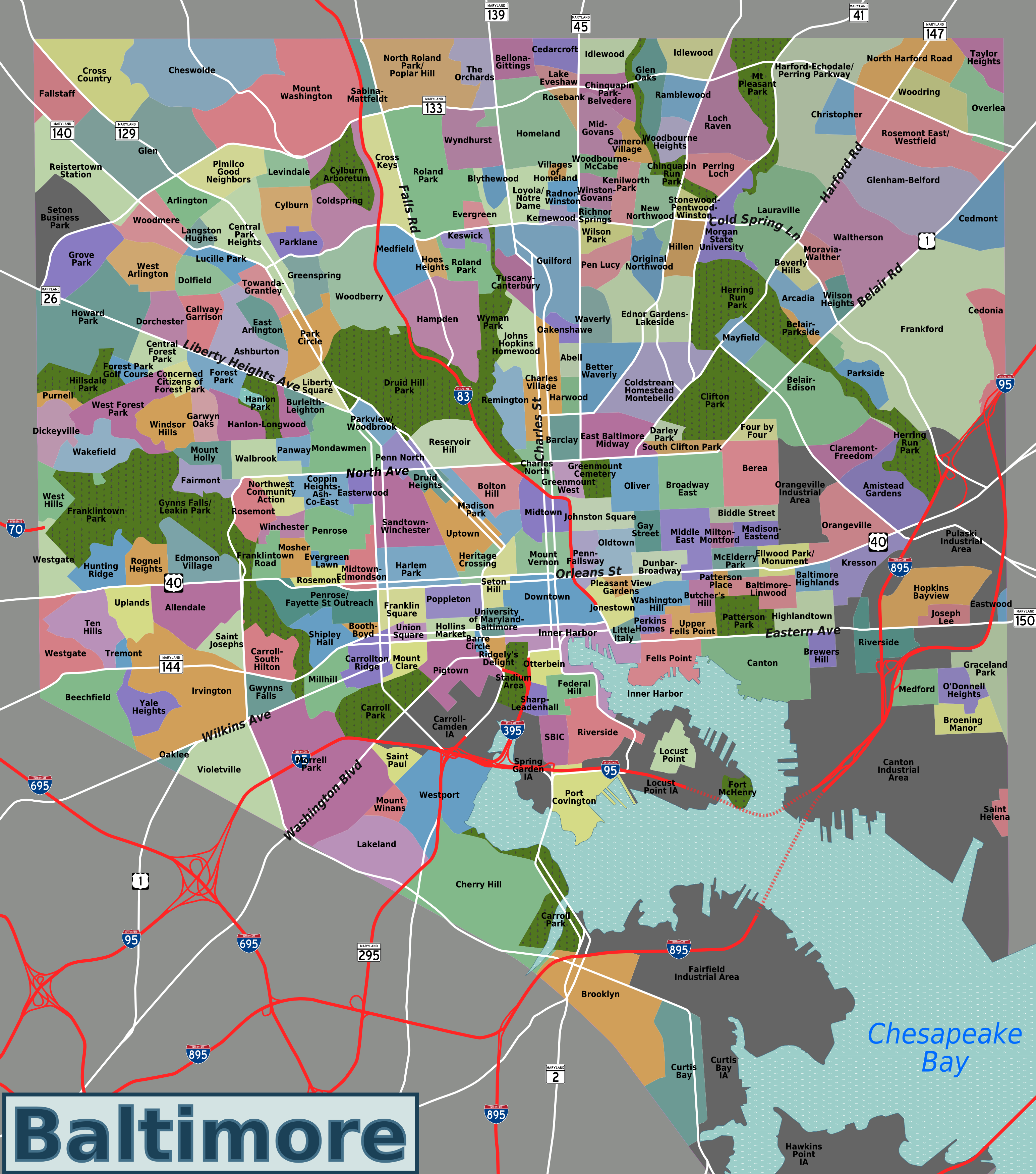
English: Map of Baltimore's neighborhoods, with official city-designated boundaries accurate to street level. |
| Date | |
| Source | self created, traced from OpenStreetMap |
| Author | Peter Fitzgerald, OpenStreetMap |
This PNG is exported from a complex SVG available at Wikitravel Shared. Please make changes to this image by editing that SVG file & exporting a new version (or better yet, just contact me with proposed changes).
Licensing
This file is licensed under the
Creative Commons
Attribution-Share Alike 3.0 Unported license.
- You are free:
- to share – to copy, distribute and transmit the work
- to remix – to adapt the work
- Under the following conditions:
- attribution – You must give appropriate credit, provide a link to the license, and indicate if changes were made. You may do so in any reasonable manner, but not in any way that suggests the licensor endorses you or your use.
- share alike – If you remix, transform, or build upon the material, you must distribute your contributions under the same or compatible license as the original.
File history
Click on a date/time to view the file as it appeared at that time.
| Date/Time | Thumbnail | Dimensions | User | Comment | |
|---|---|---|---|---|---|
| current | 07:26, 6 January 2010 |
| 3,090 × 3,500 (2.92 MB) | Peterfitzgerald | {{Information |Description={{en|1=Map of Baltimore's neighborhoods, with official city-designated boundaries accurate to street level.}} |Source=self created, traced from [http://openstreetmap.org OpenStreetMap] |Author=[[User:Peterfitzgerald|Peter Fitzge |
File usage
The following pages on the English Wikipedia use this file (pages on other projects are not listed):
Global file usage
The following other wikis use this file:
- Usage on ca.wikipedia.org
- Usage on en.wikivoyage.org
- Usage on fa.wikipedia.org
- Usage on fr.wikipedia.org
- Usage on ga.wikipedia.org
- Usage on nl.wikipedia.org
- Usage on ru.wikipedia.org
- Usage on tr.wikipedia.org
- Usage on vep.wikipedia.org