
Size of this preview:
800 × 512 pixels. Other resolutions:
320 × 205 pixels |
640 × 409 pixels |
1,024 × 655 pixels |
1,598 × 1,022 pixels.
Original file (1,598 × 1,022 pixels, file size: 306 KB, MIME type: image/png)
| This is a file from the
Wikimedia Commons. Information from its
description page there is shown below. Commons is a freely licensed media file repository. You can help. |
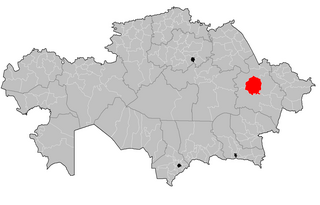
| Description | Map of the rayons of Kazakhstan. Created by Rarelibra 16:49, 3 August 2007 (UTC) for public domain use, using MapInfo Professional v8.5 and various mapping resources. |
| Date | (UTC) |
| Source | |
| Author |
|
| This is a
retouched picture, which means that it has been digitally altered from its original version. The original can be viewed here:
Kazakhstan rayons.png:
|
Vipera, the copyright holder of this work, hereby publishes it under the following license:
| I, the copyright holder of this work, release this work into the
public domain. This applies worldwide. In some countries this may not be legally possible; if so: I grant anyone the right to use this work for any purpose, without any conditions, unless such conditions are required by law. |
Original upload log
This image is a derivative work of the following images:
-
File:Kazakhstan_rayons.png licensed with PD-self
- 2007-08-03T16:49:43Z Rarelibra 1601x1025 (56761 Bytes) Map of the rayons of Kazakhstan. Created by ~~~~ for public domain use, using MapInfo Professional v8.5 and various mapping resources.
Uploaded with derivativeFX
Original upload log
| date/time | username | resolution | size | edit summary |
|---|---|---|---|---|
| 2009-08-12T08:56:08Z | User:Vipera | 1601×1025 | 53.85Kb | {{Information |Description=Map of the rayons of Kazakhstan. Created by [[User:Rarelibra|Rarelibra]] 16:49, 3 August 2007 (UTC) for public domain use, using MapInfo Professional v8.5 and various mapping resources. |Source=*[[:File:Kazakhstan_rayons.png|]] |
File history
Click on a date/time to view the file as it appeared at that time.
| Date/Time | Thumbnail | Dimensions | User | Comment | |
|---|---|---|---|---|---|
| current | 11:46, 19 July 2023 |
| 1,598 × 1,022 (306 KB) | Casserium | New regions |
| 16:09, 5 September 2011 |
 | 1,601 × 1,025 (93 KB) | Sibom | up | |
| 00:24, 13 September 2009 |
 | 1,601 × 1,025 (54 KB) | BetacommandBot | move approved by: User:Superm401 This image was moved from File:Abay District Kazakhstan.png {{Information |Description=Map of the rayons of Kazakhstan. Created by Rarelibra 16:49, 3 August 2007 (UTC) for public domain use, u |
File usage
The following pages on the English Wikipedia use this file (pages on other projects are not listed):
Global file usage
The following other wikis use this file:
- Usage on ar.wikipedia.org
- Usage on be.wikipedia.org
- Usage on bg.wikipedia.org
- Usage on el.wikipedia.org
- Usage on fa.wikipedia.org
- Usage on fr.wikipedia.org
- Usage on it.wikipedia.org
- Usage on kk.wikipedia.org
- Usage on mk.wikipedia.org
- Usage on ms.wikipedia.org
- Usage on pnb.wikipedia.org
- Usage on ru.wikipedia.org
- Usage on vi.wikipedia.org
- Usage on www.wikidata.org
- Usage on zh.wikipedia.org