
Size of this preview:
732 × 600 pixels. Other resolutions:
293 × 240 pixels |
586 × 480 pixels |
852 × 698 pixels.
Original file (852 × 698 pixels, file size: 160 KB, MIME type: image/png)
| This is a file from the
Wikimedia Commons. Information from its
description page there is shown below. Commons is a freely licensed media file repository. You can help. |
Summary
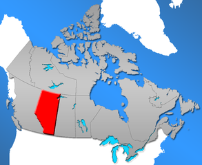
| Description | Province of Alberta in Canada |
| Date | |
| Source | Self from GIS data |
| Author | Qyd |
| Permission ( Reusing this file) |
All |
Licensing
| I, the copyright holder of this work, release this work into the
public domain. This applies worldwide. In some countries this may not be legally possible; if so: I grant anyone the right to use this work for any purpose, without any conditions, unless such conditions are required by law. |
File history
Click on a date/time to view the file as it appeared at that time.
| Date/Time | Thumbnail | Dimensions | User | Comment | |
|---|---|---|---|---|---|
| current | 22:38, 1 December 2006 |
| 852 × 698 (160 KB) | Qyd | refine contour |
| 20:13, 28 May 2006 |
 | 852 × 698 (180 KB) | Qyd | {{Information |Description=Province of Alberta in Canada |Source=Self from GIS data |Date=May 2006 |Author= Qyd |Permission=All |other_versions= }} Category:Maps of Canada Category:Maps of Alberta |
File usage
The following pages on the English Wikipedia use this file (pages on other projects are not listed):
- Demographics of Alberta
- Index of Alberta-related articles
- List of communities in Alberta
- Wikipedia:WikiProject Alberta
- Wikipedia:WikiProject Alberta/Article alerts
- Wikipedia:WikiProject Alberta/Assessment
- Wikipedia:WikiProject Alberta/Assessment links
- Wikipedia:WikiProject Alberta/Featured and good articles
- Wikipedia:WikiProject Alberta/Members
- Wikipedia:WikiProject Alberta/Navigation
- Wikipedia:WikiProject Alberta/Relations
- Wikipedia:WikiProject Alberta/Templates
- Wikipedia:WikiProject Alberta/To do
- Wikipedia talk:WikiProject Alberta
- Wikipedia talk:WikiProject Alberta/Assessment
Global file usage
The following other wikis use this file:
- Usage on bn.wiktionary.org
- Usage on cs.wikipedia.org
- Usage on de.wikipedia.org
- Usage on de.wiktionary.org
- Usage on en.wiktionary.org
- Usage on hu.wiktionary.org
- Usage on pt.wikipedia.org
- Usage on ro.wikipedia.org
- Usage on sk.wikipedia.org
- Usage on zh.wiktionary.org