| Fernhill Wollongong, New South Wales | |||||||||||||||
|---|---|---|---|---|---|---|---|---|---|---|---|---|---|---|---|
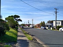
 Fernhill in 2022 | |||||||||||||||
| Coordinates | 34°23′07″S 150°53′25″E / 34.38528°S 150.89028°E | ||||||||||||||
| Population | 1,023 ( 2016 census) [1] | ||||||||||||||
| Postcode(s) | 2518 | ||||||||||||||
| Elevation | 26 m (85 ft) | ||||||||||||||
| Location |
| ||||||||||||||
| LGA(s) | City of Wollongong | ||||||||||||||
| State electorate(s) | Wollongong | ||||||||||||||
| Federal division(s) | Cunningham | ||||||||||||||
| |||||||||||||||

Fernhill is a suburb west of Towradgi, in the City of Wollongong. [2] At the 2016 census, it had a population of 1,023. [1]
References
- ^ a b Australian Bureau of Statistics (27 June 2017). "Fernhill". 2016 Census QuickStats. Retrieved 17 July 2017.
- ^ "Fernhill". Geographical Names Board of New South Wales. New South Wales Government. Retrieved 16 July 2017.
