 Snow cover in
Monkton, Vermont | |
| Type |
Extratropical cyclone Blizzard Winter storm |
|---|---|
| Formed | February 12, 2007 |
| Dissipated | February 17, 2007 |
| Lowest pressure | 970 mb (28.64 inHg) |
| Tornadoes confirmed | 19 |
| Max. rating1 | EF2 tornado |
| Maximum snowfall or ice accretion | 48 in (120 cm) Stowe, Vermont |
| Fatalities | 37 (1 tornadic) |
| Damage | >$58.32 million (2007 USD) [1] |
| Areas affected | Midwestern and Eastern North America, Gulf States |
Part of the
2006–07 North American winter 1Most severe tornado damage; see Fujita scale | |
The February 2007 North American blizzard was a massive winter storm that affected most of the eastern half of North America, starting on February 12, 2007 and peaking on Valentine's Day, February 14. The storm produced heavy snowfalls across the midwestern United States from Nebraska to Ohio and produced similar conditions across parts of the northeastern United States, and into Canada in Ontario, Quebec and New Brunswick. Significant sleet and freezing rain fell across the southern Ohio Valley and affected portions of the east coast of the United States, including the cities of Boston, Baltimore, Washington, D.C., New York City and Philadelphia.
The southern portion of the storm produced severe thunderstorms with numerous tornadoes reported. One tornado hit a subdivision of New Orleans that was still recovering from the effects of Hurricane Katrina in August 2005. In total, this storm system was responsible for 37 deaths across 13 U.S. states and Canadian provinces of New Brunswick, Ontario and Quebec. The NOAA classified the storm as a Category 3 "Major" storm. [2] The National Weather Service has determined that this storm was one of the three largest snowstorms to hit the inland areas of the northeastern United States since 1940. [3]
Prior to the storm
In sharp contrast to the mostly mild weather in the first few weeks of winter, the eastern half of the continent was under the influence of cold temperatures. Numerous areas had substantial snowfall deficits before this storm. After several weak Alberta clippers crossed the eastern half of the continent and brought occasional light snowfalls, a large dip in the Northern branch of the jet stream favored a more active pattern, which, as it connected with the southern branch, led to the development of the storm.
An area of low pressure tracked across southeastern Canada during the 12th, which brought an arctic front across the Mid Atlantic region late on the 12th. As this occurred, a strong area of high pressure located across central Canada built down into the Northeast, allowing very cold air to spill southward ultimately leading to what is known as cold air damming. This occurs east of the mountains down through the Mid Atlantic states. Meanwhile, a Pacific storm slammed onto the California coast during the 11th and as it moved eastward, a new area of low pressure developed across southeastern Colorado and the Texas Panhandle.
Previously, portions of the Great Lakes were hit by a significant lake effect snow event which dumped incredible amounts of snow over portions of central New York. Several areas received over 115 inches (over 2.5 m) of snow in a ten-day period just before the large winter storm as northwesterly winds and unfrozen lake surfaces due to the early winter warm weather favored the heavy snowfall. Several areas across Michigan and Ontario also received significant amounts of snow with locally 1 meter (3.3 ft) of snow east of Georgian Bay in Ontario. [4]
Storm track

From February 10 to 11, a low pressure system developed near the Rockies and moved towards the Great Plains of the United States. It later tracked across the Ohio Valley and merged with a new coastal low. It then moved over eastern Quebec on February 14 before exiting northeastern Quebec and Newfoundland and Labrador on February 16. It dumped over six inches (15 cm) of snow across numerous areas from Iowa to New Brunswick, including major cities such as Akron, Detroit, Champaign–Urbana, Chicago, Cleveland, Columbus, Springfield, Peoria, Indianapolis, Fort Wayne, Dayton, Toledo, Cincinnati, London, Hamilton, the Niagara Region, Toronto, Sherbrooke, Saguenay, Trois-Rivières, Ottawa, Montreal, Quebec City, Pittsburgh, Buffalo, Rochester, Windsor, Syracuse and Albany. This also includes areas such as Northern Oswego County, New York, which received historic lake effect snowfall amounts in the week prior to the storm.[ citation needed]
In addition to the general snowfall, snow squalls coming from Lake Ontario gave local amounts of over 2 feet (600 mm) of snow near the Hamilton and Niagara regions, where 1 foot (0.30 m) of snow had already fallen on February 13. [5]
Heavy ice amounts fell for locations along Interstate 95 from Maine to Virginia and west towards southern Ohio and Indiana. Ice was expected for parts of the Canadian Maritimes.[ citation needed]
This storm became impressive as it moved into the Ohio Valley during the 13th. However, as additional energy moved into the eastern part of the country, a new area of low pressure developed near the North Carolina coast late on the 13th. This allowed mainly light snow to overspread the region from south to north during the early morning hours of the 13th. Low pressure developed in the southern Plains on Monday the 12th as a cold front pushed southward across the Northeast. By Tuesday the 13th, the storm moved eastward across the lower Mississippi Valley while the cold front became stationary in the Carolinas. On the night of the 13th, the primary low moved into the far eastern Ohio Valley while a secondary low developed on the stalled front in the Carolinas. During the day on Wednesday the 14th, this secondary low strengthened rapidly and moved northeastward along the mid-Atlantic and New England coasts while the primary low dissipated in the central Appalachians. By Thursday the 15th, the storm had moved into eastern Canada.
Impact
States of emergency and mobilizations


Maine Governor John Baldacci declared a state of emergency in order to assure heating oil for residents of the state, which was one of the hardest hit areas by the snowstorm.
Due to the additional heavy snowfall, New York Governor Eliot Spitzer called in the National Guard to assist in the snow removal efforts in the areas hit by the lake effect snow storm. [6]
In Pennsylvania, Governor Ed Rendell declared a disaster emergency across the entire state on the 15th. PPL Electric Utilities Corporation reported 1,542 customers were without power for a time during the storm in the Lancaster, Harrisburg and Allentown areas. Snow began across between 6 AM and 7 AM EST on the 13th in Philadelphia, Delaware, Chester, Montgomery and Berks counties. The snow then overspread Bucks, Northampton, Lehigh, Carbon, Berks, and most of Schuylkill counties between 8 AM and 10 AM EST, but held off in Monroe County until the early afternoon hours. There was a lull in the precipitation during the evening hours of the 13th especially across southeastern Pennsylvania, however the precipitation became widespread overnight and during the early morning hours of the 14th.
As some warmer air began to move in above the surface, the snow mixed with and changed to sleet and freezing rain between 6 PM and 7 PM EST on the 13th in Philadelphia and Delaware Counties, then between 7 PM and 11 PM across most other areas in eastern Pennsylvania. The southern Poconos saw less mixed precipitation, however there was a period of mixed precipitation between about 7:30 PM on the 13th and 11:30 AM on the 14th. For a brief time during the afternoon of the 14th, temperatures rose a couple of degrees above freezing with no precipitation falling. Temperatures then dropped below freezing again by the late afternoon of the 14th with a period of snow before the precipitation came to an end between 8:30 PM and 10 PM on the 14th. Wraparound snow showers lingered in Monroe and Carbon Counties until 2 AM EST on the 15th.
In Berks County, snow and sleet along with very cold temperatures combined with some accidents and other aspects to cause a 50-mile backup on Interstate 78. Many motorists, including more than 100 trucks, were stuck on the interstate for nearly 24 hours, without food, water and running out of fuel. At 12:26 PM on the 14th, a caller tells a 911 center he's been stuck in traffic on westbound Interstate 78 near the Berks-Lehigh county line for more than an hour. At 1:02 PM, a truck driver tells the Berks Communications Center about a seven-mile backup on the eastbound lanes of Interstate 78 near Hamburg. At 4:40 PM, a 911 caller asked to speak to the Berks Emergency Management Agency. The Berks Deputy Coordinator took the call. At 4:59 PM, The Berks Deputy Coordinator called the State Emergency Operations Center and was told the center learned of the backup at 4:33 PM. At 5:22 PM, Berks Emergency Management calls the state police at the Hamburg barracks but cannot get through, so he decided to drive there. At 6:08 PM, the Berks Emergency Management Deputy Coordinator finds that the Hamburg barracks is without power and phones. At 6:27 PM, a senior decision-maker from PennDOT is requested to arrive at the Hamburg state police barracks to help with communications. At 9:30 PM, a PennDOT supervisor arrived in Hamburg.[ citation needed]
At 10:30 PM, all westbound Interstate 78 traffic is stopped at the Hamburg exit due to numerous disabled vehicles. At 10:40 PM, Governor Ed Rendell declared a disaster emergency. On the 15th at 3:54 AM, state troopers and emergency personnel began walking miles of Interstate 78, waking up truckers who have gone to sleep as traffic begins to move. At 5 PM on the 15th, the state orders Interstate 78 shut down in both directions from Interstate 81 in Lebanon County to Route 100 in Lehigh County. At 6 PM on the 15th, plowing begins and continued through the night. Additional snow removing equipment was brought in from the western part of the state to help with the clearing of the highway. Highway officials along with the National Guard and State Police worked to clear the stuck trucks and cars from the highway, therefore plowing and ice removal can get fully underway. On the 16th, the interstate remained closed throughout the day as crews continued to plow and remove ice. On the 17th at 4 PM, the interstate reopened.
The Exeter Township snow emergency, which was declared on the 14th, was extended through 4 PM on the 15th. Several schools across the county were closed on the 14th, with some also closed on the 15th. Across the Lehigh Valley: In Lehigh County, The city of Allentown declared a snow emergency early on the 14th, which was then lifted at 8 PM on the 14th. The weight of snow and ice, on the 14th, brought down the dome over the swimming pool at the West End Racquet and Fitness Club in South Whitehall Township. The dome itself was destroyed. Also, the Brookside Country Club in Wescosville also reported dome damage as a result of the snow and ice. In Northampton County, an 83-year-old woman was found dead on the rear porch of her home from hypothermia. Also in Bethlehem, a pedestrian was hospitalized after a private snowplow operator backed over him while clearing the Sheetz gas station parking lot at 3201 Schoenersville Road on the 14th.[ citation needed] County Emergency Dispatch officials reported about a dozen or so minor vehicle accidents due to the slippery conditions. The snow and ice was too much on the 15th for a dome covering a soccer field at the Iron Lakes Sports Club on Shankweiler Road in North Whitehall that it collapsed.
In the Poconos, in Carbon County, The Mansion Hill (SR 209) exiting Jim Thorpe towards Lehighton was closed for most of the 14th due to snow slides blocking the major artery or tractor-trailer trucks becoming stuck and blocking the travel lanes. The road reopened about 2:30 PM on the 14th, however it was shut down again at 3:06 PM due to an accident. This was a main trouble spot as the snow and sleet reportedly drifted on the hill across part of the highway. Drifts were reported to be higher than some vehicles. At 8:20 AM on the 14th, it was decided that drifting was occurring more frequently than road crews could clear, resulting in the heavily traveled road being closed. All schools in the county canceled classes as early as the evening of the 13th. Lansford continued their state of emergency on the 15th, which was issued on the 14th. This means that all non-essential travel should be avoided. One accident occurred when a tractor-trailer jack-knifed on the Mansion House Hill, Route 209, in Jim Thorpe at about 4 AM on the 14th. The Pennsylvania Turnpikes Lehighton interchange was closed because of a tractor-trailer crash on the 14th, and state police closed Interstate 81 late in the afternoon of the 14th, deeming it impassable. Interstate 380 also was closed because of bad road conditions.
In Monroe County, state police closed Interstates 80 and 380 during the afternoon of the 14th because of bad road conditions. Interstate 80 was closed between Interstates 81 and 380. The combination of a heavy snowfall then a mix of sleet, snow and freezing rain made for hazardous road conditions. The mixed precipitation made it more difficult for some road crews to keep up. At 4 PM EST on the 17th the interstates reopened after ice was removed and the road surfaces was safe for travel. In and around the Greater Philadelphia Metropolitan area, in Bucks County, slippery road conditions contributed to a tractor-trailer accident on the 14th on Route 309 in Richland Township. The highway was closed for more than an hour, which forced motorists to detour on slush-covered side streets.[ citation needed]
In Philadelphia itself, the combination of snow and sleet closed many of the schools, delayed flights, trains and buses. The school district parochial schools were closed on the 14th, as were the regional and central administrative offices. During the midday hours on the 14th, giant slabs of ice slid off tops of buildings in Center City and crashed to the ground. Chunks of ice as large as three feet wide made their way to the pavement from high up. Police started to block off areas where the ice was falling, however one man was hit in the head by the falling ice and was knocked to the ground.
Schenectady, Schoharie, Montgomery, Washington, Essex, Warren and Clinton counties in New York state, which were affected by extensive snowfall from the storm, had declared a state of emergency while several other counties and towns declared snow emergencies. [7] [8]
Virginia Gov. Timothy Kaine declared a statewide emergency in advance of the storm, directing state agencies to help in the response to and recovery from the storm.
Pennsylvania Gov. Ed Rendell declared a statewide disaster emergency in response to the poor road conditions and ensuing highway closings. [9]
Precipitation received

The storm left a mark on states like Illinois, Indiana, and Ohio, which received heavy snow for over 24 hours, accumulating upwards of 18 inches (457.2 mm) in some areas. Many parts of Northern and Northeastern Indiana received between 12 and 20 inches (300–510 mm), and blizzard conditions for an extended period of time. The heavy snow and blizzard conditions caused roads to close, and schools and businesses to close for three days. In Chicago, O'Hare International Airport received 10.2 inches (259 mm) of snow, while Midway Airport received 12.0 inches (300 mm). The Midway total was the largest amount of snow received in the month of February for one midnight-to-midnight day since records began to be kept in 1928. [10] Twelve to sixteen inches (300–410 mm) of snowfall and blizzard conditions in central Illinois canceled classes at the University of Illinois at Urbana–Champaign for two days, the first time classes had been canceled since 1979. [11] [12]

Areas of the Appalachian Mountains in northern New England and Quebec received accumulations of over 16 inches (410 mm) with local amount exceeding 36 inches (910 mm) in parts of Vermont and 42 inches (1,100 mm) in the Adirondacks in New York state. Also in New York state, in the hills and valleys south of Syracuse, snowfall depths ranged from 24 to 45 inches (610–1,100 mm). Snowfall rates of 5 to 6 inches (130–150 mm) per hour occurred in areas of western Schoharie County, with total storm accumulations in this county approaching three feet. The city of Hamilton, Ontario and the Niagara region, at their highest elevations, received just over 27.6 inches (700 mm) due to snow squalls off of Lake Ontario. Burlington, Vermont recorded record 24-hour snowfall, with 25.3 inches (640 mm). [13] Boston and Hartford, however, saw very little precipitation from the storm. In fact, Boston is close to setting a record for the least snow in any season. [14]
A notable feature of the system was its array of precipitation type. While the interior sections of the Northeast received mostly snow from the system, the Mid-Atlantic received snow, sleet, freezing rain and non-freezing rain. Due to the three-dimensional nature of the atmosphere, warm air was poised to overtake the cold air closer to the ground, causing precipitation to melt, then refreeze as either sleet or freezing rain. As temperatures hovered around freezing on the southern edge of the storm track, light snow accompanied freezing rain and sleet. The freezing rain coated all surfaces with thick layers of ice, including power lines and tree limbs which break under the additional weight. Some locations in the Mid-Atlantic received several inches of sleet. Four inches (100 mm) of sleet caused travel difficulties and hampered cleanup efforts in New York City. New York City's sanitation department admitted to not plowing city streets, expecting the frozen precipitation to change from ice to rain. However, this never happened. Instead, temperatures dropped very quickly and caused the slush on sidewalks and roads to freeze into thick, rock hard sheets of ice. Streets were almost impassable during the evening rush hour resulting in complete chaos. Along coastal New England, a mix of rain, sleet, and freezing rain resulted in decreased snow amounts in coastal areas of New England.in coastal Maine, snowfall amounts were restricted to 6–12 inches, while inland sections of the state got as much as 29.8 inches of snow.
Ice accumulations in Virginia and Maryland reached locally three-quarters of an inch (20 mm) [15] while it reached 1 inch (25 mm) in central Ohio near Columbus and Xenia, with up to 0.7 inches (18 mm) near Cincinnati. [16]
The effect on much of Michigan by the storm was light, although the extreme southern part of the state was hard hit with heavy snowfall, especially the Detroit Metro area. Wind whipped snow accumulations ranged from 7 to 10 inches (180–250 mm) fell throughout the area, especially the southeastern suburbs, including 8.5 inches (220 mm) at both Detroit Metropolitan Airport and Wyandotte, and 8.4 inches (210 mm) in Dundee. Drifts were as high as two to three feet (600–900 mm), and the snow was very powdery as it fell with temperatures around 10 °F (−12 °C).
Due to the near-record amounts of snow in the Appalachian Mountain chain, National Weather Service officials had issued statement for a higher risk of avalanches across northern New England. [17]
Damage and travel disruptions

Blizzard conditions were reported across most of the Midwest from Illinois to Ohio. Numerous flights were canceled due to the snow and ice across various airports including in Toronto, Ottawa, Quebec City, Montreal, Kansas City, Indianapolis, St. Louis, Cleveland, Boston and Cincinnati. 900 flights were canceled at Chicago's O'Hare International Airport.[ citation needed]
Lackawanna County and Luzerne County in northeastern Pennsylvania received so much snow that every highway was closed.
At New York's John F. Kennedy International Airport, several empty JetBlue airplanes were frozen to the parking stands at the gates and incoming flights could not access the stands as a result, while outgoing flights already taxiing were ordered to hold on the taxiway due to weather conditions. Many passengers in planes, either inbound or outbound, were held in the planes, eating peanuts and other snacks for as much as 10 hours before the decision was made to cancel the outgoing flights or a gate had opened for the inbound ones. [18] [19] Several airports including Bradley International Airport in Connecticut, Washington's Ronald Reagan National Airport, and John C. Munro International Airport in Hamilton were completely shut down for several hours. [20] [21] GO Train in Toronto and Amtrak train service from Boston was also disrupted. In Scranton, Pennsylvania the Toyota Pavilion at Montage Mountain collapsed under the weight of the snow on February 15, 2007. Strong winds also accompanied the storm but damage was minimal, though a radio tower pole was toppled by 40 mph (64 km/h) winds in Ohio. [22]
Road traveling was extensively slowed down and numerous accidents and pile-ups were reported across several states and in Ontario. One of the accidents on the Ohio Turnpike involved two tractor-trailers which fell several hundred feet, [23] and another one on Highway 403 in Hamilton involved three tractor-trailers and five cars which forced the closure of the road. [24] Numerous other major roads were also temporarily shutdown, including Highway 401 in Ontario due to a fatal accident in Napanee and Autoroute 20 and Route 132 in eastern Quebec between Quebec City and Rimouski. [25]
In Sherbrooke, Quebec, where nearly 2 feet (0.61 m) of snow fell, several hundred students were forced to sleep at schools as buses were unable to travel in the near blizzard conditions. The school board was criticized for opening schools on that day. [26]
Severe ice caused a 50-mile (80 km) stretch of Interstate 78 in Pennsylvania between Lebanon County and Allentown to be shut down, stranding motorists for upwards of 24 hours and requiring the National Guard to be called in. [27] Other stretches of highway throughout Pennsylvania were shut down, including Interstate 80, 81, and after the storm, even the Pennsylvania Turnpike. On February 16, Governor Ed Rendell called for a thorough investigation into how the state handled the winter weather emergency, citing a lack of communication and quick action as the cause of the problems, and even going so far as to taking responsibility for the situation. [28]
Deaths
Thirty-seven people were killed during the storm and its aftermath. Most of them were killed in motor vehicle accidents, including one in Ontario, [29] three in Nebraska, two in New York, [30] two in Illinois, two in New Jersey, two in Indiana, two in Delaware, one in New Brunswick, [31] five in Quebec, one in Louisiana, one in New Hampshire, six in Vermont, [32] one in Missouri, one in Pennsylvania, one in Virginia, and six in Ohio. In addition to traffic accidents, fatalities were reported due to tornadoes, heart attacks while shoveling, roof collapses due to heavy snow, falling tree branches and carbon monoxide poisoning. [23] [33] [34] [35] [36] [37] [38] [39] [13] In Quebec City, a 16-year-old boy disappeared during the snowstorm and was found dead three days later in a snow bank. [40]
Schools

The inclement weather caused many educational institutions, such as universities and secondary schools, to close. Among these were University of Michigan–Dearborn in Dearborn, Michigan, Ball State University in Muncie, Indiana, College of Mount St. Joseph in Cincinnati, Ohio, Western Illinois University in Macomb, Illinois, Eastern Illinois University in Charleston, Illinois, Champlain College and the University of Vermont in Burlington, Vermont, Mount St. Mary's University in Emmitsburg, Maryland, Illinois State University in Normal, Illinois, Western Connecticut State University in Danbury, Connecticut, Oberlin College in Oberlin, Ohio, The University of Akron, Kent State University, Ohio Northern University in Ada, Ohio, Baldwin-Wallace College in Berea, Ohio, The University of Toledo in Toledo, Ohio, the University at Albany, Rensselaer Polytechnic Institute, Case Western Reserve University in Cleveland, The Pennsylvania State University, Lyndon State College in Lyndonville, Vermont, George Mason University, Northern Virginia Community College and James Madison University in Virginia, Sherbrooke University and Bishop's University, in Quebec, the University of Maryland in College Park, Maryland, UMBC in Catonsville, Maryland, Georgetown University in Washington, D.C., Cornell University, [41] University of Pittsburgh, Chatham College in Pittsburgh, and West Chester University of Pennsylvania. Tornado damage, rather than snow fall, caused Tulane University to cancel classes.

Several elementary, middle, and high schools were closed three days in a row in central New York. Public schools in the "W Towns" in eastern Massachusetts ( Weston, Wayland, and Wellesley) did have school that day despite the fact that almost every other town in the state had the day off. Several schools' classes were canceled after years without a snow day. Dartmouth College shut down campus operations on February 14. Essential employees remained staffed, and classes were held at professors' discretion. It was the first snow day for the college since the 1970s, and its second in its 238-year history.
Ohio State University in Columbus, Ohio closed its campus for two days, beginning February 13, for the third time in 25 years. [42] Syracuse University canceled all classes after 12:45 pm on Wednesday, closing for only the third time in its 130-year history; for SUNY Geneseo, the previous snow day had occurred 14 years ago; [43] for Ithaca College, the first time in 13 years; [44] for the University of Toledo, the first time in 22 years due to winter-related conditions. [45] The University of Illinois canceled their classes for two consecutive days for the first time in at least 27 years. [46] A blizzard warning forced Purdue University to suspend classes for the first time in 13 years. [47] SUNY Oneonta closed its doors for the first time since the 1970s, and stayed closed for 3 days for the first time in its 119-year history. Hartwick College had its first recorded snow day in its 230-year history, and stayed closed for 2 days. For the first time in six years, Youngstown State University in Youngstown, Ohio canceled classes as a result of the snow. On February 14, for only the third time in school history, Bucknell University in Lewisburg, Pennsylvania canceled classes as a result of the snow. Susquehanna University in nearby Selinsgrove, however, remained open with no official cancellations.
Other closings
Legislative meetings in Ohio and Pennsylvania were also affected due to the bad weather. In Pittsburgh, tourist sites such as the zoo and aquarium were closed. [48] In New Hampshire, presidential candidate Mitt Romney ( R) was forced to cancel a campaign appearance. [49] A global warming hearing in the U.S. House of Representatives' Subcommittee on Energy and Air Quality scheduled for February 14 and a showing of the film An Inconvenient Truth at Maryville University in St. Louis were also cancelled. [50]

Power outages
Localized but extensive power outages were reported across areas that were hit by significant amounts of ice. At the peak of the storm over 300,000 customers lost power across the United States. In the Cincinnati area, 122,000 were without power at one point with 52,000 still blacked out as of Wednesday morning. All had been restored by Tuesday morning. [51] [52] About 7,500 customers in Indiana near the Indianapolis region were still without power on February 15, down from a peak of about 50,000 especially in the Bloomington area. [53] Other states that reported outages included Kentucky (14,000), Maryland (at least 135,000 customers, including 69,000 in Anne Arundel County and 25,000 in Prince George's County, Maryland), [54] New Jersey (36,000), Pennsylvania (10,000 in the Pittsburgh region), [55] Virginia (7,800), [56] and New York (18,000) on Long Island. By 10:00 am Thursday, February 15, about 73,000 homes were without electricity in the Washington, D.C. metropolitan area. [57] Most of those outages were from an ice storm that hit areas from the southern Ohio Valley towards the Atlantic Coast.
Other disruptions
As the storm hit on the week of Valentine's Day, numerous deliveries were delayed significantly. [58] The mayor of Covington, Kentucky, Butch Callery, postponed Valentine's Day until Saturday. [59] Travelers heading to Mardi Gras had to take a train to Washington, D.C. and then drive a rental vehicle to New Orleans.
Precipitation by region

| Storm Snow Totals Totals are for the main system only. | ||
|---|---|---|
| Region | in | cm |
| Stowe, VT [60] | 48 | 120 |
| DeRuyter, New York [61] | 33 | 84 |
| Stratford, NY [62] | 42 | 110 |
| Cooperstown, NY [2] | 33 | 84 |
| Canaan, VT [2] | 31 | 79 |
| Kingfield, ME [63] | 31 | 79 |
| Bennington, VT | 28.0 | 71 |
| Hamilton, ON [64] | 15.7–27.6 | 40–70 |
| Gorham, NH [2] | 26 | 66 |
| Burlington, VT [13] | 25.3 | 64 |
| Syracuse, NY [2] | 22 | 56 |
| Sherbrooke, QC [65] | 21.7 | 55 |
| Rochester, NY [66] | 21.0 | 53 |
| Binghamton, NY [67] | 18.5 | 47 |
| Niagara Region, ON [68] | 10.0–17.8 | 25–45 |
| Quebec City, QC [69] | 17.7 | 45 |
| Scranton, PA | 17.1 | 43 |
| Lafayette, IN [70] | 17.0 | 43 |
| Albany, NY [62] | 16.8 | 43 |
| Ithaca, NY [67] | 16.8 | 43 |
| Abingdon, IL | 9.6 | 24 |
| Springfield, IL [71] | 19.0 | 48 |
| Granby, QC [72] | 15.7 | 40 |
| Cleveland, OH [73] | 15.0 | 38 |
| Lima, OH [67] | 14 | 36 |
| Normal, IL [71] | 13.0 | 33 |
| Chicago – O'Hare Airport | 10.2 | 26 |
| Montreal, QC [36] [74] | 5.9–9.8 | 15–25 |
| Detroit, Michigan [75] | 8.5 | 22 |
| Indianapolis, IN [70] | 8.5 | 22 |
| Ottawa, ON [76] | 5.9 | 15 |
| Columbus, OH [77] | 5.9 | 15 |
New Orleans tornado outbreak

South of the wintry precipitation zone, severe weather erupted across the Gulf States, where a tornado was reported on February 12 in the New Orleans area killing one person and injuring a dozen in the Pontchartrain Park neighborhood, one of the hardest hit areas by Hurricane Katrina due to the flood waters. The fatality occurred in a FEMA trailer that was hit by the EF2 tornado. In addition to significant structural damage to numerous buildings, including a dozen destroyed, 20,000 residents lost power across the metropolitan area. [78] A separate destructive EF2, also struck the Carrollton and Hollygrove neighborhoods of New Orleans, as well as the town of Westwego, Louisiana.
Severe weather was also reported south of Birmingham, Alabama, near Jackson, Mississippi as well as in Georgia, Florida, and South Carolina. This small outbreak produced a total of 19 tornadoes. [79] [80] A particularly strong squall line passed through Alabama on the evening of February 13 with reports of baseball-sized hail in Montgomery, Alabama.
Confirmed tornadoes
| EFU | EF0 | EF1 | EF2 | EF3 | EF4 | EF5 | Total |
|---|---|---|---|---|---|---|---|
| 0 | 7 | 9 | 3 | 0 | 0 | 0 | 19 |
February 13 event
| EF# | Location | County / Parish | State | Start Coord. | Time ( UTC) | Path length | Max width | Summary |
|---|---|---|---|---|---|---|---|---|
| EF1 | Flanders to SW of Pilette | Lafayette | LA | 30°07′N 92°01′W / 30.11°N 92.02°W | 06:10–06:15 | 2.16 mi (3.48 km) | 50 yd (46 m) | Two brick homes received significant roof damage. One home had its garage destroyed which caused part of the roof to be ripped off. The neighbors roof was damaged by flying debris. 31 other homes sustained lesser damage, trees were downed, and other debris was blown across fields and into trees along the path as well. [81] |
| EF2 | Ruth to SSW of Henderson | St. Martin | LA | 30°14′06″N 91°51′54″W / 30.235°N 91.865°W | 06:36–06:46 | 4.31 mi (6.94 km) | 300 yd (270 m) | The same storm that spawned the previous tornado later spawned this low-end EF2 tornado to the northeast. 80 homes and mobile homes were impacted, 44 of which sustained significant damage or were destroyed. Trees in the area were damaged and uprooted, and 3 people were injured in a small brick home where the roof blew off, causing a brick wall and other debris to land on them. This was the strongest tornado in southwest Louisiana since the November 23, 2004 tornado outbreak. [82] |
| EF0 | ESE of New Iberia | Iberia | LA | 29°59′N 91°46′W / 29.98°N 91.76°W | 07:03–07:04 | 0.46 mi (0.74 km) | 25 yd (23 m) | A mobile home was pushed into a neighbor's car and house. [83] |
| EF0 | NW of Charon | Vermilion | LA | 30°02′N 92°02′W / 30.03°N 92.04°W | 07:25–07:26 | 0.46 mi (0.74 km) | 25 yd (23 m) | A brief tornado destroyed a house that was under construction. [84] |
| EF2 | Westwego to ESE of Metairie | Jefferson, Orleans | LA | 29°53′49″N 90°09′11″W / 29.897°N 90.153°W | 08:55–09:08 | 8.72 mi (14.03 km) | 50 yd (46 m) | This strong tornado first touched down in Westwego before crossing the Mississippi River into the northwestern side of New Orleans. Significant damage occurred in the Uptown and Carrollton of the city. Several structures in Westwego were significantly damaged, including a two-story motel building which had its roof removed and a portion of the second floor walls caved in. In New Orleans, the tornado heavily damaged several warehouses, homes, and commercial buildings. The roofs and portions of roofs were removed from a number of houses. The collapse of some exterior walls was also noted. 24 people were injured and damage was estimated at $2 million. [85] |
| EF2 | Gentilly | Orleans | LA | 30°00′44″N 90°03′07″W / 30.0121°N 90.0519°W | 09:10–09:12 | 1.29 mi (2.08 km) | 50 yd (46 m) | 1 death – A second strong tornado touched down after the previous one dissipated and struck the Pontchartrain Park neighborhood in Gentilly northeast of New Orleans. Several homes sustained considerable structural damage in that area. Extensive damage to trees and power lines occurred before it lifted near the Industrial Canal. Damage was also reported to many FEMA trailers in this area that was devastated by Hurricane Katrina. An 86-year-old woman died from her injuries after her FEMA trailer was destroyed. Roofs were blown off of several homes and the upper portions of two story houses were partially collapsed. 10 other people were injured. In total, the two New Orleans tornadoes destroyed 55 houses and damaged 526 others. Damage was $1 million. [86] |
| EF1 | Lemon | Smith | MS | 32°08′38″N 89°30′38″W / 32.1438°N 89.5106°W | 09:52–09:57 | 1.29 mi (2.08 km) | 50 yd (46 m) | One home had some roofing blown off, power poles were blown down and multiple trees were snapped. Another home sustained damage to its porch, and a chicken house also sustained minor roof damage. [87] |
| EF0 | SW of Bassfield | Jefferson Davis | MS | 31°25′06″N 89°50′45″W / 31.4182°N 89.8459°W | 10:13–10:16 | 3 mi (4.8 km) | 75 yd (69 m) | A weak tornado downed several trees and broke off tree limbs. [88] |
| EF0 | SE of Poplarville | Pearl River | MS | 30°46′44″N 89°28′14″W / 30.7789°N 89.4705°W | 10:45 | 0.3 mi (0.48 km) | 25 yd (23 m) | A brief, weak tornado knocked down a few trees. [89] |
| EF0 | ENE of Ocean Springs | Jackson | MS | 30°26′52″N 88°44′33″W / 30.4477°N 88.7425°W | 13:20–13:23 | 0.3 mi (0.48 km) | 25 yd (23 m) | A brief, weak tornado caused no significant damage. [90] |
| EF1 | N of Hosford | Liberty | FL | 30°24′32″N 84°48′00″W / 30.4089°N 84.8°W | 20:05–20:06 | 0.25 mi (0.40 km) | 50 yd (46 m) | The roof was blown off of a house and a large shed was destroyed. Numerous pine trees were snapped as well. [91] |
| EF1 | N of Meriwether to N of Edgefield | McCormick, Edgefield | SC | 33°39′N 82°10′W / 33.65°N 82.17°W | 22:47–23:15 | 31.33 mi (50.42 km) | 200 yd (180 m) | In McCormick County, two homes sustained minor damage and several trees were downed. In Edgefield County, numerous other trees were downed, three outbuildings were destroyed, and one other was severely damaged. The tornado was down only intermittently. [92] |
| EF0 | Newbern | Hale, Perry | AL | 32°35′34″N 87°34′17″W / 32.5928°N 87.5715°W | 23:01–23:13 | 6.52 mi (10.49 km) | 25 yd (23 m) | Several old barns and metal sheds were lightly damaged, and numerous trees were downed, including at least one that fell onto a mobile home. [93] |
| EF1 | SE of Duncanville to Eoline | Tuscaloosa, Bibb | AL | 33°00′46″N 87°23′58″W / 33.0128°N 87.3994°W | 23:10–23:29 | 9.71 mi (15.63 km) | 400 yd (370 m) | Several trailers, homes, barns and sheds were damaged along the path. Additionally, numerous trees were snapped off and downed. [94] |
| EF1 | E of Sylvania | Screven | GA | 32°45′00″N 81°35′44″W / 32.75°N 81.5956°W | 23:28–23:29 | 0.6 mi (0.97 km) | 35 yd (32 m) | A pump house was destroyed, a large tree branch fell onto a car, a mobile home and an outbuilding was damaged, and uprooted and snapped several trees. Nearly a dozen large pecan trees were uprooted. Other pecan trees had large limbs broken off, and one person was injured. [95] |
| EF0 | Sixmile | Bibb | AL | 33°01′N 87°05′W / 33.02°N 87.08°W | 23:48–00:01 | 7.47 mi (12.02 km) | 250 yd (230 m) | Sporadic tree and building damage occurred. [96] |
| EF1 | SE of Allendale | Allendale | SC | 32°59′N 81°17′W / 32.99°N 81.29°W | 00:01–00:02 | 0.03 mi (0.048 km) | 30 yd (27 m) | A brief tornado uprooted trees and damaged the skirting of a mobile home. [97] |
| EF1 | NE of Mulberry | Autauga | AL | 32°27′55″N 86°44′49″W / 32.4653°N 86.7469°W | 00:22–00:23 | 1.1 mi (1.8 km) | 200 yd (180 m) | Several trees were snapped off and uprooted. The roof of a carport was lifted off and thrown into the front yard of another residence, and a tractor shed in the same area had sheet metal blown off its roof. [98] |
| EF1 | ESE of Olar | Bamberg | SC | 33°08′21″N 81°07′52″W / 33.1391°N 81.1312°W | 00:27–00:37 | 2.01 mi (3.23 km) | 40 yd (37 m) | A weak tornado downed several trees. [99] |
Gallery
-
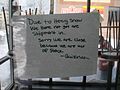 A Quiznos Sub in Syracuse, New York closed due to snowfall affecting shipments.
 -
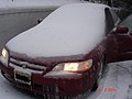 A New Jersey car covered in snow and ice after the blizzard.
 -
 Ice storm topples trees on to roadway and power lines in Tinton Falls, New Jersey, on Valentine's Day 2007.
 -
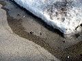 Over a week after the storm in Chester County, Pennsylvania, melted snow refreezes into ice on a street.


See also
Notes
- ^ All dates are based on the local time zone where the tornado touched down; however, all times are in Coordinated Universal Time for consistency.
References
- ^ "NCDC: Event Details". Archived from the original on 2011-05-20. Retrieved 2008-06-19.
- ^ a b c d e NOAA. "VALENTINE'S DAY WINTER STORM CLASSIFIED AS A CATEGORY 3 "MAJOR" STORM". Retrieved 2007-02-27.
- ^ Times Union. "Valentine's Day storm stacks up against history". Retrieved 2007-02-27.[ dead link]
-
^ CNN.com (2007-02-11).
"Snow about to give hard-hit towns a break". Archived from
the original on February 19, 2007.
{{ cite news}}:|author=has generic name ( help) - ^ Snowstorm rumbling through Ontario, moving east, CBC, February 13, 2007
- ^ Winter storm that battered Midwest slams into Northeast, hindering travel and closing schools Archived 2007-02-16 at the Wayback Machine WHDH, February 14, 2007
- ^ State Of Emergency Declared Archived 2007-09-28 at the Wayback Machine WPTZ, February 14, 2007
- ^ CBS Albany (2007-02-13). "Capital Region Hit by Major Winter Storm". Archived from the original on 2007-12-06.
- ^ Governor Rendell Declares Disaster Emergency Statewide, Urges Motorists to Avoid I-78 as Efforts Continue to Help Stranded Motorists PEMA, February 14, 2007
- ^ NWS Chicago (2007-02-14). "Total Snowfall from the Feb 13–14 2007 Snowstorm". Retrieved 2007-02-14.
- ^ NWS Lincoln, IL (2007-02-13). "Blizzard of February 12–13, 2007".
- ^ "Snowstorm sends semis spinning, heads east". CNN. 2007-02-13. Archived from the original on March 2, 2007.
- ^ a b c NWS Burlington. "Storm Summary: February 14, 2007". Retrieved 2007-03-11.[ dead link]
- ^ NWS Taunton/Boston. "Area Forecast Discussion". Retrieved 2007-03-11.
- ^ NWS Sterling, Virginia. "Preliminary February 13–14, 2007 Snowfall/Ice". Retrieved 2007-02-15.
- ^ NWS Wilmington, Ohio. "February 13–14 Winter Storm". Archived from the original on June 11, 2011. Retrieved 2007-02-15.
- ^ NWS Burlington, VT. "Special Weather Statement". Retrieved 2007-02-19.[ dead link]
- ^ Associated Press, Airline apologizes to passengers stranded on planes for hours in NYC, February 15, 2007 Archived September 27, 2007, at the Wayback Machine
- ^ Airport passengers weathering the storm Archived 2007-02-19 at the Wayback Machine WABC, February 14, 2007
- ^ Snowstorm sends semis spinning, heads east Archived 2007-02-16 at the Wayback Machine CNN.com, February 13, 2007
- ^ New winter storm through Midwest creates havoc for travellers CBC, February 13, 2007
- ^ Snow, ice storms freeze Ohio Archived 2007-09-27 at the Wayback Machine Newark Advocate, February 14, 2007
- ^ a b Several More Crashes Complicate Evening Rush Archived 2007-02-15 at the Wayback Machine WEWS, February 13, 2007
- ^ Airport shuts down in Ontario snowstorm CTV News, February 14, 2007
- ^ LCN (2007-02-15). "Les conditions routières sont toujours difficiles". Archived from the original on 2007-02-18. Retrieved 2007-02-16.
- ^ Radio-Canada Estrie (2007-02-15). "Mea culpa de la commission scolaire".
- ^ STUCK ON I-78: Many Motorists Stranded on Closed Highway Archived 2007-02-19 at the Wayback Machine WFMZ-TV News, February 15, 2007
- ^ Governor Rendell Launches Investigation Into State's Winter Storm Response PAPowerPort, February 16, 2007
- ^ Southern Ontario shoveling out from storm CTV, February 14, 2007
- ^ WNYT (2007-02-16). "Trucker dies on I-87 where phones don't work : Driver collapses in snow along Northway". Archived from the original on 2015-07-01. Retrieved 2007-02-18.
- ^ CBC New Brunswick (February 16, 2007). "Man dies in storm-related highway accident". CBC News. Retrieved 2007-02-16.
- ^ WCAX. "Three dead in Bennington from shoveling-related heart attacks". Archived from the original on September 27, 2007. Retrieved 2007-02-18.
- ^ Storm across Midwest, East kills 5; travel treacherous Archived 2007-09-28 at the Wayback Machine Carlsbad Current-Argus, February 13, 2007
- ^ Snow, ice storms freeze Ohio Archived 2007-09-27 at the Wayback Machine Newark Advocate. February 14, 2007
- ^ LCN/TVA. "Une pause-cigarette fatale". Archived from the original on January 19, 2013. Retrieved 2007-02-16.
- ^ a b Radio-Canada Estrie. "Lentement, mais sûrement" [Slowly but surely] (in French). Retrieved 2007-02-16.
- ^ Storm cancels classes, flights in Northeast Archived 2007-02-15 at the Wayback Machine CNN.com, February 14, 2007
-
^ CNN. com (2007-02-15).
"Storm leaves behind snow, ice, frustration". Archived from
the original on 2007-02-17.
{{ cite news}}:|author=has generic name ( help) -
^ CNN.com (2007-02-16).
"Motorists free, highways closed as death toll rises". Archived from
the original on 2007-02-18.
{{ cite news}}:|author=has generic name ( help) - ^ CBC Montreal (February 17, 2007). "Body of Quebec teenage athlete found". CBC News. Retrieved 2007-02-18.
- ^ " STORM FORCES C.U. SHUTDOWN Archived 2011-07-08 at the Wayback Machine", The Cornell Daily Sun (2007-02-15), and the University of Vermont in Burlington, Vermont. Retrieved on February 15, 2007.
- ^ The Lantern (Ohio State University) (2007-02-15). "Snow daze at OSU". Archived from the original on 2007-02-17.
- ^ WHAM-TV Rochester, NY (2007-02-14). "Snow Day for SUNY Geneseo". Archived from the original on 2007-02-19.
- ^ " Snow Day" Archived 2007-02-19 at the Wayback Machine, The Ithacan (2007-02-15). Retrieved on February 15, 2007.
- ^ " Snow shuts down UT campus Archived 2007-02-19 at the Wayback Machine", Independent Collegian (2007-02-15).
- ^ University of Illinois stays closed[ permanent dead link] WJBC, February 13, 2007
- ^ The Exponent Online (2007-02-13). "UPDATE: Timeline of closures at Purdue". Archived from the original on 2011-07-27.
- ^ Northeast: Break out those snow shovels Archived 2007-02-15 at the Wayback Machine CNN.com, February 14, 2007
- ^ " Blizzard sweeps across N America", BBC News (2007-02-15). Retrieved on February 15, 2007.
- ^ "House Hearing on 'Warming of the Planet' Canceled after Ice Storm." February 13, 2007. Accessed February 16, 2007. Archived February 16, 2007, at the Wayback Machine
- ^ Ice-Laden Limbs, Power Lines Lead To Power Outages Archived 2007-02-16 at the Wayback Machine WCPO, February 13, 2007
- ^ "Duke Energy Interactive Map". Cinergy Biz. Archived from the original on February 16, 2007.
- ^ Thousands Remain without Power after Storm[ permanent dead link] WISH, February 14, 2007
- ^ WJLA-TV (2007-02-14). "Power Out for Thousands". Archived from the original on 2007-02-16.
- ^ Scattered Power Outages Reported Around Region Archived 2007-09-27 at the Wayback Machine WTAE, February 14, 2007
- ^ Ice Storm Causes Massive Power Outages Archived 2007-02-16 at the Wayback Machine WRC, February 14, 2007
- ^ Thousands still without electricity Archived 2007-10-08 at the Wayback Machine WTOP, February 15, 2007
- ^ A blizzard for some, an icy mess for others Archived 2007-09-29 at the Wayback Machine Union Leader, February 14, 2007
- ^ Callery reschedules Valentine's Day, Cincinnati Enquirer, February 14, 2007
- ^ Stowe Mountain Resort. "Snow Report". Archived from the original on 2007-02-10. Retrieved 2007-02-16.
- ^ courtesy WSYR-TV
- ^ a b "Digging out continues in capital region". WNYT. 2007-02-15. Archived from the original on 2014-12-27.
- ^ Bill on the Hill (2007-02-15). "31 inches of fresh".[ failed verification]
- ^ Daniel Nolan (2007-02-15). "SNOW DAZE". The Hamilton Spectator. Archived from the original on 2007-09-27. Retrieved 2018-09-20.
- ^ CBC Montreal (2007-02-15). "Snow paralyzes parts of Quebec". CBC News. Archived from the original on February 17, 2007.
- ^ Democrat and Chronicle (2007-02-15). "Powdery Valentine's Day for us". Archived from the original on 2007-12-23. Retrieved 2007-02-20.
- ^ a b c "Updated snowfall amounts released". 2007-02-15. Retrieved 2016-05-07.
- ^ The Niagara Falls Review (2007-05-15). "Winter storms into Niagara".[ permanent dead link]
- ^ Radio-Canada Quebec. "La région ensevelie". Retrieved 2007-02-15.
- ^ a b "February 12–14 Storm Summary". 2007-02-14. Retrieved 2007-02-14.
- ^ a b NWS Lincoln (2007-02-14). "Blizard Feb 12–13". Retrieved 2007-02-14.
-
^ La Voix de l'Est, Granby, QC (2007-02-16).
"Des comme ça, j'ai rarement vu ça..."
{{
cite web}}
: CS1 maint: multiple names: authors list ( link) - ^ NWS Cleveland (2007-02-14). "Spotter Reports". Retrieved 2007-02-14.[ dead link]
- ^ LCN (2007-02-15). "Les conditions routières sont toujours difficiles". Archived from the original on 2007-02-18. Retrieved 2007-02-16.
- ^ NOAA (2007-02-14). "Snowfall totals from the February 13–14, 2007 winter storm". Retrieved 2007-02-15.
- ^ Le Droit (2007-02-15). "La tempête a passé ailleurs".
- ^ National Weather Service (2007-02-15). "Total Snowfall and Icing Reports".
- ^ Tornado heaps misery on Katrina-hit area Archived 2007-02-16 at the Wayback Machine CNN.com, February 14, 2007
- ^ "Storm Prediction Center 20070213's Storm Reports".
- ^ "Storm Prediction Center 20070212's Storm Reports".
- ^ NCEI. "Storm Events Database".
- ^ "Louisiana Event Report: EF2 Tornado". National Centers for Environmental Information. National Weather Service. Retrieved 1 June 2022.
- ^ NCEI. "Storm Events Database".
- ^ NCEI. "Storm Events Database".
- ^ NCEI. "Storm Events Database".NCEI. "Storm Events Database".
- ^ NCEI. "Storm Events Database".
- ^ NCEI. "Storm Events Database".
- ^ NCEI. "Storm Events Database".
- ^ NCEI. "Storm Events Database".
- ^ NCEI. "Storm Events Database".
- ^ NCEI. "Storm Events Database".
- ^ NCEI. "Storm Events Database".NCEI. "Storm Events Database".
- ^ "Alabama Event Report: EF0 Tornado". National Centers for Environmental Information. National Weather Service. Retrieved 2 June 2022. "Alabama Event Report: EF0 Tornado". National Centers for Environmental Information. National Weather Service. Retrieved 2 June 2022.
- ^ "Alabama Event Report: EF1 Tornado". National Centers for Environmental Information. National Weather Service. Retrieved 2 June 2022. "Alabama Event Report: EF1 Tornado". National Centers for Environmental Information. National Weather Service. Retrieved 2 June 2022.
- ^ NCEI. "Storm Events Database".
- ^ NCEI. "Storm Events Database".
- ^ "South Carolina Event Report: EF1 Tornado". National Centers for Environmental Information. National Weather Service. Retrieved 2 June 2022.
- ^ NCEI. "Storm Events Database".
- ^ NCEI. "Storm Events Database".
External links
- NWS Albany, NY storm totals
- Storm totals from NWS Taunton/Boston, MA
- NWS Cleveland, OH storm totals
- NWS Sterling, VA storm totals
- NWS Caribou, ME storm totals
- NWS Chicago, IL storm totals
- Storm amounts from NWS Binghamton, NY
- Storm summary from NWS Burlington, VT
- Additional storm summary from NWS Albany, NY
- Storm Summary from NWS Wilmington, OH
- Storm summary from NWS State College, PA
- Storm summary NWS Lincoln, IL
- Storm summary from NWS Mount Holly, NJ
- Tornado Summary from NWS New Orleans, LA
- Severe weather summary from NWS Birmingham, AL
- Blizzards in the United States
- Blizzards in Canada
- 2007 meteorology
- 2007 natural disasters in the United States
- 2007 disasters in Canada
- Ice storms in the United States
- F2 tornadoes
- Tornadoes of 2007
- Natural disasters in Connecticut
- Natural disasters in Illinois
- Natural disasters in Indiana
- Natural disasters in Louisiana
- Natural disasters in Maine
- Natural disasters in Maryland
- Natural disasters in Massachusetts
- Natural disasters in New Brunswick
- Natural disasters in New Hampshire
- Natural disasters in New York (state)
- Natural disasters in Ohio
- Natural disasters in Ontario
- Natural disasters in Pennsylvania
- Natural disasters in Quebec
- Natural disasters in Vermont
- Natural disasters in Virginia
- Tornadoes in Louisiana
- February 2007 events in North America
- February 2007 events in the United States