Fasa Airport فرودگاه فسا | |||||||||||
|---|---|---|---|---|---|---|---|---|---|---|---|
| Summary | |||||||||||
| Airport type | Public | ||||||||||
| Owner | Government of Iran | ||||||||||
| Operator | Iran Airports Company | ||||||||||
| Serves | Fasa, Iran | ||||||||||
| Elevation AMSL | 4,261 ft / 1,299 m | ||||||||||
| Coordinates | 28°53′30″N 053°43′24″E / 28.89167°N 53.72333°E | ||||||||||
| Map | |||||||||||
| Runways | |||||||||||
| |||||||||||
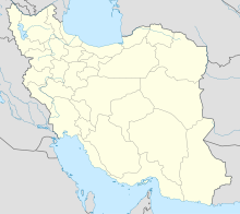
Fasa Airport ( Persian: فرودگاه فسا) ( IATA: FAZ [2] [3], ICAO: OISF) is an airport serving Fasa, [1] a city in the Fars Province in Iran. A public airport, it is operated by Iran Airports Company.
Facilities
The airport is at an elevation of 4,261 feet (1,299 m) above mean sea level. It has one runway designated 14/32 with an asphalt surface measuring 1,982 by 30 metres (6,503 ft × 98 ft). [1]
References
- ^ a b c Airport information for OISF [usurped] from DAFIF (effective October 2006)
- ^ a b Airport information for FAZ at Great Circle Mapper. Source: DAFIF (effective October 2006).
- ^ "Fasa Airport (FAZ/OISF) - Fasa, Iran". Handbook of Business Aviation. Retrieved 24 April 2010.
External links
