Farmersville, Wisconsin | |
|---|---|
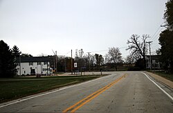
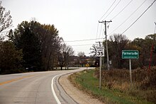
 Buildings in Farmsville | |
| Coordinates: 43°33′30″N 88°31′53″W / 43.55833°N 88.53139°W | |
| Country | |
| State | |
| County | Dodge County |
| Town | LeRoy |
| Elevation | 299 m (981 ft) |
| Time zone | UTC-6 ( Central (CST)) |
| • Summer ( DST) | UTC-5 (CDT) |
| Area code | 920 |
| GNIS feature ID | 1564865 [1] |

Farmersville is an unincorporated community located in the town of LeRoy, Dodge County, Wisconsin, United States. [1]
Notable people
- Frank E. Bachhuber, lawyer, businessman, politician [2]
Notes
- ^ a b "Farmersville, Wisconsin". Geographic Names Information System. United States Geological Survey, United States Department of the Interior.
- ^ 'Wisconsin Blue Book 1933, Biographical Sketch of Frank E. Bachhuber, pg. 242


