Evergreen
Evergreen Valley | |
|---|---|
.jpg)   .jpg) Top images:
Evergreen Village Square; bottom image:
Gurdwara Sahib of San Jose. | |
 Evergreen Location within San Jose | |
| Coordinates: 37°18′35″N 121°47′01″W / 37.3096638°N 121.7835622°W | |
| Country | United States |
| State | California |
| County | Santa Clara |
| City | San Jose |
| Zip Codes | 95148, 95121, 95138, 95135,95111 |
| Montgomery Hill | |
|---|---|
| Official name | Montgomery Hill [1] |
| Designated | September 12, 1966 |
| Reference no. | 813 |
Evergreen, also known as Evergreen Valley, is a large district of San Jose, California, located in East San Jose.
History
.jpg)
Evergreen was originally part of Rancho Yerba Buena, a Mexican-era rancho grant given to Antonio Chaboya, a member of a prominent, local Californio family, by Governor José Figueroa. The Chaboya family played an important role in the development of the area and is memorialized in Evergreen through various place names, such as Chaboya Middle School, Chaboya Park, Chaboya Road, and the Chaboya neighborhood of Evergreen.
Evergreen was the site of gliding experiments in 1911 by John J. Montgomery, an important figure in pioneering aeronautics. In his honor the local community has established John J. Montgomery Elementary School, Montgomery Park (City of San Jose). [2]
Montgomery's last glider, named "The Evergreen", after the San Jose district, was restored by the Smithsonian Institution and is currently on display at the San Diego Air and Space Museum in San Diego, California.
Geography

Evergreen is located in East San Jose. The Alum Rock district is located north of Evergreen and Silver Creek Valley (sometimes considered part of Evergreen) is located south of Evergreen. To the east of Evergreen is the Diablo Range.
Waterways in Evergreen include Thompson Creek, Upper Silver Creek and Lower Silver Creek.
Education
.jpg)
The area is served by Evergreen Elementary School District and East Side Union High School District. Evergreen Valley High School with an API score of 10 in 2016 and Silver Creek High School with an API score of 9 in 2016 are the primary comprehensive high schools to serve Evergreen. [3]
Evergreen Valley College is at the base of the foothills of the Diablo Range. [4]
- Libraries
Evergreen area is served by two libraries as part of San Jose Public Library System:
- Evergreen Branch Library on Aborn Road [5]
- Evergreen Village Square Branch Library at Evergreen Village Square [6]
Evergreen Valley College also has its Library and Educational Technology Center.
Landmarks
- Evergreen Village Square
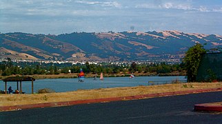
- Lake Cunningham
- Raging Waters San Jose
- Eastridge
- Evergreen Valley College
- Gurdwara Sahib of San Jose
- Montgomery Hill (Evergreen Aviation Monument)
Montgomery Hill landmark

On September 12, 1966, the State Historic Preservation Office designated the Montgomery Hill as a California historical landmark #813. A description on the commemorative plaque reads: "Three-quarters of a mile northeast is Montgomery Hill, site of the 55 successful flights of John Joseph Montgomery's 'aeroplane' that demonstrated aerodynamic developments still indispensable to modern aircraft. Montgomery combined his engineering skill with the basic principles of aerodynamics that he discovered to produce a heavier-than-air flying machine which had complete control: cambered wing, rear stabilizer, flexible wingtips, and wing-warping aileron." [1]
Plazas and parks
.jpg)
- Evergreen Village Square
- Lake Cunningham
- Joseph D. Grant County Park
- Boggini Park
- Canyon Creek Park, [7]
- Montgomery Hill Park, [8]
- Groesbeck Hill Park, [9]
- Fowler Creek Park [10]
- Arcadia Ballpark
- Brigadoon Park
Gallery
-
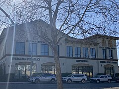 Businesses on San Felipe
 -
 Townhomes on the Evergreen Loop
 -
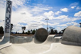 Lake Cunningham Skate Park
 -
-
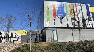 Evergreen Valley College Centers for Visual and Performing Arts
 -

-
 Traditional Californian Spanish style homes in Evergreen

.jpg)
.jpg)
_(cropped).jpg)
.jpg)
_0901_(cropped).jpg)
.jpg)
References
- ^ a b "Montgomery Hill Historical Landmark". Office of Historic Preservation. Retrieved 2023-12-13.
- ^ "San Jose, CA - Official Website - Montgomery Hill". www.sanjoseca.gov. Retrieved 2017-11-09.
- ^ "East Side Union High School District - School Boundaries". www.esuhsd.org. Retrieved 2017-11-09.
- ^ "Evergreen Valley College: About". Archived from the original on 2011-08-21. Retrieved 2011-08-06.
- ^ "Evergreen Branch Library".
- ^ "Village Square Branch Library".
- ^ "Facility Directory Table List | City of San Jose". www.sanjoseca.gov. Retrieved 2020-03-29.
- ^ "Facility Directory Table List | City of San Jose". www.sanjoseca.gov. Retrieved 2020-03-29.
- ^ "Facility Directory Table List | City of San Jose". www.sanjoseca.gov. Retrieved 2020-03-29.
- ^ "Facility Directory Table List | City of San Jose". www.sanjoseca.gov. Retrieved 2020-03-29.