| Edgewood Park & Natural Preserve | |
|---|---|
.jpg) Trail with fog rolling over the mountains | |
 | |
| Location | San Mateo County, California |
| Nearest city | Redwood City |
| Coordinates | 37°28′26.2″N 122°16′43.1″W / 37.473944°N 122.278639°W |
| Area | 467 acres (189 ha) |
Edgewood County Park and Natural Preserve is a 467-acre protected area located in San Mateo County, California, United States, and is best known for its spring wildflower displays. [1] The park receives about 50,000 visitors each year.
Description
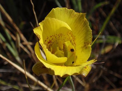
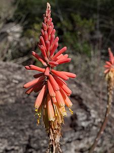
Edgewood has 160 acres of serpentine soil which are known for having high proportions of native plant species including rare and locally endemic species. Edgewood has grasslands, chaparral, coastal scrub, foothill woodlands, and wetlands supporting over 500 distinct species, three of which are federally listed as endangered or threatened. Edgewood is also home to the Bay checkerspot butterfly, also a threatened species. Its northwestern slopes have small tributaries to Cordilleras Creek, [2] while its southwestern slopes host the source of Laguna Creek. [3]
Edgewood contains all the major ecological zones specific to the San Francisco Peninsula with the exception of Redwood forest. [4]
History
Various development projects were proposed on what is now Edgewood beginning in 1967 including a college, recreational complex, solar energy facility, and a golf course. The property was acquired by San Mateo County in 1979 from California for approximately US$2,000,000 (equivalent to $8,400,000 in 2023). [5] County supervisors moved forward with plans for an 18-hole public golf course, approving a master plan and certifying an Environmental Impact Report (EIR) by the end of 1982. In 1983, the California Native Plant Society (CNPS) filed a lawsuit challenging the EIR, which was settled out-of-court on the condition that sensitive habitats would be given protection. The Bay checkerspot was declared a threatened species in 1987, followed by the Edgewood Park harvestman in 1988, [6] and one of the members of the County Board of Supervisors ran for Congress in 1988, narrowly defeating a primary challenger after the supervisor's support of the golf course was made one of the focal points of the campaign. [5] In 1992, two-thirds of Edgewood Park were set aside for a natural preserve with one-third to be considered for the golf course, pending the results of a feasibility study. In the summer of 1993, the County Board of Supervisors declared Edgewood County Park a Natural Preserve, following the feasibility study results, which concluded the parts of the park flat enough to support a golf course were also the same parts that contained the protected species. The Natural Preserve declaration in 1993 protected the entire park from future development.
Gallery
-
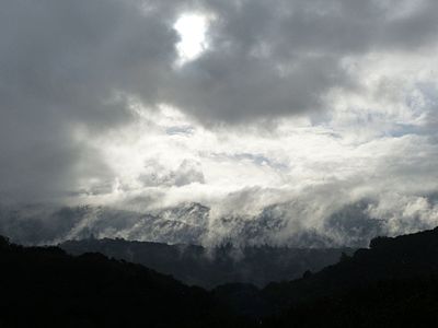 Storm clearing over hillside
 -
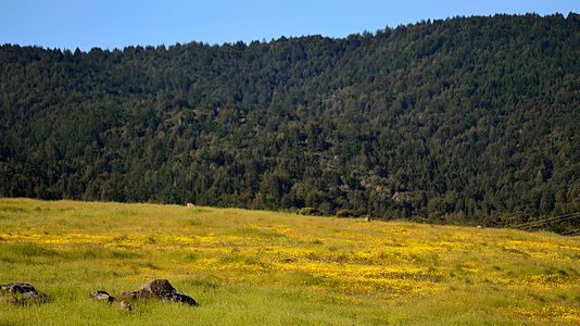 Springtime fields of color
 -
-

-

-
 California state flower ( golden poppy) and state rock ( serpentine)
 -

-

-
.jpg)
.jpg)
.jpg)
.jpg)
.jpg)
.jpg)
.jpg)
.jpg)
_(4361450614).jpg)
References
- ^ Kay, Jane (11–12 February 1995). "January's showers bring California flowers". Bangor Daily News. San Francisco Examiner. Retrieved 20 July 2016.
- ^ "Cordilleras Creek". Geographic Names Information System. United States Geological Survey, United States Department of the Interior.
- ^ "Laguna Creek (San Mateo County)". Geographic Names Information System. United States Geological Survey, United States Department of the Interior.
- ^ Boland, Christine (2016). "Edgewood Preserve Trail". City of San Carlos. Archived from the original on 26 June 2016. Retrieved 20 July 2016.
- ^ a b Curtis, Carolyn (Winter 2008). "Edgewood County Park and Natural Preserve: How it happened" (PDF). Fremontia. 36 (1). California Native Plant Society: 3–11. Retrieved 20 July 2016.
- ^ "Daddy-longlegs may block golf course". Lakeland Ledger. 17 February 1988. Retrieved 20 July 2016.
External links
- "Edgewood Park & Natural Preserve". County of San Mateo Parks Department. 2016. Retrieved 20 July 2016.
- Friends of Edgewood Natural Preserve
- "Edgewood County Park and Natural Preserve". California Native Plant Society: Santa Clara Valley. 2016. Retrieved 20 July 2016.