Eden Valley 216 | |
|---|---|
| Eden Valley Indian Reserve No. 216 | |
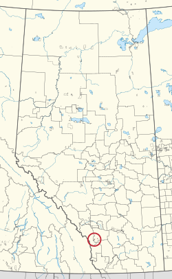
 Location in Alberta | |
| First Nations |
Stoney Nakoda |
| Country | Canada |
| Province | Alberta |
| Municipal district | Foothills |
| Area | |
| • Land | 17.65 km2 (6.81 sq mi) |
| Population (2016)
[1] | |
| • Total | 596 |
| • Density | 33.8/km2 (88/sq mi) |
| Website | edenvalleyreserve.ca |
Eden Valley 216 is an Indian reserve of the Stoney Nakoda First Nation, comprising Bearspaw, Chiniki, and Wesley First Nations, located near Longview, Alberta. [2]
References
- ^ a b "Census Profile, 2016 Census". Statistics Canada. February 8, 2017. Retrieved 2019-08-10.
- ^ "Eden Valley 216". Statistics Canada. 2001. Retrieved 27 December 2009.[ permanent dead link]