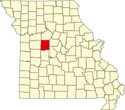
Dresden, Missouri | |
|---|---|
 | |
| Coordinates: 38°45′04″N 93°20′06″W / 38.75111°N 93.33500°W | |
| Country | United States |
| State | Missouri |
| County | Pettis |
| Elevation | 827 ft (252 m) |
| Time zone | UTC-6 ( Central (CST)) |
| • Summer ( DST) | UTC-5 (CDT) |
| GNIS feature ID | 717048 [1] |
Dresden (also Dresdon) is an unincorporated community in Pettis County, Missouri, United States.
History
A post office called Dresden was established in 1863, and remained in operation until 1954. [2] The community was named after Dresden, Germany. [3] Dresden was once an incorporated town. [4]
References
- ^ a b U.S. Geological Survey Geographic Names Information System: Dresden, Missouri
- ^ "Post Offices". Jim Forte Postal History. Retrieved November 27, 2016.
- ^ Eaton, David Wolfe (1917). How Missouri Counties, Towns and Streams Were Named. The State Historical Society of Missouri. pp. 340.
- ^ "Pettis County Place Names, 1928–1945". The State Historical Society of Missouri. Archived from the original on June 24, 2016. Retrieved November 27, 2016.
