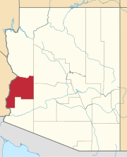
Desert Wells, originally Desert Station, a stagecoach station on the La Paz–Wickenburg Road in the 1870s, is a populated place in La Paz County, Arizona, United States. It lies at an elevation of 1,132 feet / 345 meters and is located 4.7 miles west-southwest of Vicksburg on U.S. Route 60. [1]
History
Desert Wells was originally known as Desert Station, a stagecoach station on the La Paz–Wickenburg Road, in what was then Yuma County. It lay 26 miles from Tyson's Wells to the west and 20 miles from Flint's on Centennial Wash to the east. In 1875, it was seen by Martha Summerhayes, and later described in her book Vanished Arizona:
At night we arrived at Desert Station. There was a good ranch there, kept by Hunt and Dudley, Englishmen, I believe. I did not see them, but I wondered who they were and why they staid in such a place. They were absent at the time; perhaps they had mines or something of the sort to look after. One is always imagining things about people who live in such extraordinary places. At all events, whatever Messrs. Hunt and Dudley were doing down there, their ranch was clean and attractive, which was more than could be said of the place where we stopped the next night, a place called Tyson’s Wells. [2]: 144
Desert Station appears on Arizona Territory maps between 1875 and 1880, [3] [4] and an itineraries in 1878. [5]: xxvii The name was retained for many years. It took its present form because it had a 120-foot well. [1]
See also
References
- ^ a b U.S. Geological Survey Geographic Names Information System: Desert Wells
- ^ Martha Summerhayes, Vanished Arizona Recollections of the Army Life by a New England Woman, The Salem Press Co., Salem. Mass., 1908.
- ^ Sheet No. 3, Department of Arizona. Revised, 1875. Compiled under the authority of Maj. Gen. J.M. Schofield Commanding Mil. Div. of the Pacific by 1st Lieut. J.C. Mallery Corps of Engrs. Published by authority of The Hon. The Secretary of War in the Office of the Chief Of Engineers U.S. Army Washington D.C. 1876. Drawn by J.W. Ward.
- ^ Official Map Of The Territory Of Arizona Compiled from Surveys, Reconnaissances and other Sources. By E.A. Eckhoff And P. Riecker, Civil Engineers, 1880. Drawn by Eckhoff & Riecker. The Graphic Co. Photo-Lith. 39 & 41 Park Place, N.Y. Entered ... 1879, by Emil Eckhoff and Paul Riecker ... Washington, D.C., 1880 “Official Map of the Territory of Arizona” showing La Paz – Wikenburg Road and Hardyville – Prescott Road with mileage between locations along the roads, from davidrumsey.com, accessed on June 21, 2016
- ^ Richard Josiah Hinton, The Handbook to Arizona: Its Resources, History, Towns, Mines, Ruins, and Scenery, Payot, Upham & Company, San Francisco, 1878
