Desert Haven | |
|---|---|
 Desert Haven Location within the state of Texas | |
| Coordinates: 31°50′10″N 105°57′43″W / 31.83611°N 105.96194°W | |
| Country | United States |
| State | Texas |
| County | Hudspeth |
| Time zone | UTC-6 ( Central (CST)) |
| • Summer ( DST) | UTC-5 (CDT) |
Desert Haven is an unincorporated community in Hudspeth County, Texas, United States. It lies along US Highway 62– 180 in the northwestern part of the county, just east of the El Paso County line, approximately 28 miles east of El Paso, and is synonymous with Loma Linda Estates Colonia.
Government and infrastructure
The local fire department is the Desert Haven Fire Department. [1]
References
Municipalities and communities of
Hudspeth County, Texas, United States | ||
|---|---|---|
| City | 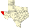 | |
| CDPs | ||
|
Other communities | ||
| Ghost towns | ||
 | This article about a location in Hudspeth County, Texas is a stub. You can help Wikipedia by expanding it. |