The topic of this article may not meet Wikipedia's
notability guideline for geographic features. (April 2011) |
| Daveys Hut | |
|---|---|
| Coordinates | 36°13′53.7″S 148°31′57.9″E / 36.231583°S 148.532750°E |
| Country | Australia |
| State/territory | New South Wales |
| Construction | |
| Built in | 1909 |
| Built by | Tom Bolton |
| Built for | Cattle grazing |
| Administration | |
| Maintained by | Kosciuszko Huts Association |
| Accessibility | |
| Accessed by | Foot |
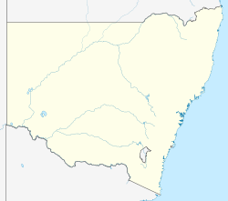
Daveys Hut is an Australian alpine hut in the Kosciuszko National Park.
The hut was built in 1909 by grazier Tom Bolton, who moved into it with his new wife, Mary, in 1911. It is now maintained by the Kosciuszko Huts Association as a stopover for hikers, and was listed on the former Register of the National Estate. [1] [2]
Extensive repairs were carried out in 2012, replacing the wooden foundations with brick, repairing broken fittings and doors and relining an interior plywood wall.
See also
References
- ^ "Regional State of the Environment Report 2004-2009". Government of the Australian Capital Territory. 14 October 2009. Retrieved 13 December 2015.
- ^ "Daveys Hut, Eucumbene, NSW, Australia - listing on the now-defunct Register of the National Estate (Place ID 103744)". Australian Heritage Database. Australian Government. 25 August 1981. Retrieved 23 November 2019.

