Darband ( Persian: دربند, [dæɾˈbænd]), formerly a village close to Tajrish, Shemiran, is a neighborhood inside Tehran's metropolitan limits. [1] It is the beginning of a hiking trail into Mount Tochal, which towers over Tehran. The Persian term darband translates to "door of the mountain" (band, a variation of vand and fand, meaning "mountain").
The start of the trail at Darband is about 250 metres long and is dotted with a number of small cafes and restaurants. These are quite popular and are busy in the evenings, as locals and tourists alike visit the many hooka lounges along the trail. [2] The Zahir-od-dowleh cemetery is also located in Darband.
Gallery
-
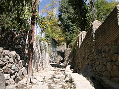 A steep path in Darband
 -
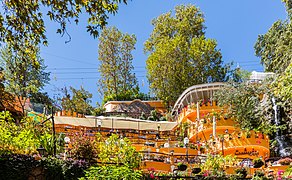 A cafe in Darband
 -
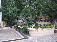 A restaurant in Darband


References
- ^ Fatemeh Farnaz Arefian. Seyed Hossein Iradj Moeini. (Dec 18, 2015). Urban Change in Iran: Stories of Rooted Histories and Ever-accelerating Developments. p. 144.
- ^ Naomi Duguid (2016). Taste of Persia: A Cook's Travels Through Armenia, Azerbaijan, Georgia, Iran, and Kurdistan. p. 57.
External links
35°49′23.92″N 51°25′30.1″E / 35.8233111°N 51.425028°E

|
| This Shemiranat County location article is a stub. You can help Wikipedia by expanding it. |