Cross Roads | |
|---|---|
 | |
| Coordinates: 36°49′19″N 93°31′59″W / 36.82194°N 93.53306°W | |
| Country | United States |
| State | Missouri |
| County | Stone |
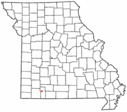
Cross Roads is an unincorporated community in western Stone County, Missouri, United States. [1] It is located at the intersection of State Routes 173 and 248, approximately four miles west of Galena. [2] Crossroads is part of the Branson, Missouri Micropolitan Statistical Area.
References
- ^ U.S. Geological Survey Geographic Names Information System: Cross Roads, Stone County, Missouri
- ^ Missouri Atlas & Gazetteer, DeLorme, 1998, First edition, p. 61, ISBN 0-89933-224-2

