Coy, Alabama | |
|---|---|
 Coy, Alabama Location within the state of Alabama  Coy, Alabama Coy, Alabama (the United States) | |
| Coordinates: 31°53′42″N 87°27′46.8″W / 31.89500°N 87.463000°W | |
| Country | United States |
| State | Alabama |
| County | Wilcox |
| Elevation | 95 ft (29 m) |
| Time zone | UTC-6 ( Central (CST)) |
| • Summer ( DST) | UTC-5 (CDT) |
| ZIP code | 36435 |
| Area code | 334 |
Coy is an unincorporated community in Wilcox County, Alabama, United States. [1] [2] Coy is located in a bend of the Alabama River and is home to several historic plantations. The most notable of these is Dry Fork Plantation, included on the National Register of Historic Places. [3]
Geography
Coy is located at 31°53′42″N 87°27′47″W / 31.8950°N 87.4630°W and has an elevation of 95 feet (29 m). [2]
Notable person
- John Cooper Godbold, United States circuit judge for the United States Court of Appeals for the Eleventh Circuit, was born in Coy. [4]
References
- ^ "Coy, Alabama". Geographic Names Information System. United States Geological Survey, United States Department of the Interior.
- ^ a b "Coy, Alabama". "AL HomeTownLocator". Retrieved October 14, 2008.
- ^ "National Register Information System". National Register of Historic Places. National Park Service. April 15, 2008.
- ^ Federal Judicial Center-John Cooper Godbold
Municipalities and communities of
Wilcox County, Alabama, United States | ||
|---|---|---|
| City | 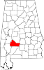 | |
| Towns | ||
| CDPs | ||
|
Unincorporated communities | ||
| Ghost towns | ||
|
| This Wilcox County, Alabama state location article is a stub. You can help Wikipedia by expanding it. |