Coon Box, Mississippi | |
|---|---|
 Coon Box  Coon Box | |
| Coordinates: 31°47′45″N 91°04′42″W / 31.79583°N 91.07833°W | |
| Country | United States |
| State | Mississippi |
| County | Jefferson |
| Elevation | 161 ft (49 m) |
| Time zone | UTC-6 ( Central (CST)) |
| • Summer ( DST) | UTC-5 (CDT) |
| Area code(s) | 601 & 769 |
| GNIS feature ID | 668795 [1] |
Coon Box is an unincorporated community located in Jefferson County, Mississippi, United States. [1] Coon Box is 5.9 miles (9.5 km) north of Fayette. The Coon Box Fork Bridge, which is listed on the National Register of Historic Places, is located one mile southwest of Coon Box. [2] [3]
References
- ^ a b "Coon Box". Geographic Names Information System. United States Geological Survey, United States Department of the Interior.
- ^ "National Register Information System". National Register of Historic Places. National Park Service. July 9, 2010.
- ^ "Coon Box Fork Bridge". Historic Sites Survey. Mississippi Department of Archives and History. Retrieved October 25, 2012.
Municipalities and communities of
Jefferson County, Mississippi, United States | ||
|---|---|---|
| City | 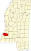 | |
|
Unincorporated communities | ||
| Ghost towns | ||
|
| This Jefferson County, Mississippi state location article is a stub. You can help Wikipedia by expanding it. |