Condé-en-Normandie | |
|---|---|
 St. Martin's Church in Condé-sur-Noireau | |
 Condé-en-Normandie  Condé-en-Normandie | |
| Coordinates: 48°51′04″N 0°33′11″W / 48.851°N 0.553°W | |
| Country | France |
| Region | Normandy |
| Department | Calvados |
| Arrondissement | Vire |
| Canton | Condé-en-Normandie |
| Intercommunality | Intercom de la Vire au Noireau |
| Government | |
| • Mayor (2020–2026) | Valérie Desquesne [1] |
| Area 1 | 62.98 km2 (24.32 sq mi) |
| Population (2021)
[2] | 6,157 |
| • Density | 98/km2 (250/sq mi) |
| Time zone | UTC+01:00 ( CET) |
| • Summer ( DST) | UTC+02:00 ( CEST) |
| INSEE/Postal code |
14174 /14110, 14770 |
| 1 French Land Register data, which excludes lakes, ponds, glaciers > 1 km2 (0.386 sq mi or 247 acres) and river estuaries. | |
Condé-en-Normandie (French pronunciation: [kɔ̃de ɑ̃ nɔʁmɑ̃di]) is a commune in the department of Calvados, northwestern France. The municipality was established on 1 January 2016 by merger of the former communes of Condé-sur-Noireau (the seat), La Chapelle-Engerbold, Lénault, Proussy, Saint-Germain-du-Crioult and Saint-Pierre-la-Vieille. [3]
Geography
The commune is part of the area known as Suisse Normande. [4]
The commune is made up of the following collection of villages and hamlets, Le Mesnil, Lénault, Le Tremblay, Cresme, Rousseville, Saint-Pierre-la-Vieille, Le Hamel Roger, Le Vieux Douet, La Chapelle-Engerbold, Le Hamel, Le Mont Hue, Proussy, Les Haies, Le Coudray, Le Hamel, Les Îles, Bouilly, Solier, Vaux, Condé-sur-Noireau, Le Bosq and L'Abbaye. [5]
The Tortillon, la Druance plus The Noireau are the three rivers flowing through the commune. [6] [7] [8] In addition the commune has five streams flowing through its borders, La Blare, The Cresme, The Vaux, The Hamelet and The Val Fournet. [9] [10]
Neighbouring communes In addition to
Pontécoulant which Condé-en-Normandie completely surrounds
[5] | |
|---|---|
Population
| Year | Pop. | ±% p.a. |
|---|---|---|
| 1968 | 8,335 | — |
| 1975 | 8,889 | +0.92% |
| 1982 | 8,805 | −0.14% |
| 1990 | 8,055 | −1.11% |
| 1999 | 7,595 | −0.65% |
| 2007 | 7,503 | −0.15% |
| 2012 | 7,260 | −0.66% |
| 2017 | 6,634 | −1.79% |
| Source: INSEE [11] | ||
Points of Interest
Museums
- Musée Charles Léandre - Based in Condé-sur-Noireau, museum dedicated to Charles Lucien Léandre and other Normandy based artists. [12]
- Musée de l'Imprimerie Typographique - a museum dedicated to Typographic Printing based in Condé-sur-Noireau. [13]
National heritage sites
The Commune has two buildings and areas listed as a Monument historique [14]
- Galland-Duclos House an eighteenth century private house, that was classed as a Monument historique in 1996. [15]
- House on Grand Rue - listed as a monument in 1929, it was destroyed in the second world war. [16]
-
 Saint-Pierre-la-Vieille Church
 -
 Chateau dor bigny
 -
 La Chapelle-Engerbold
 -
 Saint-Gerbold church in La Chapelle Engerbold
 -
 Saint Sauveur Church in Condé-sur-Noireau
 -
 Condé-sur-Noireau Municipal lake with beach
 -
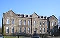 Hospice in Condé-sur-Noireau
 -
 Monument dedicated to asbestos victims in Condé-sur-Noireau


_-_panoramio.jpg)
Notable People
- Jules Dumont d'Urville - (1790 – 1842) a French explorer and naval officer who explored the south and western Pacific, Australia, New Zealand, and Antarctica, was born here. [17]
- Henri Duret - (1849 - 1921) a French neurologist whose contributions to the knowledge of cerebral circulation and the physiology of the brainstem were important for the early years of brain surgery, was born here. [18]
- Maximilien Vox - (1894–1974) a French writer, cartoonist, illustrator, publisher, journalist, critic art theorist and historian of the French letter and typography, was born here. [19]
- Michèle Fabien - (1945 – 1999) a Belgian writer and playwright, is buried here at Saint-Pierre-la-Vieille cemetary. [20] [21]
Twin towns – sister cities
Condé-en-Normandie is twinned with:
-
 Ross-on-Wye, United Kingdom since 1980
[22]
Ross-on-Wye, United Kingdom since 1980
[22] -
 Elsenfeld, Germany since 2004
[23]
Elsenfeld, Germany since 2004
[23]
Former Twin Towns
-
 Poggio Rusco, Italy - from 1999 to 2021.
[24]
[25]
Poggio Rusco, Italy - from 1999 to 2021.
[24]
[25]
See also
References
- ^ "Répertoire national des élus: les maires" (in French). data.gouv.fr, Plateforme ouverte des données publiques françaises. 13 September 2022.
- ^ "Populations légales 2021". The National Institute of Statistics and Economic Studies. 28 December 2023.
- ^ Arrêté préfectoral 1 December 2015 (in French)
- ^ "Map of Suiss Normande" (PDF).
- ^ a b "Condé-en-Normandie · France". Condé-en-Normandie · France.
- ^ Sandre. "Fiche cours d'eau - Le Noireau (I24-0400)".
- ^ Sandre. "Fiche cours d'eau - la Druance (I24-0420)".
- ^ Sandre. "Fiche cours d'eau - le Tortillon (I2439000)".
- ^ Sandre. "Fiche cours d'eau - Ruisseau du Val Fournet (I2506400)".
- ^ Sandre. "Fiche cours d'eau - Ruisseau de Cresme (I2429000)".
- ^ Population en historique depuis 1968, INSEE
- ^ "Condé-en-Normandie. Le musée Léandre prête ses œuvres". caen.maville.com.
- ^ "Le musée de l'imprimerie typographique a rouvert à Condé-en-Normandie". Ouest-France.fr. 15 November 2021.
- ^ "Les Monuments Historiques en Calvados - 14". monumentum.fr.
- ^ "Maison dite Galland-Duclos à Condé-en-Normandie - PA14000001 - Monumentum". monumentum.fr.
- ^ "Maison à Condé-en-Normandie - PA00111242 - Monumentum". monumentum.fr.
- ^ LECORNU-BAERT, Nathalie (19 March 2023). "Condé-en-Normandie. Le contre-amiral Dumont d'Urville demeure un enfant du pays". Ouest-France.fr.
- ^ Walusinski, Olivier; Courrivaud, Philippe (11 September 2014). "Henry Duret (1849-1921): A Surgeon and Forgotten Neurologist". European Neurology. 72 (3–4): 193–202. doi: 10.1159/000361046 – via Silverchair.
- ^ LELION, Mélanie (18 October 2014). "Le long parcours pour avoir un timbre de Maximilien Vox". Ouest-France.fr.
- ^ "Poster un commentaire - Cimetières de France et d'ailleurs". www.landrucimetieres.fr.
- ^ "Michèle Fabien - biographie". michelefabien.be.
- ^ "HRH The Princess Royal visits Coleford to celebrate the town's twinning links". Visit Dean Wye. 16 May 2023.
- ^ "Condé-en-Normandie. Jumelage avec Elsenfeld : les habitants invités aux 20 ans". caen.maville.com.
- ^ "Une classe en moins, clocher de Saint-Sauveur... que faut-il attendre en 2023 à Condé-en-Normandie ?". actu.fr. 14 January 2023.
- ^ "Le dernier conseil municipal de l'année étoffé à Condé-en-Normandie". Ouest-France.fr. 14 December 2021.
|
| This Calvados geographical article is a stub. You can help Wikipedia by expanding it. |