Coabey | |
|---|---|
Barrio | |
 Cemi Museum in Coabey | |
 Location of Coabey within the municipality of Jayuya shown in red | |
 Coabey Location of Puerto Rico | |
| Coordinates: 18°12′51″N 66°33′44″W / 18.214119°N 66.56214°W [1] | |
| Commonwealth | |
| Municipality | |
| Area | |
| • Total | 3.81 sq mi (9.9 km2) |
| • Land | 3.81 sq mi (9.9 km2) |
| • Water | 0.00 sq mi (0.0 km2) |
| Elevation | 1,880 ft (570 m) |
| Population (2010) | |
| • Total | 2,166 |
| • Density | 568.5/sq mi (219.5/km2) |
| Source: 2010 Census | |
| Time zone | UTC−4 ( AST) |
Coabey is a barrio in the municipality of Jayuya, Puerto Rico. Its population in 2010 was 2,166. [3] [4] [5] Coabey is a newer barrio which was formed from areas of Jayuya barrio-pueblo and its first census was done in 1930. [6]
| Census | Pop. | Note | %± |
|---|---|---|---|
| 1930 | 680 | — | |
| 1940 | 959 | 41.0% | |
| 1950 | 1,277 | 33.2% | |
| 1960 | 1,118 | −12.5% | |
| 1970 | 1,079 | −3.5% | |
| 1980 | 1,286 | 19.2% | |
| 1990 | 1,753 | 36.3% | |
| 2000 | 2,069 | 18.0% | |
| 2010 | 2,166 | 4.7% | |
| U.S. Decennial Census 1930 [7] 1930-1950 [8] 1980-2000 [9] 2010 [10] | |||
Features
The El Cemí Museum (Museo El Cemí) is in Coabey, Jayuya. The museum features Taíno history. [11]
The Casa Canales Museum (Museo Casa Canales) is in Coabey. The museum features the events and people surrounding the Jayuya Uprising event in 1950.
Gallery
- Places in Coabey
-
 Hacienda San Pedro Museum
 -
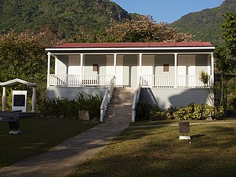 Museo Casa Canales


See also
References
- ^ a b "US Gazetteer 2019". US Census. US Government.
- ^ U.S. Geological Survey Geographic Names Information System: Coabey Barrio
- ^ Picó, Rafael; Buitrago de Santiago, Zayda; Berrios, Hector H. Nueva geografía de Puerto Rico: física, económica, y social, por Rafael Picó. Con la colaboración de Zayda Buitrago de Santiago y Héctor H. Berrios. San Juan Editorial Universitaria, Universidad de Puerto Rico,1969.
- ^ Gwillim Law (20 May 2015). Administrative Subdivisions of Countries: A Comprehensive World Reference, 1900 through 1998. McFarland. p. 300. ISBN 978-1-4766-0447-3. Retrieved 25 December 2018.
- ^ Puerto Rico: 2010 Population and Housing Unit Counts.pdf (PDF). U.S. Dept. of Commerce, Economics and Statistics Administration, U.S. Census Bureau. 2010.
- ^ Mapa de Municipios y Barrios (PDF). Santurce, Puerto Rico: Junta de Planificación. 1955. p. 25. Retrieved 10 April 2021.
- ^ "Table 3-Population of Municipalities: 1930 1920 and 1910" (PDF). United States Census Bureau. Archived (PDF) from the original on August 17, 2017. Retrieved September 21, 2017.
- ^ "Table 4-Area and Population of Municipalities Urban and Rural: 1930 to 1950" (PDF). United States Census Bureau. Archived (PDF) from the original on August 30, 2015. Retrieved September 21, 2014.
- ^ "Table 2 Population and Housing Units: 1960 to 2000" (PDF). United States Census Bureau. Archived (PDF) from the original on July 24, 2017. Retrieved September 21, 2017.
- ^ Puerto Rico: 2010 Population and Housing Unit Counts.pdf (PDF). U.S. Dept. of Commerce Economics and Statistics Administration U.S. Census Bureau. 2010. Archived (PDF) from the original on 2017-02-20. Retrieved 2019-08-02.
- ^ "Museo El Cemí". Discover Puerto Rico. Retrieved 2021-09-05.
External links
|
| This Jayuya, Puerto Rico location article is a stub. You can help Wikipedia by expanding it. |