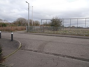
Clydebank East | |
|---|---|
 The site of the station in 2019 | |
| General information | |
| Location |
Clydebank,
West Dunbartonshire Scotland |
| Coordinates | 55°53′54″N 4°24′01″W / 55.8983°N 4.4002°W |
| Grid reference | NS500698 |
| Platforms | 2 |
| Other information | |
| Status | Disused |
| History | |
| Original company | Glasgow, Yoker and Clydebank Railway |
| Pre-grouping | North British Railway |
| Post-grouping |
London and North Eastern Railway British Railways (Scottish Region) |
| Key dates | |
| 1 December 1882 | Opened as Clydebank |
| 17 May 1897 | Name changed to Clydebank East |
| 14 September 1959 | Closed |
Clydebank East railway station served the town of Clydebank, West Dunbartonshire, Scotland, from 1882 to 1959 on the Glasgow, Yoker and Clydebank Railway.
History
The station was opened on 1 December 1882 by the Glasgow, Yoker and Clydebank Railway. It was originally a terminus until Dalmuir opened to the south on 17 May 1897, at which point the station's name changed to Clydebank East. It had carriage sidings on either side, goods sidings to the south, which served John Brown Ship Yard and Clydebank East Shed. The station closed on 14 September 1959. [1] [2]
References
| Preceding station | Disused railways | Following station | ||
|---|---|---|---|---|
|
Yoker Line and station closed |
Glasgow, Yoker and Clydebank Railway |
Clydebank Line and station closed |