33°54′27″N 82°36′07″W / 33.9076218°N 82.6020786°W
Chennault is an unincorporated community in Lincoln County, Georgia, United States. It lies at the intersection of State Routes 44 and 79, to the northwest of the city of Lincolnton, the county seat of Lincoln County. [1] Its elevation is 466 feet (142 m), and it is located at 33°54′27″N 82°36′07″W / 33.90750°N 82.60194°W (33.9076218, -82.6020786). [2]
See also
References
- ^ Rand McNally. The Road Atlas '06. Chicago: Rand McNally, 2006, p. 28.
- ^ Geographic Names Information System Feature Detail Report, Geographic Names Information System, 1979-09-25. Accessed 2007-12-23.
Municipalities and communities of
Lincoln County, Georgia, United States | ||
|---|---|---|
| Cities | 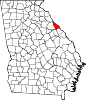 | |
|
Unincorporated communities | ||
| Ghost town | ||
|
| This Lincoln County, Georgia state location article is a stub. You can help Wikipedia by expanding it. |