| Cedar Key Scrub State Reserve | |
|---|---|
IUCN category V (protected landscape/seascape) | |
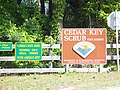
 Entryway | |
  | |
| Location | Levy County, Florida, USA |
| Nearest city | Cedar Key, Florida |
| Coordinates | 29°11′21″N 83°2′4″W / 29.18917°N 83.03444°W |
| Area | 5,028 acres (20 km2) |
| Governing body | Florida Department of Environmental Protection |
The Cedar Key Scrub State Reserve is a Florida State Park, located six miles (10 km) northeast of Cedar Key on State Road 24.
Admission and Hours
There is no entrance charge. Florida state parks are open between 8 a.m. and sundown every day of the year (including holidays).
Gallery
-
 Another view of the entrance
 -
 Wooded area
 -
 Trail through woods
 -
 Trailhead


External links
- Cedar Key Scrub State Reserve at Florida State Parks
- Cedar Key Scrub State Reserve at State Parks
- Cedar Key Scrub State Reserve at Wildernet
|
| This Florida State Park related article is a stub. You can help Wikipedia by expanding it. |