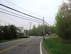
Carrs Tavern, New Jersey | |
|---|---|
 | |
| Coordinates: 40°10′17″N 74°25′18″W / 40.17139°N 74.42167°W | |
| Country | |
| State | |
| County | Monmouth |
| Township | Millstone |
| Elevation | 167 ft (51 m) |
| GNIS feature ID | 875220 [1] |
Carrs Tavern is an unincorporated community in Millstone Township in Monmouth County, in the U.S. state of New Jersey. [1] [2] It is located at the intersection of County Route 526 and County Route 571.
Author Caren Lissner wrote about the settlement in her essay A Rumble and a Scream: "I took Carrs Tavern Road (though I couldn't find the tavern)." [3]: 52
References
- ^ a b c U.S. Geological Survey Geographic Names Information System: Carrs Tavern
- ^ Locality Search, State of New Jersey. Accessed December 15, 2014.
-
^ Lissner, Caren (2007). Reyn, Irina (ed.).
A Rumble and a Scream. Simon & Schuster. p. 52.
ISBN
9781416545637.
{{ cite book}}:|work=ignored ( help)


