| Canjilón Mountain | |
|---|---|
| Highest point | |
| Elevation | 10,922 ft (3,329 m) NAVD 88 [1] |
| Prominence | 1,034 ft (315 m) [2] |
| Coordinates | 36°34′05″N 106°21′06″W / 36.567965633°N 106.351597322°W [1] |
| Geography | |
| Location | Rio Arriba County, New Mexico, U.S. |
| Parent range | Tusas Mountains |
| Topo map | USGS Canjilon Mountain |
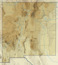
Canjilón Mountain is a 10,922 feet (3,329 m). mountain approximately six miles northeast of the village of Canjilón, [3] in the Carson National Forest.
The word cajilon is the term for "deer antler" in Northern New Mexican Spanish. [4] The mountain was so named because of its resemblance to an antler. [4] The mountain gave its name to the nearby creek (Canjilon Creek), to the nearby lakes (Canjilon lakes), and to the village of Canjilon. [4]
Canjilón Mountain was the site of a 3.7 magnitude earthquake on June 4, 2008. [5]
References
- ^ a b "Jilon". NGS Data Sheet. National Geodetic Survey, National Oceanic and Atmospheric Administration, United States Department of Commerce. Retrieved 2014-02-12.
- ^ "Canjilon Mountain, New Mexico". Peakbagger.com. Retrieved 2014-02-12.
- ^ "Canjilón Lakes". Digital Abiquiu. Archived from the original on February 1, 2012. Retrieved February 12, 2014.
- ^ a b c Julyan, Robert (1998). The place names of New Mexico. Albuquerque, NM: University of New Mexico Press. ISBN 978-0826316899.
- ^ "Information on New Mexico Seismic Activity from the New Mexico Tech Seismological Observatory: Earthquake between Chama and Abiqui, NM". Department of Earth and Environmental Science, New Mexico Institute of Mining and Technology. Archived from the original on 27 September 2008.
