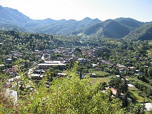
Canelas | |
|---|---|
Municipal seat and city | |
 Canelas, Durango | |
| Coordinates: 25°06′N 106°34′W / 25.100°N 106.567°W | |
| Country | |
| State | Durango |
| Municipality | Canelas |
| Elevation | 1,369 m (4,491 ft) |
| Population (2010) | |
| • Total | 734 |
| Time zone | UTC-6 (Central Standard Time) |
| • Summer ( DST) | UTC-5 (Central Daylight Time) |
Canelas is a town and seat of the municipality of Canelas, in the state of Durango, northwestern Mexico. [1] Canelas is also known for a wedding that took place, that of the famous Mexican drug lord Joaquín Guzmán Loera and Emma Coronel Aispuro. Reports indicate that this wedding took place in 2007 in Canelas. [2] As of 2010, the town had a population of 734. [3]
Geography
Canelas is located in the Sierra Madre Occidental. It is surrounded by pine trees. Its location gives Canelas humid sub-tropical weather. Many people have been benefited with the natural resource of the forest and involved in logging.
Notable people
- Domingo Arrieta León (1874-1962), Mexican general and statesman [4]
- Ignacio Coronel Villarreal, known as Nacho Coronel (1954-2010), Mexican drug lord and one of the founders of the Sinaloa Cartel
- Inés Coronel Barreras (born 1968), Mexican drug lord, high-ranking leader of Sinaloa Cartel and the father of Emma Coronel Aispuro, El Chapo's wife
References
- ^ Instituto Nacional de Estadística y Geografía. Principales resultados por localidad 2005 (ITER). Retrieved on December 19, 2008
- ^ "Y que se nos casa el Chapo la historia de la boda con Emma Coronel Aispuro | Historias del Narco - Blog del Narco - Diario del Narco". Archived from the original on 2012-06-04. Retrieved 2012-05-28.
- ^ "Canelas". Catálogo de Localidades. Secretaría de Desarrollo Social (SEDESOL). Retrieved 23 April 2014.
- ^ www.durango.net.mx; Gomez, Eduardo Ortega - Juan Arturo. "Domingo Arrieta Leon". Durango.net.mx. Archived from the original on 2017-08-31. Retrieved 2017-07-15.

