Calder Highway Calder Freeway – New South Wales | |
|---|---|
 | |
| Calder Freeway facing Mount Macedon | |
 | |
| General information | |
| Type | Highway |
| Length | 558 km (347 mi) [1] |
| Route number(s) |
|
| Former route number |
|
| Major junctions | |
| NW end | Curlwaa, New South Wales |
| SE end | Niddrie, Melbourne |
| Location(s) | |
| Major settlements | Mildura, Ouyen, Charlton, Bendigo, Harcourt, Malmsbury, Kyneton, Woodend, Macedon, Gisborne, Diggers Rest, Sunbury |
| Highway system | |
Calder Highway is a rural highway in Australia, linking Mildura and the Victoria/New South Wales border to Bendigo, in North Central Victoria. South of Bendigo, where the former highway has been upgraded to freeway-standard, Calder Freeway links to Melbourne, subsuming former alignments of Calder Highway; the Victorian Government completed the conversion to freeway standard from Melbourne to Bendigo on 20 April 2009.
Route
South of the Victoria/ New South Wales border the highway is a dual-lane, single-carriageway road, continuing through northwest Victoria from the Abbotsford Bridge, through Merbein to the major regional town of Mildura, where it is 2 lanes each way through southern Mildura and Irymple, in the state's north-west. Here also it crosses the Sturt Highway (A20) leading to capital cities Adelaide heading west and Sydney heading east. Further south, it crosses the Mallee Highway (B12) at Ouyen and runs south-east eventually to Bendigo. Between Red Cliffs and Wycheproof the highway has a speed limit of 110 km/h. Note that the highway is unumbered in NSW since 2013 as the Silver City Highway (B79) starts back from the Sturt Highway and joins back onto the Calder Highway at Curlwaa via Dareton.
The Calder Alternate Highway (A790) connects to the Calder Highway at either end – just north of Ravenswood, and at Marong – and provides a bypass west of Bendigo.
For most of its length from Ravenswood to the junction with the Tullamarine Freeway in Melbourne, the Calder Freeway is a four-lane dual-carriageway freeway which bypasses the towns along the former alignment of the highway.
The northern end of the freeway shares a concurrency with the Midland Highway (A300), from Bendigo until south of Harcourt, where it resumes south-westerly to the major regional centres of Castlemaine, Ballarat, and Geelong.
Towns bypassed by, but still accessible from, the Calder Freeway include Harcourt, Elphinstone, Taradale, Malmsbury, Kyneton, Woodend, Macedon, Gisborne, and Diggers Rest.
The freeway ends at the interchange with the Tullamarine Freeway, the main route to Melbourne's central business district to Melbourne Airport.
Within the urban section of the Calder Freeway (between Kings Road and the Tullamarine Freeway), the standard travel time, in each direction, is 10 minutes. (5 minutes between Kings Road and the Western Ring Road and 5 minutes between the Western Ring Road and the Tullamarine Freeway.
History
The passing of the Highways and Vehicles Act of 1924 [2] through the Parliament of Victoria provided for the declaration of State Highways, roads two-thirds financed by the State government through the Country Roads Board (later VicRoads). The North Western Highway was declared a State Highway on 1 July 1925, [3] cobbled from a collection of roads from Melbourne through Kyneton, Castlemaine, Bendigo, Sea Lake and Ouyen to Mildura (for a total of 324 miles); before this declaration, the road between Melbourne and Bendigo was referred to as (Main) Bendigo Road or Melbourne–Bendigo Road. [4]
The North-Western Highway was renamed the Calder Highway in 1928, after William Calder, chairman of the Country Roads Board from 1913–28. [5] In the 1959/60 financial year, another section from Elphinstone to Harcourt was added as a deviation bypassing Castlemaine, along the former Elphinstone–Harcourt Road [6] (already having been declared a Main Road by the Country Roads Board in 1937/38 financial year [7]); the previous alignments of the Calder Highway from Elphinstone to Castlemaine, and Castlemaine to Harcourt, were subsumed into the Pyrenees Highway and Midland Highway respectively. The Calder Alternative Highway was declared in June 1983, along the former Ravenswood–Marong Road. [8] [9]
The Calder Highway was later signed National Route 79 in 1955; when the Midland Highway was allocated State Route 149 in 1986, it shared a concurrency along the Calder Highway between Harcourt and Bendigo. With Victoria's conversion to the newer alphanumeric system in the late 1990s this was altered to an A79 designation for the highway portion, and a M79 designation for the freeway portion into Melbourne (and the concurrency with Midland Highway was replaced with route A300); the New South Wales section was left unallocated when they switched to the alphanumeric system in 2013. Calder Alternative Highway was signed Alternative National Route 79 between Ravenswood and Marong, and was later replaced by route A790.
Originally, the Calder Highway ran through northwestern Melbourne as an undivided highway, ultimately through Niddrie as Keilor Road and terminating in Essendon; traffic continued south along Mount Alexander Road to reach central Melbourne. Keilor Road – already heavily congested and supporting a tram line – was eventually bypassed by a freeway-standard road in 1972 to terminate at a junction with Lancefield Road (later upgraded to the Tullamarine Freeway), rejoining the Calder Highway at the western end of Niddrie; [10] the freeway-standard was extended further west to East Keilor (the future location of the Western Ring Road interchange) in 1975, and to Keilor by the early 1980s. However, it was not until the 1990s that work began to duplicate the rest of the highway to Bendigo.
The Howard government broadened the criteria under which roads qualify for Commonwealth road funding by introducing Roads of National Importance program in the 1996–97 financial year [11] where such declarations were based on the recognition that roads outside the National Highway system also provide social benefits, and were funded jointly with the States and Territories usually on a 50:50 basis. As a major road link between Melbourne, Bendigo, and the state's northwest, supporting the region's primary manufacturing and tourism industries, the Calder Highway was declared a Road of National Importance between Melbourne and Bendigo in December 1996. [12] [13]
The passing of the Road Management Act 2004 [14] granted the responsibility of overall management and development of Victoria's major arterial roads to VicRoads: in 2004, VicRoads re-declared the road as Calder Alternative Highway (Arterial #6200) between Ravenswood and Marong, [15] and in 2011 as Calder Highway (Arterial #6530) between the border with New South Wales at Yelta and the interchange with Calder Alternate Highway and Ravenswood Street in Ravenswood, [16] and as Calder Freeway (Freeway #1530) between Ravenswood and Tullamarine Freeway, Airport West. [17]
Timeline of construction

- 1950–54 – Calder Highway, straightening of the "Hattah deviation", a 21-mile (34 km) circuitous course through Hattah replaced by 14.6 miles (23.5 km) of straight alignment, south of Nowingi, started construction in 1950, [18] was delayed a year in 1952 due to lack of funds, [19] and eventually completed two years later in 1954. [20]
- 1972 – Calder Freeway, initial 1.2 miles (1.9 km) section of freeway with 3 lanes in each direction, from the Tullamarine Freeway/Lancefield Road intersection to Calder Highway at Niddrie, opened by Minister for Local Government, the Hon. A J Hunt MLC, 21 April 1972, at a cost of $3 million. [10]
- 1975 – Extended 2 km from The Avenue in Niddrie to Erebus Street in Keilor East, opened December 1974 at a cost of $2.5 million. [21]
- 1982 – Extended 3.8 km from Erebus Street to Arundel Road, Keilor, with two lanes each direction plus emergency stopping lanes, opened by Minister for Transport, the Hon S M Crabb MP, 18 May 1982, at a cost of $15.5 million. [22]
- 1984 – Keilor bypass, Bendigo-bound carriageway from Arundel Road to west of Oakbank Road, opened by Assistant Minister of Transport, the Hon Jack Simpson MP, 17 April 1984; the opening of this carriageway completed the bypass of Keilor. The cost of the entire bypass from Erebus Street to west of Oakbank Road was $30 million. [8]
- 1989 – Gisborne bypass opened 17 March 1989. The 6 km bypass cost A$25m. [23]
- 1990/1991 – Oakbank Road, Keilor North to Duncans Lane, Diggers Rest. 7.7 km of newly duplicated '2 lane carriageway' opened to traffic at a cost of A$14m. No exact date was given, however VicRoads Annual Reports cover the previous financial year. [24]
- 1991/1992 – 2 km of duplication completed at Ravenswood during 1991/1992 at a cost of A$1.3m. [25]
- 1993 – Diggers Rest bypass. $A32m 6.5 km bypass opened to traffic in July 1993, followed by the Vinyard Road interchange in November 1993. [26]
- 1994 – Ravenswood section. Duplication of the highway completed 'in 1994' [26]
- 1995 – Kyneton bypass opened to traffic in April 1995, at a cost of A$31m. [27]
- 1996 – Gap Hill section (Diggers Rest to Millett Road). Opened in May 1996, at a cost of A$32m. [28]
- 1998 – Gisborne South to Gisborne. 6 km completed at a cost of A$31 and opened to traffic on 3 April 1998. [29]
- 2000 – Gisborne to Woodend (Black Forest section). 6.8 km section opened to traffic on 17 March 2000. Completed at a cost of A$51m. [30]
- 2001 – Woodend bypass. 13.5 km bypass opened to traffic on 19 December 2001. The total cost of the project was A$85m. [31]
- 2003 – Carlsruhe section. 6.5 km section opened to traffic on 16 April 2003, at a cost of A$46m. This section completed the dual carriageways from Keilor to Kyneton. [32]
- 2005 – 2.5 km north of Kyneton completed in January 2005. [33]
- 2005 – Ravenswood. 6.5 km duplication south of Ravenswood completed in May 2005 [33]
- 2008 – 15 km Malmsbury section opened in April 2008. [34]
- 2009 – Harcourt North to Elphinstone opened on 20 April 2009. This 19 km section cost A$404m and completed the duplication of the highway between Melbourne and Bendigo. The project was jointly funded by the state and federal governments. [35]
- 2012 – Kings Road interchange, opened in January 2012, at a cost of $62 million, jointly funded by state and federal governments. [36]
- 2018 – Ravenswood (Calder Highway, Calder Freeway and Calder Alternative Highway) interchange, reconstruction started May 2016 and completed in March 2018, at a cost of $86 million, jointly funded by state and federal governments. [37] [38]
1969 Melbourne Transportation Plan
The Calder Highway between the Melton Highway and the Western Ring Road is shown in the 1969 Melbourne Transportation Plan as part of the F4 Freeway corridor, which extends past the Tullamarine Freeway and Bell Street to Templestowe.[ citation needed]
Upgrades
Western Ring Road to Kings Road
In 2008, VicRoads completed the widening of the Calder Freeway from the Western Ring Road to Melton Highway. The road was widened from 2 lanes each direction to 3 lanes in each direction. The speed limit was reduced permanently from 100 km/h to 80 km/h. [39] The 80 km/h limit applies northbound from Keilor Park Drive to Melton Highway, [40] and southbound it applies from the Green Gully Road bridge to just prior to the Western Ring Road interchange. In October 2010, it was announced that as part of a year long trial, the speed limit on this section of freeway will be increased back to 100 km/h in off-peak times (8pm-5am), with 30 variable speed limits to be installed along the stretch of freeway[ citation needed]. A further upgrade completed in 2012 resulted in a new interchange at Kings Road (the freeways's urban / metropolitan limits) and closure of three at grade intersections in the area. Despite these upgrades the 80 km/h speed limit remained in place.
Gallery
-
 The Calder Highway, passing through Irymple.
 -
 The end of the Calder Highway at the intersection of the Silver City Highway, near Curlwaa, New South Wales.
 -
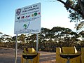 Fruit disposal bins and warning signs along the Calder Highway, approaching the Fruit Fly Exclusion Zone near Mildura.


Major Intersections and Towns
| State | LGA | Location [1] [16] [17] | km [1] | mi | Destinations | Notes |
|---|---|---|---|---|---|---|
| New South Wales | Wentworth | Curlwaa | 565 | 351 | Northern terminus of highway | |
| Murray River | 564.5 | 350.8 | Abbotsford Bridge | |||
| State border | 564 | 350 | New South Wales – Victoria state border | |||
| Victoria | Mildura | Yelta | Calder Highway – Curlwaa | Northern terminus of route A79 | ||
| Merbein | 553.5 | 343.9 | ||||
| Mildura | 544 | 338 | Concurrency with route A20 | |||
| 541 | 336 | |||||
| 539 | 335 | |||||
| Red Cliffs | 526 | 327 | ||||
| 525 | 326 | Kulkyne Way – Colignan | ||||
| Hattah | 476 | 296 | ||||
| Ouyen | 440.8 | 273.9 | Concurrency with route B12 | |||
| 440.7 | 273.8 | |||||
| 430 | 270 | |||||
| Buloke | Bimbourie | 371 | 231 | |||
| Sea Lake | 356 | 221 | ||||
| 352 | 219 | Concurrency with route C246 | ||||
| 351.5 | 218.4 | |||||
| Dumosa | 291 | 181 | ||||
| Wycheproof | 276 | 171 | ||||
| 275 | 171 | |||||
| Wycheproof South | 269 | 167 | ||||
| Charlton | 246 | 153 | ||||
| 245 | 152 | |||||
| 244 | 152 | |||||
| Loddon | Wedderburn | 213.7 | 132.8 | Concurrency with route C273 | ||
| 213.5 | 132.7 | |||||
| Bridgewater | 178 | 111 | ||||
| 177 | 110 | |||||
| Greater Bendigo | Marong | 155 | 96 | |||
| Golden Square | 155 | 96 | ||||
| Ironbark | 153 | 95 | ||||
| 152.4 | 94.7 | |||||
| Bendigo | 150 | 93 | Calder Highway continues north along Don Street, west along High Street Northern terminus of concurrency with route A300 | |||
| Golden Square | 147.4 | 91.6 | ||||
| Kangaroo Flat | 145 | 90 | ||||
| Ravenswood | 0 | 0.0 | Continues north as Calder Highway (route A79), south as Calder Freeway (route M79) | |||
| Mount Alexander | Ravenswood South– Harcourt North boundary | 8.1 | 5.0 | Harmony Way –
Harcourt,
Elphinstone Fogartys Gap Road (west) – Maldon | At-grade intersection | |
| Barkers Creek– Harcourt boundary | 13.9 | 8.6 | Southern terminus of concurrency with route A300 | |||
| Elphinstone | 26.4 | 16.4 | ||||
| Macedon Ranges | Malmsbury | 41.1 | 25.5 | Malmsbury East Road (east) – Greenhill | ||
| Kyneton | 44.3 | 27.5 | At-grade intersection | |||
| 49.4 | 30.7 | |||||
| 51.4 | 31.9 | Trio Road (east) – Carlsruhe | North west bound exit and south east bound entrance only | |||
| Carlsruhe | 56.5 | 35.1 | Springvale Road – Carlsruhe | |||
| Woodend North | 60.1 | 37.3 | South-eastbound exit and north west bound entrance only | |||
| Woodend | 64.9 | 40.3 | ||||
| Macedon | 72.3 | 44.9 | ||||
| 78.3 | 48.7 | North-westbound exit and south east bound entrance only | ||||
| Gisborne– New Gisborne boundary | 80.7 | 50.1 | ||||
| Gisborne | 83.6 | 51.9 | Emmeline Drive (east) – Gisborne East | |||
| Macedon Ranges– Hume boundary | Gisborne South– Sunbury boundary | 89.7 | 55.7 | Couangalt Road (west) –
Gisborne South Mundy Road (east) – Sunbury | ||
| Hume– Melton boundary | Sunbury– Diggers Rest boundary | 94.7 | 58.8 | |||
| 99.6 | 61.9 | |||||
| Diggers Rest | 102.8 | 63.9 | Bulla–Diggers Rest Road – Bulla, Diggers Rest | |||
| Brimbank | Calder Park– Keilor North boundary | 106.2– 107.1 | 66.0– 66.5 | Holden Road (west) – Toolern Vale | North-westbound exit and entrance only; north west bound and south east bound access to service centres | |
| 108.0 | 67.1 | Organ Pipes Road – Organ Pipes National Park | At-grade intersection | |||
| 108.8 | 67.6 | Calder Park Drive – Calder Park | North-eastbound exit and entrance only | |||
| Keilor North– Taylors Lakes boundary | 110.6 | 68.7 | ||||
| Keilor North– Keilor Lodge boundary | 112.5 | 69.9 | North-eastbound exit and entrance only | |||
| Keilor | 113.8 | 70.7 | Partial Y interchange: north east bound exit and south-westbound entrance only | |||
| 115.5 | 71.8 | Arundel Road (north) – Tullamarine | North-westbound exit and south east bound entrance only | |||
| Keilor Park– Keilor East boundary | 117.8 | 73.2 | No north west bound exit | |||
| 118.7 | 73.8 | Partial
turbine interchange North-westbound exit to Western Ring Road south-westbound, north-westbound entrance from Western Ring Road south-westbound only South-eastbound exit to Western Ring Road north-eastbound, south-eastbound entrance from Western Ring Road north-eastbound Access from north west bound exit to Keilor Park Drive | ||||
| Moonee Valley | Keilor East– Airport West boundary | 119.6 | 74.3 | Woorite Place – Keilor East, Airport West | North-westbound exit and south east bound entrance only | |
| Airport West– Niddrie boundary | 120.6 | 74.9 | Fullarton Road (south) –
Niddrie McNamara Avenue – Airport West | North-eastbound entrance and exit only | ||
| 120.9 | 75.1 | Keilor Road – Niddrie | South-westbound entrance and exit only | |||
| 121.3 | 75.4 | South-westbound exit and north east bound entrance only | ||||
| Airport West–Niddrie– Essendon Fields– Essendon North quadripoint | 122.2 | 75.9 | Partial Y interchange: eastbound exit and westbound entrance only | |||
| ||||||
See also
- Highways in Australia
- Highways in Victoria
- Freeways in Australia
- Freeways in Victoria
- Road transport in Victoria
External links
References
- ^ a b c Google (13 January 2022). "Calder Highway/Freeway" (Map). Google Maps. Google. Retrieved 13 January 2022.
- ^ State of Victoria, An Act to make further provision with respect to Highways and Country Roads Motor Cars and Traction Engines and for other purposes 30 December 1924
- ^ "Country Roads Board Victoria. Twelfth Annual Report: for the year ended 30 June 1925". Country Roads Board of Victoria. Melbourne: Victorian Government Library Service. 31 December 1925. p. 3.
- ^ "Country Roads Board Victoria. Second Annual Report". Country Roads Board of Victoria. Melbourne: Victorian Government Library Service. 1 November 1915. pp. 11, 20, 25, 75, 77.
- ^ "Country Roads Board Victoria. Fifteenth Annual Report: for the year ended 30 June 1928". Country Roads Board of Victoria. Melbourne: Victorian Government Library Service. 31 December 1928. p. 8.
- ^ "Country Roads Board Victoria. Forty-Seventh Annual Report: for the year ended 30 June 1960". Country Roads Board of Victoria. Melbourne: Victorian Government Library Service. 21 November 1960. pp. 7–8.
- ^ "Country Roads Board Victoria. Twenty-Fifth Annual Report: for the year ended 30 June 1938". Country Roads Board of Victoria. Melbourne: Victorian Government Library Service. 24 November 1938. p. 14.
- ^ a b "Road Construction Authority of Victoria. Annual Report for the year ended 30 June 1984". Road Construction Authority of Victoria. Melbourne: Victorian Government Library Service. 21 December 1984. pp. 10, 54.
- ^ "Victorian Government Gazette". State Library of Victoria. 30 June 1983. p. 1972. Retrieved 30 December 2021.
- ^ a b "Country Roads Board Victoria. Fifty-Ninth Report: for the year ended 30 June 1972". Country Roads Board of Victoria. Melbourne: Victorian Government Library Service. 1 November 1972. p. 5.
- ^ Australia Parliament House. "Commonwealth Road Funding Since 1990 (Updated 1 March 2004)". Parliament of Australia. Archived from the original on 19 May 2019. Retrieved 15 December 2021.
- ^ "VicRoads Annual Report 1996-97". VicRoads. Melbourne: Victorian Government Library Service. 27 August 1997. p. 16.
- ^ Department of Transport and Regional Services. "Roads of National Importance: Calder Highway". DOTARS. Archived from the original on 26 May 2004. Retrieved 15 December 2021.
- ^ State Government of Victoria. "Road Management Act 2004" (PDF). Government of Victoria. Archived (PDF) from the original on 18 October 2021. Retrieved 19 October 2021.
- ^ VicRoads. "VicRoads – Register of Public Roads (Part A) 2015" (PDF). Government of Victoria. p. 961. Archived from the original on 1 May 2020. Retrieved 19 October 2021.
- ^ a b VicRoads. "VicRoads – Register of Public Roads (Part A) 2015" (PDF). Government of Victoria. pp. 986–7. Archived from the original on 1 May 2020. Retrieved 19 October 2021.
- ^ a b VicRoads. "VicRoads – Register of Public Roads (Part A) 2015" (PDF). Government of Victoria. pp. 31–5. Archived from the original on 1 May 2020. Retrieved 19 October 2021.
- ^ "Country Roads Board Victoria. Thirty-Seventh Annual Report: for the year ended 30 June 1950". Country Roads Board of Victoria. Melbourne: Victorian Government Library Service. 4 December 1950. p. 10.
- ^ "Country Roads Board Victoria. Thirty-Ninth Annual Report: for the year ended 30 June 1952". Country Roads Board of Victoria. Melbourne: Victorian Government Library Service. 22 December 1952. p. 23.
- ^ "Country Roads Board Victoria. Forty-First Annual Report: for the year ended 30 June 1954". Country Roads Board of Victoria. Melbourne: Victorian Government Library Service. 25 October 1954. p. 18.
- ^ "Country Roads Board Victoria. Sixty-Second Annual Report: for the year ended 30 June 1975". Country Roads Board of Victoria. Melbourne: Victorian Government Library Service. 3 November 1975. p. 5.
- ^ "Country Roads Board Victoria. Sixty-Ninth Annual Report: for the year ended 30 June 1982". Country Roads Board of Victoria. Melbourne: Victorian Government Library Service. 30 November 1982. p. 1.
- ^ Road Construction Authority Victoria. Annual Report 1988-1989, Kew, Victoria: Road Construction Authority, Victoria, 1989. p. 46
- ^ VicRoads. VicRoads Annual Report, 1990–1991, Kew, Victoria: VicRoads, 1991, p. 37
- ^ VicRoads. VicRoads Annual Report, 1991–1992, Kew, Victoria: VicRoads, 1992, p. 42
- ^ a b Vicroads. Vicroads Annual Report 1993-94, Kew, Victoria: Vicroads, 1994, p. 16
- ^ Vicroads. Vicroads Annual Report 1994-95, Kew, Victoria: Vicroads, 1995, p. 9
- ^ Vicroads. Vicroads Annual Report 1995-96, Kew, Victoria: Vicroads, 1996, p. 15
- ^ Vicroads. Vicroads Annual Report 1997-98, Kew, Victoria: Vicroads, 1998, p. 33
- ^ Vicroads. Vicroads Annual Report 2000-01, Kew, Victoria: Vicroads, 2000, p. 27
- ^ Vicroads. Vicroads Annual Report 2001-02, Kew, Victoria: Vicroads, 2002, p. 33
- ^ Vicroads. Vicroads Annual Report 2002-03, Kew, Victoria: Vicroads, 2003, p. 13
- ^ a b Vicroads. Vicroads Annual Report 2004-05, Kew, Victoria: Vicroads, 2005, p. 33
- ^ VicRoads. VicRoads Annual Report 2007-08, Kew, Victoria: VicRoads, 2008, p. 35
- ^ VicRoads. VicRoads Annual Report 2008-09, Kew, Victoria: VicRoads, 2009, p. 41
- ^ "VicRoads Annual Report 2011-12". VicRoads. Melbourne: Victorian Government Library Service. 18 September 2012. p. 6.
-
^
Luke Donnellan, Minister for Roads and Road Safety,
Government of Victoria (1 April 2016).
"New Ravenswood Interchange moving ahead with CPB contractors". Archived from
the original on 6 January 2017. Retrieved 6 January 2017.
{{
cite web}}
: CS1 maint: multiple names: authors list ( link) - ^ "VicRoads Annual Report 2017-18". VicRoads. Melbourne: Victorian Government Library Service. 18 September 2018. p. 15.
- ^ Freeway slowdown to ease traffic jams in Melbourne at the Wayback Machine (archived 12 June 2008)
- ^ Google Streetview
- Highways in Victoria (state)
- Highways and freeways in Melbourne
- Transport in the City of Moonee Valley
- Transport in the City of Brimbank
- Transport in the City of Hume
- Transport in the City of Melton
- Transport in Bendigo
- Rural City of Mildura
- Shire of Buloke
- Shire of Loddon
- Mount Alexander Shire
- Shire of Macedon Ranges