Caimito | |
|---|---|
.jpg) Fireworks in Caimito on New Year's Eve 2014 | |
.gif) Flag | |
 Location of Caimito shown in yellow. | |
| Coordinates: 18°19′59″N 66°04′22″W / 18.333129°N 66.072676°W [1] | |
| Commonwealth | |
| Municipality | |
| Area | |
| • Total | 5.41 sq mi (14.0 km2) |
| • Land | 5.41 sq mi (14.0 km2) |
| • Water | 0 sq mi (0 km2) |
| Elevation | 322 ft (98 m) |
| Population (2020) | |
| • Total | 19,217 |
| • Density | 3,600/sq mi (1,400/km2) |
| 2020 census | |
| Time zone | UTC−4 ( AST) |
Caimito is one of the 18 barrios of the municipality of San Juan, Puerto Rico located in the mountainous part of the municipality. With a land area of 5.41 square miles (14.0 km2), Caimito is the second largest barrio in the municipality of San Juan, Puerto Rico. In 2010 it had 21,825 inhabitants and a population density of 4,034.2 per sq.mi. Located in the southern part of San Juan, Caimito is bordered by barrios Tortugo and Quebrada Arenas to the west, by Monacillo to the north, by Cupey to the east and by the municipality of Caguas to the south. [3] [4] [5]
History
The name Caimito comes from the Caimito tree, which is common in the region. The word caimito is possibly a Spanish adaptation (-ito being the Spanish diminutive) of the Taino word caima, possibly related to the Carib acayouman, meaning crocodile (see caiman). [6]
Assigned as a suburb of Río Piedras in 1835 by Pedro Tomás de Córdova, who was Captain General of Puerto Rico from 1816 to 1836, Caimito consisted of 3,595.30 acres or land or roughly 5.16 square miles. [7] Caimito comprises the former barrios of Caimito Alto and Caimito Bajo, which were last documented in the 1899 census. [8] Caimito was part of Rio Piedras until 1951 when it was merged as a barrio of the municipality of San Juan. Historian Dr. Fernando Picó S.J., wrote a book about the history and genealogy of the area, published in 1989, called Vivir en Caimito. [9]
The neighborhood commissioner (comisario de barrio was the main representative of Caimito to the Mayor of Río Piedras. By the 19th century, they were the main local representatives of an absent state. Most of them were not originally from Caimito, but instead were people who had settled there, usually businessmen and farmers. This position was not compensated properly but they garnered some power and prestige.
List of comisarios de barrio in Caimito during the 19th century
| Name | Year |
|---|---|
| Vicente Viera | 1839 |
| Eusebio Noa | 1840 |
| Jose María Noa | 1842 |
| Ramón González | 1852 |
| Rafael Bigio | 1853 |
| Miguel Rodríguez | 1852 |
| Esteban Hernández | 1862 |
| Federico Pastrana | 1867 |
| Cecilio García | 1867 |
| Miguel Rodríguez | 1868 |
| José Perez | 1871 |
| Juan Noa | 1874 |
| Hilario Isaga | 1893 |
Geography
Caimito is located in the mountainous area of San Juan. The municipality's highest point, an unnamed peak measuring almost 1,030 feet (314 m) above sea level, close to the municipal border with Caguas, is located in this barrio close to the Sendra Forest Park on the Morcelo sector. [10] Some of the most important rivers in San Juan have their source in this area too, such as the Piedras River, which gives its name to Río Piedras and flows into the Puerto Nuevo River and the San Juan Bay. [11]
The major routes that cross Caimito include the PR-199, PR-842 and PR-1.
-
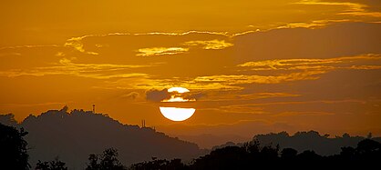 Sunset in Caimito (2014)
 -
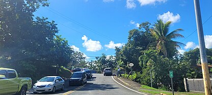
 Puerto Rico Highway 199 in Caimito
 -
 Puerto Rico Highway 842 in Caimito


Demographics
| Census | Pop. | Note | %± |
|---|---|---|---|
| 1900 | 1,706 | — | |
| 1910 | 1,934 | 13.4% | |
| 1920 | 2,329 | 20.4% | |
| 1930 | 2,884 | 23.8% | |
| 1940 | 3,115 | 8.0% | |
| 1950 | 4,588 | 47.3% | |
| 1960 | 6,987 | 52.3% | |
| 1970 | 13,268 | 89.9% | |
| 1980 | 15,939 | 20.1% | |
| 1990 | 19,413 | 21.8% | |
| 2000 | 20,832 | 7.3% | |
| 2010 | 21,825 | 4.8% | |
| 2020 | 19,217 | −11.9% | |
| U.S. Decennial Census 1899 (shown as 1900) [12] 1910-1930 [13] 1930-1950 [14] 1980-2000 [15] 2010 [16] 2020 [17] | |||
The population of Caimito in 2020 was 19,217. [18] Caimito is further divided into the following sectors and neighborhoods: Camino Dr. Colorado, La Cuchilla, Camino Los Ramos, Morcelo, Camino Sánchez Guzmán, Camino Pablo Sánchez, Camino Los Sánchez, Camino Francisco Escribano and Camino El Piloto. [19]
Landmarks and attractions
- The Outlets at Montehiedra, developed in 1994, is a one level enclosed mall with over 100 stores located within Caimito. Anchored by Home Depot, Marshall's and Capri, the Outlet also includes stores such as Nike, Old Navy and Gap. It includes a fourteen-screen theater by Caribbean Cinemas with IMAX, CXC and 4DX screens. [20]
- Centro Zen de Puerto Rico (Puerto Rico Zen Center) [21]
- Gimnasio Municipal de Caimito
- Centro Sor Isolina Ferré
- Iglesia Episcopal San José
Notable people
- Eduardo Bonilla-Silva - Sociology professor at Duke University, president of the American Sociological Association.
- Félix Trinidad - Former professional boxer. Although born in Fajardo, Puerto Rico and raised in Cupey, "Tito" Trinidad is also often associated with Caimito, having been trained by Freddy Trinidad at the Gimnasio Municipal de Caimito. [22]
- Rubén Berrios - President of the Puerto Rican Independence Party, professor at the University of Puerto Rico School of Law. [23]
The noted boxing family, the Solis family, hails from Caimito.
- Enrique Solis- Boxer, fought for world title.
- Julian Solís- Boxer, world champion.
- Rafael Solis- Boxer, fought for world title.
- Santos Solis- a professional boxer.
See also
References
- ^ a b "US Gazetteer 2019". US Census. US Government.
- ^ U.S. Geological Survey Geographic Names Information System: Caimito barrio
- ^ Picó, Rafael; Buitrago de Santiago, Zayda; Berrios, Hector H. (1969). Nueva geografía de Puerto Rico: física, económica, y social, por Rafael Picó. Con la colaboración de Zayda Buitrago de Santiago y Héctor H. Berrios. San Juan Editorial Universitaria, Universidad de Puerto Rico,1969.
- ^ Gwillim Law (20 May 2015). Administrative Subdivisions of Countries: A Comprehensive World Reference, 1900 through 1998. McFarland. p. 300. ISBN 978-1-4766-0447-3. Retrieved 25 December 2018.
- ^ Puerto Rico: 2010 Population and Housing Unit Counts.pdf (PDF). U.S. Dept. of Commerce, Economics and Statistics Administration, U.S. Census Bureau. 2010.
- ^ "caiman", Wiktionary, 2021-01-25, retrieved 2021-10-13
- ^ Ocasio Meléndez, Marcial E. 1985. Río Piedras (Ciudad Universitaria): Notas para su historia. San Juan: Comité Historia de los Pueblos.
- ^ Joseph Prentiss Sanger; Henry Gannett; Walter Francis Willcox (1900). Informe sobre el censo de Puerto Rico, 1899, United States. War Dept. Porto Rico Census Office (in Spanish). Imprenta del gobierno. p. 160.
- ^ Bibliografía Fernando Picó - Universidad de Puerto Rico. Selected Works.
- ^ "Áreas naturales protegidas y bosques urbanos – Estuario" (in European Spanish). 2 October 2019. Retrieved 2021-10-13.
- ^ U.S. Department of Agriculture, Forest Service. "The Rio Piedras Watershed and Its Surrounding Environment" (PDF). fs.fed.us. Archived (PDF) from the original on 2011-10-25.
- ^ "Report of the Census of Porto Rico 1899". War Department Office Director Census of Porto Rico. Archived from the original on July 16, 2017. Retrieved September 21, 2017.
- ^ "Table 3-Population of Municipalities: 1930 1920 and 1910" (PDF). United States Census Bureau. Archived (PDF) from the original on August 17, 2017. Retrieved September 21, 2017.
- ^ "Table 4-Area and Population of Municipalities Urban and Rural: 1930 to 1950" (PDF). United States Census Bureau. Archived (PDF) from the original on August 30, 2015. Retrieved September 21, 2014.
- ^ "Table 2 Population and Housing Units: 1960 to 2000" (PDF). United States Census Bureau. Archived (PDF) from the original on July 24, 2017. Retrieved September 21, 2017.
- ^ Puerto Rico: 2010 Population and Housing Unit Counts.pdf (PDF). U.S. Dept. of Commerce Economics and Statistics Administration U.S. Census Bureau. 2010. Archived (PDF) from the original on 2017-02-20. Retrieved 2019-08-02.
- ^ "Puerto Rico Population Declined 11.8% from 2010 to 2020".
- ^ "Census profile: Caimito barrio, San Juan Municipio, PR". Census Reporter. Retrieved 2023-09-08.
- ^ Estado Libre Asociado de Puerto Rico, Comision Estatal de Elecciones (2011). "Desglose de Sectores y Centros de Votacion" (PDF). ceepur.org.
- ^ "The Outlets at Montehiedra".
- ^ Agsar, Wendy Biddlecombe (2018-01-05). "Meet a Sangha: Centro Zen de Puerto Rico". Tricycle: The Buddhist Review. Retrieved 2021-10-13.
- ^ "Freddy Trinidad Muriel, Boxeo". Salon de la Fama del Deporte Riopedrense.
- ^ "Rubén Berríos vive en Caimito y no en una mansión en la Florida". 18 April 2017.

| International | |
|---|---|
| National | |