(Redirected from
Bzommar)
Bzoummar
بزمار | |
|---|---|
Village | |
| Coordinates: 33°59′14″N 35°40′40″E / 33.98722°N 35.67778°E | |
| Country | |
| Governorate | Keserwan-Jbeil |
| District | Keserwan |
| Highest elevation | 950 m (3,120 ft) |
| Lowest elevation | 920 m (3,020 ft) |
| Time zone | UTC+2 ( EET) |
| • Summer ( DST) | UTC+3 ( EEST) |
| Dialing code | +961 9 |
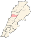
Bzoummar ( Arabic: بزمار; also spelled Bzommar or Bzemmar) is a village in the Keserwan District of the Keserwan-Jbeil Governorate in Lebanon. It is 36 km (22 mi) northeast of Beirut, and has an elevation ranging between 920 and 950 m (3,020 and 3,120 ft) above sea level. Bzoummar's inhabitants are predominantly Maronite and Armenian Catholics. [1] Bzoummar is home to a monastery of the Armenian Catholic Church that was built in 1749, where the image of Our Lady of Bzommar is venerated.
References
- ^ "Elections municipales et ikhtiariah au Mont-Liban" (PDF). Localiban. Localiban. 2010. p. 19. Archived from the original (pdf) on 2015-07-24. Retrieved 2016-02-12.
External links
- Bzoummar, localiban

