Butterfield Valley is a valley along the course of Temecula Creek, in Riverside County, California. Its lower end is now filled by Vail Lake. It heads at 33°27′39″N 116°55′34″W / 33.46083°N 116.92611°W and its mouth is at the site of the Vail Lake Dam at the head of the deep canyon Temecula Creek has cut through Oak Mountain to the Pauba Valley. [1]
History
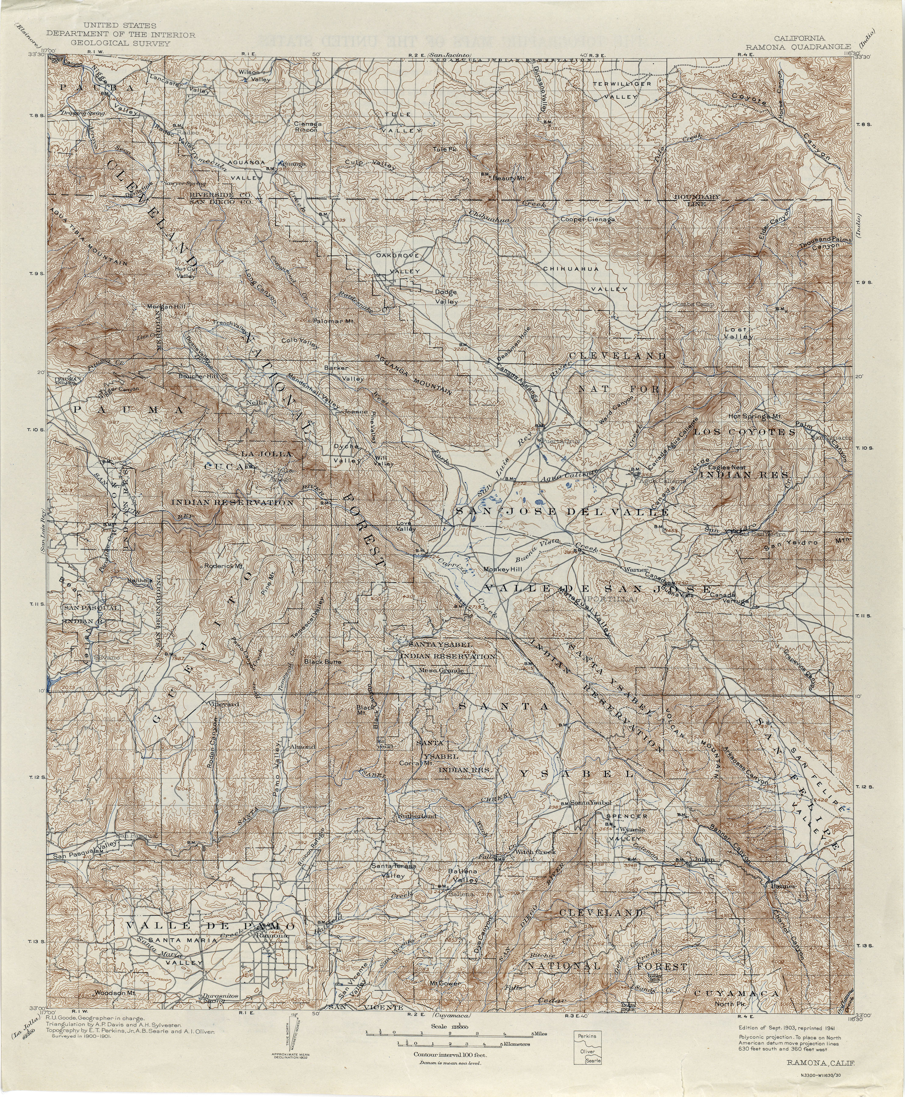
The original name of Butterfield Valley, found on the first topographic map of the region, was "Nigger Valley" and was not renamed by the U. S. Geological Survey until 1970. [2] It was named after Jim Hamilton, an African American man who settled there as a squatter on the east end of the Rancho Pauba in the later 1860s. The 1870 census of Temecula showed James Hamilton was a 49-year-old widower, living on a 160-acre farm with his four children. The farm was evaluated at $5,000, more than the value of other similar farms in the area. Eventually Hamilton lost this land in a lawsuit over ownership of the Rancho Pauba in the early 1880s. [3]
However, Hamilton moved out to the lands of the Cahuilla, where he and two of his sons continued to raise cattle at their ranch in the Anza Valley, [4] which was first known as the Hamilton Plain. Hamilton Creek, originating east of Anza, still bears his name. Hamilton School in Anza was also named after him. [5] [6] The school has been divided into a K-8 School and Hamilton High School since 2006–2007. [7] [8]
Hamilton was married to a Native American woman and had three sons. Two became U. S. Marshals, and one was killed in the line of duty at San Jacinto, California. The two surviving sons also married native women. [9]
References
- ^ U.S. Geological Survey Geographic Names Information System: Pauba Valley
- ^ California, Ramona Quadrangle, 1903 reprinted 1941
- ^ Robert L. Carlton, Blacks in San Diego County: A Social Profile, 1850-1880, The Journal of San Diego History, SAN DIEGO HISTORICAL SOCIETY QUARTERLY, Volume 21, Number 4, Fall 1975[ permanent dead link]
- ^ U.S. Geological Survey Geographic Names Information System: Anza Valley
- ^ Steve Lech, Pioneers of Riverside County: The Spanish, Mexican, and Early American Periods, Arcadia Publishing, Dec 10, 2012, Notes, Chapter 4, note 58.
- ^ U.S. Geological Survey Geographic Names Information System: Hamilton Creek
- ^ U.S. Geological Survey Geographic Names Information System: Hamilton School
- ^ About Us > School History from hamiltonbobcats.net accessed August 23, 2016.
- ^ Edgar F. Hastings, “An Interview with HARRY P. JONES” (March 10, 1960), Seth Mallios, Sarah Stroud, Lauren Lingley, Jaime Lennox, Hillary Sweeney, Olivia Smith, and David Caterino, Archaeological Excavations at the Nate Harrison Site in San Diego County, California: An Interim Technical Report for the 2005 Field Season, © 2006 by San Diego State University, Department of Anthropology