Brockway, Wisconsin | |
|---|---|
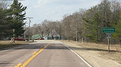
 Looking north at the sign for Brockway on
U.S. Route 12 | |
| Coordinates: 44°17′05″N 90°50′23″W / 44.28472°N 90.83972°W | |
| Country | |
| State | |
| County | Jackson |
| Town | Brockway |
| Elevation | 255 m (837 ft) |
| Time zone | UTC-6 ( Central (CST)) |
| • Summer ( DST) | UTC-5 (CDT) |
| Area code(s) | 715 & 534 |
| GNIS feature ID | 1845427 [1] |
Brockway is an unincorporated community located in the town of Brockway, Jackson County, Wisconsin, United States. [1] It is located at the intersection of U.S. Route 12 and Wisconsin Highway 27 and shares its northern border with Black River Falls, Wisconsin. [2]
History
The community was named for Eustace L. Brockway, an area sawmill and steamboat operator who served in the Wisconsin legislature in 1872. [3]
Images
Notes
- ^ a b "Brockway, Wisconsin". Geographic Names Information System. United States Geological Survey, United States Department of the Interior.
- ^ "Location". Google Maps. Retrieved March 28, 2012.
- ^ Callary, Edward. Place Names of Wisconsin. Madison, WI: University of Wisconsin Press. p. 38. ISBN 978-0-299-30964-0.


