Broadbeach North | |||||||||||
|---|---|---|---|---|---|---|---|---|---|---|---|
 Broadbeach North station | |||||||||||
| General information | |||||||||||
| Location | Gold Coast Highway, Broadbeach | ||||||||||
| Coordinates | 28°01′42″S 153°25′18″E / 28.0281987°S 153.421683°E | ||||||||||
| Owned by | Translink | ||||||||||
| Operated by | Keolis Downer | ||||||||||
| Line(s) | G:link | ||||||||||
| Platforms | 2 (1 island) | ||||||||||
| Tracks | 2 | ||||||||||
| Connections | No connections available | ||||||||||
| Construction | |||||||||||
| Structure type | Ground | ||||||||||
| Parking | No | ||||||||||
| Bicycle facilities | No | ||||||||||
| Accessible | Yes | ||||||||||
| Other information | |||||||||||
| Station code | 600802 (platform 1) 600803 (platform 2) | ||||||||||
| Fare zone | go card 5 | ||||||||||
| Website | http://ridetheg.com.au/stations/ | ||||||||||
| History | |||||||||||
| Opened | 20 July 2014 | ||||||||||
| Electrified | Yes | ||||||||||
| Services | |||||||||||
| |||||||||||
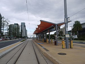
Broadbeach North light rail station located in the suburb of Broadbeach is serviced by the Gold Coast light rail system known as the G:link. The station serves the northern end of the Broadbeach precinct, [1] offering direct access to the Gold Coast Convention and Exhibition Centre, Oasis Shopping Centre and the Star Casino.
Broadbeach North is located in the median of the Gold Coast Highway.
Location
Below is a map of the area that surrounds the station.
References
- ^ "Broadbeach North - G:link". G:link. Retrieved 24 May 2018.