This article needs additional citations for
verification. (December 2011) |
Bramley & Wonersh | |
|---|---|
 | |
| General information | |
| Location |
Bramley,
Waverley,
Surrey England |
| Grid reference | TQ010451 |
| Platforms | 2 |
| Other information | |
| Status | Disused |
| History | |
| Original company | London, Brighton and South Coast Railway |
| Post-grouping |
Southern Railway Southern Region of British Railways |
| Key dates | |
| 2 October 1865 | Opened as "Bramley" |
| 1 June 1888 | Renamed "Bramley & Wonersh" |
| 14 June 1965 | Closed |
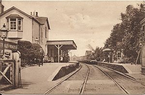
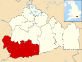
Bramley & Wonersh was a railway station on the Cranleigh Line. It served the villages of Bramley and Wonersh in Surrey.
History

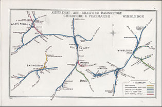
Opened in 1865 as "Bramley", its name was changed in June 1888 to "Bramley & Wonersh" as the station, although situated in Bramley, was only a short distance from Wonersh. A passing loop and a second platform were installed in 1876. The station was the last before the line joined the main line to Guildford at Peasmarsh Junction.
In the Second World War a German Dornier 217 aircraft attacked a train carrying Christmas shoppers as it was departing Bramley & Wonersh on 16 December 1942. [1] The plane machine-gunned the train and dropped a bomb [1] that exploded on the embankment, narrowly missing the train. The driver and guard were killed, a number of passengers were killed or wounded and the train was badly damaged. The fireman and the porter-in-charge of Bramley station attended the wounded and dying, later helped by six soldiers who were billetted nearby. [1] Afterwards fireman William Fairey and porter-in-charge Violet Wisdom were presented with certificates of merit for their actions, and Miss Wisdom was singled out for her "great courage and resource directly the bombs had fallen". [1]
The line was closed in 1965 following The Reshaping of British Railways report of 1963, and the main station building was demolished a few years later. The trackbed remained overgrown for many years before being brought back into use in the 1980s as part of the Downs Link, a public footpath and bridleway linking the North Downs and South Downs National Trails. In 2004 major renovation works were carried out at the station by the[ which?] local council and the Bramley Historical Society.
| Preceding station | Disused railways | Following station | ||
|---|---|---|---|---|
|
Guildford Line closed, station open |
London, Brighton and South Coast Railway Horsham and Guildford Direct Railway |
Cranleigh Line and station closed |
Future
Studies of the feasibility of reopening the Guildford – Bramley – Cranleigh section of the line were completed in 1994, 1997 and 2009. The 1994 report concluded that the investment required would not justify reinstatement, but Waverley Borough Council has protected the line from development in its Local Plan. The 2009 report estimates that reopening the Guildford – Bramley – Cranleigh section would have a positive benefit-cost ratio of 1.7 to 1 including capital costs. [2]
Gallery
-
The station in 1961
-
Since renovation in 2004
-
Since renovation in 2004
-
Commemorative plaque
Other Cranleigh Line stations
See also
References
- ^ a b c d Wojtczak, Helena (2005). Railwaywomen: Exploitation, Betrayal and Triumph in the Workplace. Hastings: Hastings Press. p. 149. ISBN 1-904109-04-7.
- ^ Connecting Communities: Expanding Access to the Rail Network. London: Association of Train Operating Companies. June 2009. pp. 16, 18.


