Braman, Oklahoma | |
|---|---|
 Location of Braman, Oklahoma | |
| Coordinates: 36°55′25″N 97°20′09″W / 36.92361°N 97.33583°W | |
| Country | United States |
| State | Oklahoma |
| County | Kay |
| Area | |
| • Total | 0.20 sq mi (0.51 km2) |
| • Land | 0.20 sq mi (0.51 km2) |
| • Water | 0.00 sq mi (0.00 km2) |
| Elevation | 1,047 ft (319 m) |
| Population (
2020) | |
| • Total | 160 |
| • Density | 816.33/sq mi (315.68/km2) |
| Time zone | UTC-6 ( Central (CST)) |
| • Summer ( DST) | UTC-5 (CDT) |
| ZIP code | 74632 |
| Area code | 580 |
| FIPS code | 40-08450 [3] |
| GNIS feature ID | 2411719 [2] |
Braman is a town in Kay County, Oklahoma, United States. The population was 217 at the 2010 census, a decline of 11.1 percent from the figure of 244 in 2000. [4]
History
Braman was named for railroad developer Dwight Braman, when its post office was first established on April 22, 1898. In that year, the Kansas and Southeastern Railroad—which was bought by the Atchison, Topeka and Santa Fe Railroad (AT&SF) in 1899—built a track from Hunnewell, Kansas to Braman. The following year, the Blackwell and Southern Railway—which was bought by the AT&SF in 1900—continued the line south through Blackwell to Tonkawa. [5] Meanwhile the town, located 5 miles (8.0 km) inside the Kansas-Oklahoma state line, officially incorporated on January 9, 1899. There were 249 residents in 1900, growing to 300 by statehood in 1907. [6]
In 1920, the population was 396 and the local economy was largely based on wheat farming. Oil was discovered nearby during the 1920s, briefly attracting a peak population of nearly five thousand, but the population dropped quickly to 507 in 1930. This was the highest number ever recorded in the census for Braman. It has remained an agricultural center since then. [6]
Geography
According to the United States Census Bureau, Braman has a total area of 0.2 square miles (0.52 km2), all land.
Demographics
| Census | Pop. | Note | %± |
|---|---|---|---|
| 1900 | 249 | — | |
| 1910 | 339 | 36.1% | |
| 1920 | 396 | 16.8% | |
| 1930 | 507 | 28.0% | |
| 1940 | 427 | −15.8% | |
| 1950 | 392 | −8.2% | |
| 1960 | 336 | −14.3% | |
| 1970 | 295 | −12.2% | |
| 1980 | 355 | 20.3% | |
| 1990 | 251 | −29.3% | |
| 2000 | 244 | −2.8% | |
| 2010 | 217 | −11.1% | |
| 2020 | 160 | −26.3% | |
| U.S. Decennial Census [7] | |||
As of the census [3] of 2000, there were 244 people, 103 households, and 66 families residing in the town. The population density was 1,558.2 inhabitants per square mile (601.6/km2). There were 117 housing units at an average density of 747.2 per square mile (288.5/km2). The racial makeup of the town was 85.66% White, 0.41% African American, 6.56% Native American, and 7.38% from two or more races. Hispanic or Latino of any race were 3.28% of the population.
There were 103 households, out of which 31.1% had children under the age of 18 living with them, 49.5% were married couples living together, 11.7% had a female householder with no husband present, and 35.0% were non-families. 31.1% of all households were made up of individuals, and 7.8% had someone living alone who was 65 years of age or older. The average household size was 2.37 and the average family size was 2.99.
In the town, the population was spread out, with 25.4% under the age of 18, 6.1% from 18 to 24, 26.6% from 25 to 44, 29.5% from 45 to 64, and 12.3% who were 65 years of age or older. The median age was 39 years. For every 100 females, there were 92.1 males. For every 100 females age 18 and over, there were 93.6 males.
The median income for a household in the town was $27,841, and the median income for a family was $33,750. Males had a median income of $23,750 versus $21,667 for females. The per capita income for the town was $17,721. About 3.0% of families and 10.0% of the population were below the poverty line, including 5.0% of those under the age of eighteen and 24.0% of those 65 or over.
Transportation
Braman is served by Interstate 35 and US Route 177. [8]
Braman has freight rail service through the Blackwell Northern Gateway Railroad. [9]
The nearest airfield is Blackwell-Tonkawa Municipal Airport (FAA Identifier: BKN), about 12 miles south, with a 3501’ x 60’ paved runway. [10] [11] Commercial airline service is available at Wichita Dwight D. Eisenhower National Airport, about 58 miles to the north. [11] [12]
Notable person
- Dale DeWitt, the former majority leader of the Oklahoma House of Representatives, resides in Braman.
References
- ^ "ArcGIS REST Services Directory". United States Census Bureau. Retrieved September 20, 2022.
- ^ a b U.S. Geological Survey Geographic Names Information System: Braman, Oklahoma
- ^ a b "U.S. Census website". United States Census Bureau. Retrieved January 31, 2008.
- ^ CensusViewer:Braman, Oklahoma Population.
- ^ "The Atchison, Topeka and Santa Fe Railway Company". Railroads of Oklahoma, June 6, 1870-April 1, 1978, pp. 29-38 (accessed on Oklahoma Digital Prairie). Retrieved March 24, 2023.
- ^ a b Johnston, Jerry. Encyclopedia of Oklahoma History and Culture. "Braman". Archived from the original on January 5, 2009. Retrieved August 31, 2009.
- ^ "Census of Population and Housing". Census.gov. Retrieved June 4, 2015.
- ^ "Braman, Oklahoma". Google Maps. Retrieved March 24, 2023.
- ^ "Oklahoma 2018-2020 State Railroad Map" (PDF). Oklahoma Department of Transportation. Retrieved March 24, 2023.
- ^ "Blackwell-Tonkawa Municipal Airport". AirNav.com. Retrieved March 24, 2023.
- ^ a b "Major airports near Braman, Oklahoma". TravelMath. Retrieved March 24, 2023.
- ^ "Wichita Dwight D. Eisenhower National Airport to Braman, Oklahoma". Google Maps. Retrieved March 24, 2023.
External links
- Encyclopedia of Oklahoma History and Culture - Braman
- Oklahoma Digital Maps: Digital Collections of Oklahoma and Indian Territory
- Ponca City Centennial Guide
Municipalities and communities of
Kay County, Oklahoma, United States | ||
|---|---|---|
| Cities | 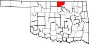 | |
| Towns | ||
| CDPs | ||
|
Other communities | ||
| Ghost towns | ||
| Authority control databases: Geographic |
|---|