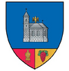
Brăești | |
|---|---|
 View of Brăești village | |
 Location in Buzău County | |
| Coordinates: 45°26′N 26°30′E / 45.433°N 26.500°E | |
| Country | Romania |
| County | Buzău |
| Subdivisions | Brăești, Brătilești, Goidești, Ivănețu, Pârscovelu, Pinu, Ruginoasa |
| Government | |
| • Mayor (2020–2024) | Gheorghe Negoiță [1] ( PSD) |
| Area | 46.7 km2 (18.0 sq mi) |
| Population (2021-12-01)
[2] | 2,057 |
| • Density | 44/km2 (110/sq mi) |
| Time zone | EET/ EEST (UTC+2/+3) |
| Postal code | 127095 |
| Vehicle reg. | BZ |
| Website |
www |
Brăești is a commune in Buzău County, Muntenia, Romania. It is composed of seven villages: Brăești, Brătilești, Goidești, Ivănețu, Pinu, Pârscovelu and Ruginoasa.
The commune is traversed by the river Bălăneasa. Brăești borders the following communes: Chiliile to the east, Odăile to the south, Bozioru to the south-west, Gura Teghii to the north-west, and Lopătari to the north-east.
Located nearby is Pinul Monastery, which was built in 1647–1648, during the reign of Matei Basarab.
Notes
- ^ "Results of the 2020 local elections". Central Electoral Bureau. Retrieved 16 June 2021.
- ^ "Populaţia rezidentă după grupa de vârstă, pe județe și municipii, orașe, comune, la 1 decembrie 2021" (XLS). National Institute of Statistics.

