Bourem | |
|---|---|
Commune and town | |
 Bourem | |
| Coordinates: 16°57′12″N 0°21′14″W / 16.95333°N 0.35389°W | |
| Country | |
| Region | Gao Region |
| Cercle | Bourem Cercle |
| Area | |
| • Total | 6,294 km2 (2,430 sq mi) |
| Population (2009 census)
[2] | |
| • Total | 27,486 |
| • Density | 4.4/km2 (11/sq mi) |
| Time zone | UTC+0 ( GMT) |
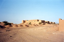
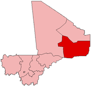
Bourem is a commune and small town in the Gao Region of northeastern Mali. The town sits on the left bank of the River Niger.
References
- ^ Schéma Directeur de Lutte Contre l’Ensablement dans le Nord du Mali (6ème et 7ème Régions): Monographie de la Commune de Bourem (PDF) (in French), Ministère de l’Environnement et de l’Assainissement, République du Mali, 2004, archived from the original (PDF) on 2011-07-22.
- ^ Resultats Provisoires RGPH 2009 (Région de Gao) (PDF) (in French), République de Mali: Institut National de la Statistique, archived from the original (PDF) on 2011-07-22.
External links
- Plan de Sécurite Alimentaire Commune Urbaine de Bourem 2005-2009 (PDF) (in French), Commissariat à la Sécurité Alimentaire, République du Mali, USAID-Mali, 2005, archived from the original (PDF) on 2014-05-19, retrieved 2011-02-12.

