 Boomer Island Location in
Tasmania | |
| Geography | |
|---|---|
| Coordinates | 42°52′16″S 147°50′28″E / 42.871°S 147.841°E |
| Adjacent to | Boomer Bay, Blackman Bay, Tasman Sea |
| Administration | |
Australia | |
| State | Tasmania |
| Region | South East |
| Additional information | |
| Time zone | |
| • Summer ( DST) | |
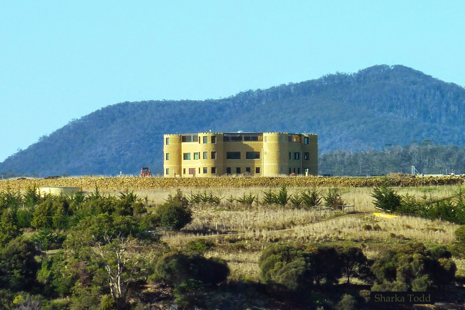
Boomer Island is a tied island in the south east region of Tasmania, Australia. It is known for a large castle built upon it and is owned by Gunter Jaeger, a businessman. [1] [2]
Tenure
The landmass is Crown land from the high-water mark to 30 metres inland. The landlocked parcel of land within this crown land is privately owned.
Geography
An artificial tombolo connects the landmass to the mainland in Boomer Bay, which itself lies within Blackman Bay.
The island can be seen in several public photographs. [3] [4]
See also
References
- ^ Glaetzer, Sally (17 November 2013). "An island of your own". The Mercury ( The Sunday Tasmanian). Archived from the original on 29 November 2014. Retrieved 15 November 2014.
- ^ "Tasmania 2011: The Rogue Castle of Dunalley Harbour". Grumpy neighbour. Archived from the original on 15 November 2014. Retrieved 15 November 2014.
- ^ Unknown. "Untitled photograph". Archived from the original on 28 January 2015. Retrieved 4 August 2015.
- ^ Sharka Todd (July 2014). "Boomer Island Castle". Archived from the original on 6 March 2015. Retrieved 4 August 2015.
Southern region of
Tasmania, Australia | |||||
|---|---|---|---|---|---|
| Settlements | |||||
| Governance | |||||
| Mountains | |||||
| Protected areas, parks and reserves | |||||
| Rivers | |||||
| Harbours, bays, inlets and estuaries | |||||
| Coastal features | |||||
| Transport | |||||
| Landmarks |
| ||||
| Islands | |||||
| Books and newspapers | |||||
| Flora, fauna, and fishlife | |||||
| Bioregions | |||||
| Indigenous heritage | |||||
| Other | |||||