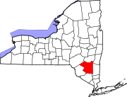
Boiceville is a hamlet in the town of Olive, Ulster County, New York, United States. [1] [2] Located at the intersection of New York State Route 28 and New York State Route 28A, Boiceville is within Catskill State Park.
Boiceville was named for Lemuel Boice (born in Shokan in 1819, died in Boiceville, 1899), who established a tannery in the town. Members of the Boice family owned tanneries, bluestone quarries, stores, farms, lumber businesses and mills in Olive for many years. [3] Boiceville was relocated due to the construction of the Ashokan Reservoir. The current commercial center of the town is subject to severe flooding during exceptionally powerful storms. Some businesses have accepted buyouts from the New York City Department of Environmental Protection. The future of others is in doubt. [4]
The Emile Brunel Studio and Sculpture Garden was listed on the National Register of Historic Places in 1999. [5]
Education
Onteora Central School District operates the public schools in Boiceville, including Onteora High School, Onteora Middle School, and Bennett Elementary School.
References
- ^ "Ulster County History and Information". Genealogy Inc. Archived from the original on 2008-10-13. Retrieved 2008-10-22.
- ^ "Feature Detail Report for: Boiceville (Ulster County, New York)". Geographic Names Information System. United States Geological Survey, United States Department of the Interior. Retrieved October 22, 2008.
- ^ Clearwater, Alphonso Trumpbour (1907). "Alphonso T. Clearwater, The History of Ulster County, New York, Kingston, NY:W.J. Van Deusen, 1907, p. 555-556". "Our Family Tree entry for Lemuel Boice". "Ulster Co. Historical Society, Ulster County Gazette, Vol. 34, No. 1, March 2002".
- ^ "Hudson Valley News, 2019/01/05".
- ^ "National Register Information System". National Register of Historic Places. National Park Service. July 9, 2010.
42°00′18″N 74°15′58″W / 42.005°N 74.266°W
