Boaz, Wisconsin | |
|---|---|
 Location of Boaz in Richland County, Wisconsin. | |
| Coordinates: 43°19′51″N 90°31′38″W / 43.33083°N 90.52722°W | |
| Country | |
| State | |
| County | Richland |
| Area | |
| • Total | 0.36 sq mi (0.93 km2) |
| • Land | 0.36 sq mi (0.93 km2) |
| • Water | 0.00 sq mi (0.00 km2) |
| Elevation | 751 ft (229 m) |
| Population | |
| • Total | 156 |
| • Estimate (2019)
[4] | 146 |
| • Density | 405.56/sq mi (156.56/km2) |
| Time zone | UTC-6 ( Central (CST)) |
| • Summer ( DST) | UTC-5 (CDT) |
| Area code | 608 |
| FIPS code | 55-08600 [5] |
| GNIS feature ID | 1561987 [2] |
Boaz is a village in Richland County, Wisconsin, United States. According to the 2010 census, the population of the village was 156.
Geography
Boaz is located at 43°19′51″N 90°31′38″W / 43.33083°N 90.52722°W (43.330793, -90.527280). [6]
According to the United States Census Bureau, the village has a total area of 0.36 square miles (0.93 km2), all of it land. [7]
History
Boaz was the boyhood home of Richard M. Brewer, the first leader of the Regulators in the Lincoln County (New Mexico) War. [8] A skeleton of a mastodon, the Boaz mastodon, was found in 1897, near Boaz. [9]

Demographics
| Census | Pop. | Note | %± |
|---|---|---|---|
| 1880 | 75 | — | |
| 1940 | 230 | — | |
| 1950 | 188 | −18.3% | |
| 1960 | 117 | −37.8% | |
| 1970 | 126 | 7.7% | |
| 1980 | 161 | 27.8% | |
| 1990 | 131 | −18.6% | |
| 2000 | 137 | 4.6% | |
| 2010 | 156 | 13.9% | |
| 2019 (est.) | 146 | [4] | −6.4% |
| U.S. Decennial Census [10] | |||
2010 census
As of the census [3] of 2010, there were 156 people, 67 households, and 40 families living in the village. The population density was 433.3 inhabitants per square mile (167.3/km2). There were 68 housing units at an average density of 188.9 per square mile (72.9/km2). The racial makeup of the village was 98.7% White and 1.3% Asian. Hispanic or Latino of any race were 0.6% of the population.
There were 67 households, of which 20.9% had children under the age of 18 living with them, 50.7% were married couples living together, 4.5% had a female householder with no husband present, 4.5% had a male householder with no wife present, and 40.3% were non-families. 29.9% of all households were made up of individuals, and 9% had someone living alone who was 65 years of age or older. The average household size was 2.33 and the average family size was 2.75.
The median age in the village was 49.3 years. 19.2% of residents were under the age of 18; 7% were between the ages of 18 and 24; 19.3% were from 25 to 44; 32.1% were from 45 to 64; and 22.4% were 65 years of age or older. The gender makeup of the village was 52.6% male and 47.4% female.
2000 census
As of the census [5] of 2000, there were 137 people, 64 households, and 41 families living in the village. The population density was 383.2 people per square mile (146.9/km2). There were 67 housing units at an average density of 187.4 per square mile (71.9/km2). The racial makeup of the village was 99.27% White and 0.73% Native American.
There were 64 households, out of which 28.1% had children under the age of 18 living with them, 45.3% were married couples living together, 10.9% had a female householder with no husband present, and 35.9% were non-families. 26.6% of all households were made up of individuals, and 7.8% had someone living alone who was 65 years of age or older. The average household size was 2.14 and the average family size was 2.61.
In the village, the population was spread out, with 21.2% under the age of 18, 10.2% from 18 to 24, 29.9% from 25 to 44, 24.1% from 45 to 64, and 14.6% who were 65 years of age or older. The median age was 40 years. For every 100 females, there were 95.7 males. For every 100 females age 18 and over, there were 89.5 males.
The median income for a household in the village was $31,563, and the median income for a family was $32,000. Males had a median income of $22,500 versus $22,500 for females. The per capita income for the village was $16,883. There were 16.7% of families and 13.2% of the population living below the poverty line, including 41.7% of under eighteens and none of those over 64.
Images
-
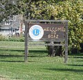 Welcome sign
 -
 View of Boaz
 -
 Entrance on WIS 171


See also
References
- ^ "2019 U.S. Gazetteer Files". United States Census Bureau. Retrieved August 7, 2020.
- ^ a b "US Board on Geographic Names". United States Geological Survey. October 25, 2007. Retrieved January 31, 2008.
- ^ a b "U.S. Census website". United States Census Bureau. Retrieved November 18, 2012.
- ^ a b "Population and Housing Unit Estimates". United States Census Bureau. May 24, 2020. Retrieved May 27, 2020.
- ^ a b "U.S. Census website". United States Census Bureau. Retrieved January 31, 2008.
- ^ "US Gazetteer files: 2010, 2000, and 1990". United States Census Bureau. February 12, 2011. Retrieved April 23, 2011.
- ^ "US Gazetteer files 2010". United States Census Bureau. Archived from the original on January 25, 2012. Retrieved November 18, 2012.
- ^ Wisconsin Historical Society Dictionary of Wisconsin History Archived 2009-07-17 at the Wayback Machine
- ^ "forts". www.wisconsinhistory.org. Archived from the original on December 24, 2004.
- ^ "Census of Population and Housing". Census.gov. Retrieved June 4, 2015.
External links
![]() Media related to
Boaz, Wisconsin at Wikimedia Commons
Media related to
Boaz, Wisconsin at Wikimedia Commons
Municipalities and communities of
Richland County, Wisconsin, United States | ||
|---|---|---|
| City |  | |
| Villages | ||
| Towns | ||
| CDPs | ||
|
Other communities |
| |
| Former communities | ||
| Footnotes | ‡This populated place also has portions in an adjacent county or counties | |