Bièvres | |
|---|---|
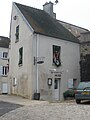
 The town hall | |
.svg) Coat of arms | |
 Bièvres  Bièvres | |
| Coordinates: 48°45′15″N 2°12′54″E / 48.7542°N 2.2151°E | |
| Country | France |
| Region | Île-de-France |
| Department | Essonne |
| Arrondissement | Palaiseau |
| Canton | Gif-sur-Yvette |
| Intercommunality | CA Versailles Grand Parc |
| Government | |
| • Mayor (2020–2026) | Anne Pelletier-Le Barbier [1] |
| Area 1 | 9.69 km2 (3.74 sq mi) |
| Population (2021)
[2] | 4,748 |
| • Density | 490/km2 (1,300/sq mi) |
| Time zone | UTC+01:00 ( CET) |
| • Summer ( DST) | UTC+02:00 ( CEST) |
| INSEE/Postal code |
91064 /91570 |
| Elevation | 67–178 m (220–584 ft) |
| 1 French Land Register data, which excludes lakes, ponds, glaciers > 1 km2 (0.386 sq mi or 247 acres) and river estuaries. | |
Bièvres (French pronunciation: [bjɛvʁ] ⓘ) is a commune in the Essonne department and Île-de-France region of north-central France.
The commune derives its name from that of the River Bièvre which flows through the village. Bièvre is the old French word for a beaver (castor in modern French), so that the original meaning of the name of this stream is "beaver river".
Population
| Year | Pop. | ±% p.a. |
|---|---|---|
| 1968 | 3,323 | — |
| 1975 | 4,133 | +3.17% |
| 1982 | 3,844 | −1.03% |
| 1990 | 4,209 | +1.14% |
| 1999 | 4,034 | −0.47% |
| 2007 | 4,982 | +2.67% |
| 2012 | 4,433 | −2.31% |
| 2017 | 4,639 | +0.91% |
| Source: INSEE [3] | ||
The inhabitants of Bièvres are known in French as les Bièvrois.
See also
References
- ^ "Répertoire national des élus: les maires". data.gouv.fr, Plateforme ouverte des données publiques françaises (in French). 2 December 2020.
- ^ "Populations légales 2021". The National Institute of Statistics and Economic Studies. 28 December 2023.
- ^ Population en historique depuis 1968, INSEE
Gallery
-
 Saint Martin's church
 -
 Bièvres railway station
 -
 The War Memorial
 -
 The Tool Museum


External links
Wikimedia Commons has media related to
Bièvres (Essonne).
- Official website (in French)
- Base Mérimée: Search for heritage in the commune, Ministère français de la Culture. (in French)
- Land use (IAU ÎdF) (in French)
- Mayors of Essonne Association (in French)
| International | |
|---|---|
| National | |
|
| This Essonne geographical article is a stub. You can help Wikipedia by expanding it. |