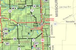
Berlin, Kansas | |
|---|---|
 | |
| Coordinates: 37°55′17″N 94°53′46″W / 37.92139°N 94.89611°W [1] | |
| Country | United States |
| State | Kansas |
| County | Bourbon |
| Named for | Berlin, Georgia |
| Elevation | 909 ft (277 m) |
| Time zone | UTC-6 ( CST) |
| • Summer ( DST) | UTC-5 (CDT) |
| Area code | 620 |
| FIPS code | 20-06240 |
| GNIS ID | 474538 [1] |
Berlin is an unincorporated community in Bourbon County, Kansas, United States. [1]
History
A post office was opened in Berlin in 1879, and remained in operation until it was discontinued in 1903. [2] The community has most likely been named in the honor of Berlin, Georgia.
References
- ^ a b c d U.S. Geological Survey Geographic Names Information System: Berlin, Kansas
- ^ "Kansas Post Offices, 1828-1961". Kansas Historical Society. Retrieved August 2, 2014.
Further reading
External links
