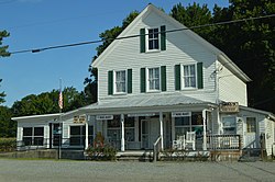
Bena, Virginia | |
|---|---|
 Post office | |
| Coordinates: 37°16′16″N 76°27′20″W / 37.27111°N 76.45556°W | |
| Country | United States |
| State | Virginia |
| County | Gloucester |
| Elevation | 7 ft (2 m) |
| Time zone | UTC-5 ( Eastern (EST)) |
| • Summer ( DST) | UTC-4 (EDT) |
| ZIP code | 23018 |
| Area code | 804 |
| GNIS feature ID | 1477108 [1] |
Bena is an unincorporated community in Gloucester County, Virginia, United States. The community is located on Virginia State Route 216, 2.5 miles (4.0 km) east-northeast of Gloucester Point. Bena has a post office with ZIP code 23018. [2]

The historic Little England plantation house is in the area and Bena was home to the Little England Daffodil Farm. [3] [4]


