Ben Bolt, Texas | |
|---|---|
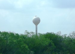
 Water tower in Ben Bolt | |
| Coordinates: 27°38′51″N 98°5′0″W / 27.64750°N 98.08333°W | |
| Country | United States |
| State | Texas |
| County | Jim Wells County |
| Population (2020) | |
| • Total | 1,662 |
| Time zone | CST |
| • Summer ( DST) | CDT |
| ZIP code | 78342 |
| Area code | 361 |
| FIPS code | 48-07540 |
Ben Bolt is an unincorporated community and census-designated place (CDP) in south central Jim Wells County, Texas, United States, 7 miles (11 km) south of Alice on U.S. Route 281. It was first listed as a CDP in the 2020 census, with a population of 1,662. [1]
History
Ben Bolt was founded in 1904. [2] The community took its name from the popular song " Ben Bolt and Sweet Alice". [3]
Geography
Ben Bolt is located at 27°38′51″N 98°5′0″W / 27.64750°N 98.08333°W (27.6475, -98.08333).
Education
Most of Ben Bolt is served by the Ben Bolt-Palito Blanco ISD. A small portion is within the Alice Independent School District. [4] The schools of the former district include Palito Blanco Elementary School for grades K-3, Ben Bolt Middle School for grades 4-8, and Ben Bolt-Palito Blanco High School for grades 9-12. Alice High School is of the latter district.
References
- ^ "Ben Bolt CDP, Texas". United States Census Bureau. Retrieved April 7, 2022.
- ^ Ben Bolt from the Handbook of Texas Online
- ^ Tarpley, Fred (July 5, 2010). 1001 Texas Place Names. University of Texas Press. p. 23. ISBN 978-0-292-78693-6.
- ^ "2020 CENSUS - SCHOOL DISTRICT REFERENCE MAP: Jim Wells County, TX" (PDF). U.S. Census Bureau. Retrieved June 28, 2022.


