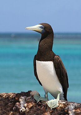
 Bedout Island is a breeding site of world importance for the
Brown booby | |
|
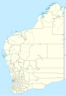
Location of Bedout Island in Western Australia | |
| Geography | |
|---|---|
| Location | Indian Ocean |
| Coordinates | 19°34′40″S 119°05′40″E / 19.57778°S 119.09444°E |
| Administration | |
| State | Western Australia |
| LGA | Town of Port Hedland |
Bedout Island is a small Western Australian island on the Pilbara coast. It lies 42 km offshore from Larrey Point and the mouth of the De Grey River, and 96 km north-east of Port Hedland.
It was named by Baudin during his exploration in the early 1800s after Jacques Bedout. [1]
Description
Bedout is a low and undulating, 31 ha sandy cay on limestone bedrock, heavily vegetated with beach spinifex. It has an arid climate, an annual average rainfall of 300 mm, and experiences occasional tropical cyclones. There is a navigational beacon in the centre of the island. There are three listed shipwrecks in the surrounding waters, all of vessels wrecked between 1890 and 1912. At some time in the past black rats were inadvertently introduced, probably by visiting pearling vessels in the late 19th century, but were eradicated in 1991. [2]
Status
The island is an A-class nature reserve, managed by the Department of Environment and Conservation. It is part of the Western Australian Coastal Islands (Dixon Island to Cape Keraudren) site which is listed on Australia's Register of the National Estate. [3] It is also classified by BirdLife International as an Important Bird Area because of its seabird breeding colonies. [2]
The Bedout Island Nature Reserve was declared in 1975 and has a size of 31 hectares (77 acres). [4]
Birds
The island supports over 1,000 nesting pairs of brown boobies, making it one of the largest colonies in Western Australia. This species regularly incorporates anthropogenic debris into its nests, presumably mistaking items for nesting materials, including on Bedout Island where around 5% of >700 nests surveyed in 2016 and 2017 contained debris (primarily hard plastic fragments, rope, and fishing line). [5]
Bedout Island is also home to over 1,000 nesting pairs each of common noddies and crested terns, 500–1,000 lesser frigatebirds, 100-500 masked boobies, as well as lesser crested, roseate and sooty terns, silver gulls and white-bellied sea eagles. Many of these do not breed elsewhere in the Pilbara. The main breeding season comprises the winter months from May to September. [2] [3]
References
- ^ page 18, Murray, Ian; Hercock, Marion; Murray, Ian; Hercock, Marion (2008), Where on the coast is that?, Hesperian Press, ISBN 978-0-85905-452-2
- ^ a b c "Bedout Island". Important Bird Areas factsheet. BirdLife International. Retrieved 17 May 2011.
- ^ a b "Phoenix MC3D marine seismic survey environment plan: public summary" (PDF). Fugro. Retrieved 17 May 2011.
- ^ "Terrestrial CAPAD 2022 WA summary". www.dcceew.gov.au/. Department of Climate Change, Energy, the Environment and Water. Retrieved 22 October 2023.
- ^ Grant, Megan L.; Lavers, Jennifer L.; Stuckenbrock, Silke; Sharp, Paul B.; Bond, Alexander L. (December 2018). "The use of anthropogenic marine debris as a nesting material by brown boobies (Sula leucogaster)". Marine Pollution Bulletin. 137: 96–103. Bibcode: 2018MarPB.137...96G. doi: 10.1016/j.marpolbul.2018.10.016. hdl: 10141/622420. PMID 30503494. S2CID 54507773.
