This article needs additional citations for
verification. (September 2015) |
Basse-sur-le-Rupt | |
|---|---|
 Monument to martyrs of the Resistance at Piquante-Pierre | |
 Coat of arms | |
 Basse-sur-le-Rupt  Basse-sur-le-Rupt | |
| Coordinates: 47°59′22″N 6°46′05″E / 47.9894°N 6.7681°E | |
| Country | France |
| Region | Grand Est |
| Department | Vosges |
| Arrondissement | Saint-Dié-des-Vosges |
| Canton | La Bresse |
| Intercommunality | CC Hautes Vosges |
| Government | |
| • Mayor (2020–2026) | Nadine Perrin [1] |
| Area 1 | 13.73 km2 (5.30 sq mi) |
| Population (2021)
[2] | 866 |
| • Density | 63/km2 (160/sq mi) |
| Time zone | UTC+01:00 ( CET) |
| • Summer ( DST) | UTC+02:00 ( CEST) |
| INSEE/Postal code |
88037 /88120 |
| Elevation | 409–1,060 m (1,342–3,478 ft) |
| 1 French Land Register data, which excludes lakes, ponds, glaciers > 1 km2 (0.386 sq mi or 247 acres) and river estuaries. | |
Basse-sur-le-Rupt (French pronunciation: [bas syʁ lə ʁy] ⓘ) is a commune in the Vosges department in Grand Est in northeastern France. Its inhabitants are called Bassurois. It is a mountainous commune of seven hamlets, crossed by the river Rupt. Its landmarks include Le Haut du Roc, Le Pierre des Communes, Le Piquante Pierre and the memorial of Le Croix des Moinats. Its historical industries were textiles, sawmills and granite.
Geography
Situated in fairly mountainous country, the Basse-sur-le-Rupt is laid out over approximately 10 kilometres along the départementale 34 which links Vagney with La Bresse, rising from 409 to 1060m in altitude. The commune's seven hamlets are:
- La Burotte
- Contrexard
- Planois
- Presles
- Pubas
- Trougemont
- L'Echté
History
Basse-sur-le-Rupt was notable during the Second World War. Piquante Pierre, one of the highest summits in the commune, through its height and its surrounding forests provided shelter to a Maquis. This unit was destroyed on 21 September 1944 by the German army. Piquante Pierre [3] became thereafter a memorial to the dead, commemorating the 83 maquisards who were lost.
Demography
| Year | Pop. | ±% p.a. |
|---|---|---|
| 1968 | 778 | — |
| 1975 | 704 | −1.42% |
| 1982 | 786 | +1.59% |
| 1990 | 804 | +0.28% |
| 1999 | 819 | +0.21% |
| 2007 | 890 | +1.04% |
| 2012 | 878 | −0.27% |
| 2017 | 864 | −0.32% |
| Source: INSEE [4] | ||
Administration

The mayor is Nadine Perrin, re-elected in 2020. [1]
Monuments and notable landmarks
Le Haut du Roc is a high point shared with the commune of Saulxures-sur-Moselotte. It is located at 1014 metres altitude, on poudingues ("puddings", mixtures of sandstone and pebbles). On a platform which offers a wide panorama of the commune, a cross was set up in 1933.
La Pierre des Quatre Communes is a boundary stone originally found by a trail walker in the forest. It marks the communes' border with three of its neighbours, La Bresse, Cornimont and Rochesson. It is also the highest point in the commune at 1060 metres.
La Piquante Pierre is a monolith situated at 1008 metres altitude of unknown origin. It is remarkable because if one looks closely at it, it is notable that it has four faces (like the statues on Easter Island. Each face points in a cardinal direction. During the Second World War it was home to a maquis group of resistance fighters.
La Croix des Moinats is a monument to commemorate the Moroccan Goumiers who fought in the region during the Second World War. Their battalions, known as tabors, comprised 12000 soldiers, paid a heavy price of 9000 killed or wounded.
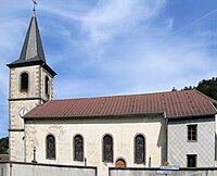
- L'église Saint-Nicolas
-

-


Personalities
- Isidore Étienne, 4 February 1872 - 2 January 1960, a local businessman, was president of the union of French granite-workers.
Heraldry
| Description of the emblazon | ||
|---|---|---|
|
|
Original French | Tranché: - au I : d'argent, aux monts de sinople mouvants de la pointe chargés d'une pierre de granit d'argent mouvant aussi de la pointe et mise en pal; - au II : d'or, à la roue à aubes de sable; - une cotice en bande d'azur brochant la partition; - au chef de gueules chargé de sept besants d'argent rangés en fasce. |
| English blazon | blazon needed… | |
| Notes |
The blazon is recent, designed in 1999 by a local artist, Olivier Claudon. It represents some characteristics of the commune:
|
|
| Status | Official status to be determined… | |
See also
References
- ^ a b "Répertoire national des élus: les maires". data.gouv.fr, Plateforme ouverte des données publiques françaises (in French). 2 December 2020.
- ^ "Populations légales 2021". The National Institute of Statistics and Economic Studies. 28 December 2023.
- ^ Le maquis de la piquante pierre, secteurs de la Moselotte et de la Vologne[ permanent dead link]
- ^ Population en historique depuis 1968, INSEE
External links
- (in French) Homepage of the mairie
- (in French) Tourist office
- (in French) The architectural and design heritage of the commune on the official site of the French ministry of culture (Bases Mérimée, Palissy, Palissy, Mémoire, ArchiDoc), Médiathèque de l'architecture et du patrimoine (archives photographiques) diffusion RMN, et service régional de l'inventaire général de la Région Lorraine
- Basse-sur-le-Rupt on Ifrance.com
| International | |
|---|---|
| National | |