Baranagar is a major industrial centre for the manufacture of agricultural and industrial machinery, chemicals,
castor oil, and matches; Baranagar is also home to numerous cotton-processing companies, offset & digital printing companies and book publishers.
Etymology
The word Baranagar derives from the Bengali term Barahanagore (
Bengali: বরাহনগর), meaning "City of the Hogs". (বরাহ: hog, নগর: city)
Streynsham Master who visited the area in 1676 spoke of the hog factory where about 3,000 hogs a year were slaughtered and salted for export.[27]
There are several explanations for the etymology of this name:
Map of Bengal by De Barros in 1550 showing "Bernagar" which refers to BaranagarBaranagar or Barahanagar, meaning the "big" (Bara) and "town or land" (nagar) of the "pig" (baraha).[19]
Baranagar might be named after
Varaha avatar of
Vishnu.
History
Dutch Kuthi in BaranagarMap of Bengal by Van de Broucke in 1660 showing "Barrenger" which refers to Baranagar
The earliest reference of Baranagar can be found in Sri Sri Chaitanya Bhagabat written by Sri Brindaban Das where it was said that
Chaitanya Mahaprabhu came to Baranagar in 1512. He writes:
হেন মতে পাণিহাটী গ্রাম ধন্য করি।
আছিলেন কথোদিন শ্রীগৌরাঙ্গ হরি ॥
তবে প্রভু আইলেন বরাহনগরে।
মহাভাগ্যবন্ত এক ব্রাহ্মণের ঘরে ॥
সেই বিপ্র বড় সুশিক্ষিত ভাগবতে।
প্রভু দেখি ভাগবত লাগিলা পড়িতে ॥
এতেক তোমার নাম ভাগবতাচার্য।
ইহা বিনে আর কোন না করিহ কার্য।
References to Baranagar can be found in many literary texts dating to 17th and 18th centuries. Even maps made by Dutch and Portuguese had references to Baranagar as "Bernagar" or "Barrenger".
Baranagar Municipality was established in 1869; it is one of the oldest municipalities in India.[7] The
Dutch had homes there in the seventeenth century.[28]Streynsham Master who visited the area in 1676 spoke of the hog factory where about 3,000 hogs a year were slaughtered and salted for export. Later it became the centre for the extensive
jute trade, manufacturing
gunny bags.[27] A major road (Surya Sen Road) parallel to the
Hooghly river connects Baranagar Bazaar with
Dakshineswar. In between temples such as Kaancher Mandir (i.e. Glass Temple),[29]Joy Mitra Kali Bari[30] and Pathbari are located.
Portuguese colonist first established their business camp here, which was in existence till 1862. Dutch settlers established their ‘Kuthi’ or office for business. Dutch supremacy ended with the arisen of British power in Bengal. M/s. Colvin Cow II Co. was the pioneer of industrial Baranagar. They founded a Sugar Mill near Alambazar. Later George Henderson founded Borneo Jute Factory at that site.[31] In 1859, the factory was renamed Baranagar Jute Factory and is still in existence. The Baranagar Jute Factory was the
first mechanical Jute Factory in India. During the two World Wars, many engineering factories were set up in Baranagar, and the town became famous as Industrial City. To provide civic amenities, North Suburban Municipality was formed in 1869 consisting of Chitpur and Cossipore (presently under Kolkata M.C.), all mouzas of present Baranagar Municipal Area along with Kamarhati, Ariadaha and Dakshineswar mouzas of present Kamarhati Municipality. In 1881 North Suburban Municipality was divided into two parts, 1) Cossipore- Chitpur Municipality (later amalgamated with Kolkata Municipal area) and 2) Baranagar Municipality. On 01.08.1899, Kamarhati Municipality was formed, parting Kamarhati and Ariadaha Mouzas from Baranagar. In 1949 Dakshineswar Mouza was parted from Baranagar and merged with Kamarhati Municipality.[19]
In Kuthighat (Baranagar), there is still an old house/lodge of Nigerian merchants.[32][33]
Cities and towns in the southern portion of Barrackpore subdivision in North 24 Parganas district M: municipal city/ town, CT: census town, N: neighbourhood/ administrative location Owing to space constraints in the small map, the actual locations in a larger map may vary slightly
More particularly to say, the boundary of Baranagar is :- in the east – the Rail line from
Sealdah towards
Krishnanagar; in the west – the
holy riverGanga, in the north –
Dakshineshwar and PWD Road and in the south –
Cossipore and
Sinthee.
Dakshineshwar Kali Temple lies just a quarter of a mile from this place. There are many Ganga ghats in Baranagar for example Pramanic ghat, Kuthighat, Kancher mandir or
glass temple ghat etc.
96% of the population of
Barrackpore subdivision (partly presented in the map alongside, all places marked on the map are linked in the full screen map) lives in urban areas. In 2011, it had a density of population of 10,967 per km2. The subdivision has 16 municipalities and 24 census towns.[63]
Climate
In summer, i.e. from April to June, the weather remains hot and temperatures range from a maximum of 35 °C (95 °F) to a minimum of 26 °C (79 °F).
Monsoon season prevails during beginning-June to mid-September. Also retrieving monsoon from mid-October till mid-November
The weather is quite pleasant, the summers and winters are moderate. The level of moisture increases during summers.[62]
As per the
2011 Census of India, Baranagar had a total population of 245,213, of which 126,187 (51%) were males and 119,026 (49%) were females. Population below 6 years was 16,825. The total number of literates in Baranagar was 208,779 (91.41% of the population over 6 years), male literates are 110,118 (93.69%) and female literates are 98,661 (89%).[2]
As of 2001[update] India census,[66] Baranagar had a population of 250,615. Males constitute 53% of the population and females 47%. Baranagar has an average literacy rate of 82%, higher than the national average of 59.5%; with 55% of the males and 45% of females literate. 8% of the population is under 6 years of age.
Almost 82% of the population speaks
Bengali while 15% speaks Hindi and Urdu. There is a significant
Punjabi speaking population as well owing to the significant Sikh population who migrated here during
1984 anti-Sikh riots. There has been significant increase in Hindi-Urdu speaking population due to migration from
Uttar Pradesh and
Bihar.
As per the District Census Handbook 2011, Baranagar Municipal city covered an area of 7.12 km2. Amongst the civic amenities it had 160.23 km of roads and both open and closed drains. Amongst the medical facilities It had 55 medicine shops. Amongst the educational facilities it had 49 primary schools, 33 middle schools, 33 secondary schools, many higher secondary schools and 2 non-formal education centres. Amongst the social, recreational and cultural facilities it had 2 cinema/theatres and 2 auditorium/ community halls. It had 20 bank branches.[68]
Economy
Baranagar is also economically enriched for "Baranagar Jute Mill".[69] Hessian, sacking, fabrics, carpets and bags from jute (Corchorus spp) are manufactured in here. It is one of the oldest jute mills. The service sector includes the rest of the economy. Baranagar is also home to numerous cotton-processing companies, offset & digital printers and
Purushottam Publishers, an academic book publishing company.[70]
Barrackpore Trunk Road (part of both
SH 1 and
SH 2) passes through Baranagar.[78]Belghoria Expressway also passes through Baranagar.
Dunlop Crossing is one of the largest crossings near
Kolkata which connects Kolkata with Northern suburban areas and
Howrah,
Hooghly.[79][80][81] Another important road is Gopal Lal Tagore Road which is connected to
B.T. Road at
Sinthee More (via Kashi Nath Dutta Road), at Tobin More (via Baghajatin Road) and also at
Dunlop. Gopal Lal Tagore Road is also connected to
Dakshineswar via Deshbandhu Road-Surya Sen Road (through Alambazar). Many buses ply along all these roads.[78]
Kali Puja at Baranagar Ramakrishna Mission in 2013
Baranagar Math near Pramanick ghat is the place where Swami Vivekananda and a few other disciples of Sri Ramakrishna Dev started their spiritual journey that culminated in forming the monastic order later located at
Belur Math, the present headquarters of
Ramakrishna Mission.[102] Other places worth visiting are
Jay Mitra Kalibari, Pramanick Kalibari, and Kouleswar Mandir. Pathbari Mandir is a place where
Chaitanya Mahaprabhu, the great religious leader, set his foot on his way to Puri nearly five hundred years ago here.[103] In Baranagar a math has been set up very recently, called
Alambazar Math in the heritage building where Swami Vivekananda first put up after coming back from abroad.[104]
The Annapurna Temple and the newly built
Omkarnath Temple are also other two attractions of the "Mahamilan Math".[105]Trailanga Swami Math is also here in Baranagar at Vidyayatan Sarani. There is also an old kalibari in Baranagar Bazar and one in Kutighat and Pramanicghat.
Baranagar has a gurdwara named "Dunlop Gurudwara" near Dunlop Bridge, a church named "St. James' Church, Baranagar"[106] near Sinthee More along with many mosques.
Baranagar is famous for
Durga Puja. Popular Durga Puja organizations like Netaji Colony Lowland, Bandhudal Sporting club, Noapara Dadabhai Sangha, Karmi Sangha, Kalakar para, Ashokgarh Sarbojanin, Nainan Bandhav Samiti, Mullick Colony, Shibmandir maath, Satin sen Sangsad, Friend's association, Rabindranagar Yubak brinda - all lie in Baranagar. [107][108][109] In every winter, a circus is organised at 'Sinthi Circus Maidan' named "Ajanta Circus".[110]
Annual fairs- textile and handloom fair in March-April season and Durga Puja Sharadiya fair in September-October season in Sinthi More Circus and mela ground.
Jhulanbari in Jhulantala and Pathbari are famous for celebrating the festival of Jhulan Jatra and Rash Jatra.
Baranagar also hosts some of the biggest Kali Puja of Kolkata. Haowa Shokal, Bonhoogly Yubak Sangha, Kalpataru seva samiti, Pally Shanti Sangha, Kalitala Maath and Baranagar Boro Ma are among the popular ones.
The annual Saraswati Puja is also widely celebrated in the area.
Christmas celebrations at the Baranagar St.James Church also attracts thousands of visitors.
Kalpataru Utsav held on the New Year's day, the day on which Sri Ramkrishna Became Kalpataru and fulfilled the wishes of his desciples, also attracts thousands of devotees to Baranagar. Devotees visit the infamous Baranagar Math and Ramkrishna Maha Smashan in Baranagar and also the nearby Cossipore Udyanbati and Dakhineshwar Temple.
Recently in 2019, AlamBazar
Shyam Mandir has been inaugurated by then Governor of Bengal
Jagdeep Dhankhar.
^Jones, Daniel (2003) [1917], Peter Roach; James Hartmann; Jane Setter (eds.), English Pronouncing Dictionary, Cambridge: Cambridge University Press,
ISBN3-12-539683-2
^“Industrial Railways and Locomotives of India and South Asia” compiled by Simon Darvill. Published by ‘The Industrial Railway Society’ 2013. ISBN 978 1 901556 82-7. Available at
http://irsshop.co.uk/India. Reference: Entry WB125 page ....
^"District Statistical Handbook". North 24 Parganas 2013, Tables 2.1, 2.2, 2.4b. Department of Statistics and Programme Implementation, Government of West Bengal. Retrieved 2 May 2018.
^"District Census Handbook North Twenty Four Parganas, Census of India 2011, Series 20, Part XII A"(PDF). Section II Town Directory, Pages 781-783 Statement I: Growth History, Pages 799-803; Statement II: Physical Aspects and Location of Towns, Pages 791-794; Statement III: Civic and other Amenities, Pages 795-796; Statement IV: Medical Facilities 2009, Pages 803-805 Section: Educational, Recreational and Cultural Facilities. Directorate of Census Operations V, West Bengal. Retrieved 31 May 2018.


.jpg)


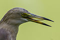 Pond Heron in Baranagar
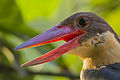 Stork-billed Kingfisher in Baranagar
 White-throated kingfisher in Baranagar


 Media from Commons
 Travel information from Wikivoyage
 Data from Wikidata

