Balete | |
|---|---|
| Municipality of Balete | |
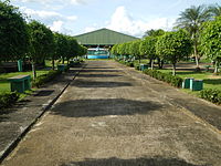
 Street in Balete | |
 Flag  Seal | |
| Nickname(s): Land of Honeybees, Biking Capital of CALABARZON | |
 Map of Batangas with Balete highlighted | |
.svg) Balete Location within the
Philippines | |
| Coordinates: 14°01′N 121°06′E / 14.02°N 121.1°E | |
| Country | Philippines |
| Region | Calabarzon |
| Province | Batangas |
| District | 3rd district |
| Founded | June 21, 1969 |
| Barangays | 13 (see Barangays) |
| Government | |
| • Type | Sangguniang Bayan |
| • Mayor | Wilson V. Maralit |
| • Vice Mayor | Alvin T. Payo |
| • Representative | Ma. Theresa V. Collantes |
| • Municipal Council | Members |
| • Electorate | 15,006 voters ( 2022) |
| Area | |
| • Total | 25.00 km2 (9.65 sq mi) |
| Elevation | 187 m (614 ft) |
| Highest elevation | 383 m (1,257 ft) |
| Lowest elevation | 5 m (16 ft) |
| Population (2020 census)
[3] | |
| • Total | 24,055 |
| • Density | 960/km2 (2,500/sq mi) |
| • Households | 5,709 |
| Economy | |
| • Income class | 5th municipal income class |
| • Poverty incidence | 12.66 |
| • Revenue | ₱ 90.05 million (2020) |
| • Assets | ₱ 234.4 million (2020) |
| • Expenditure | ₱ 82.47 million (2020) |
| • Liabilities | ₱ 102.6 million (2020) |
| Service provider | |
| • Electricity | Batangas 2 Electric Cooperative (BATELEC 2) |
| Time zone | UTC+8 ( PST) |
| ZIP code | 4219 |
| PSGC | |
| IDD : area code | +63 (0)43 |
| Native languages | Tagalog |
Balete, officially the Municipality of Balete ( Tagalog: Bayan ng Balete), is a 5th class municipality in the province of Batangas, Philippines. According to the 2020 census, it has a population of 24,055 people. [3] The people from Balete is called Baleteños.
Balete is well known for its location on Taal Lake, providing a panoramic view of the Taal Volcano. The pilgrimage site Marian Orchard is located in Barangay Malabanan.
Etymology
Balete originates from the tree of the same name that grew abundantly in the area. [5]
History
Balete was once a barrio part of Lipa. It was the site of Lipa's third municipal center from circa 1702 to 1754. Due to a Taal Volcano eruption, Lipa moved its center to its present location inland to seek refuge from further volcanic eruptions. [6]
On June 21, 1969, barrios Malabanan, Looc, Alangilan, Palsara, Makina, Magapi, Solis, Sampalukan, Calawit, and Balete and the sitios of Sala, Paligawan, and Wani-Wani were separated from Lipa and constituted into a new independent municipality of Balete. [7]
Geography
According to the Philippine Statistics Authority, the municipality has a land area of 25.00 square kilometers (9.65 sq mi) [8] constituting 0.80% of the 3,119.75-square-kilometer (1,204.54 sq mi) total area of Batangas.
Barangays
Balete is politically subdivided into 13 barangays. [9] Each barangay consists of puroks and some have sitios.
| PSGC | Barangay | Population | ±% p.a. | |||
|---|---|---|---|---|---|---|
| 2020 [3] | 2010 [10] | |||||
| 041004001 | Alangilan | 5.9% | 1,428 | 1,296 | 0.97% | |
| 041004002 | Calawit | 4.3% | 1,028 | 809 | 2.42% | |
| 041004003 | Looc | 8.7% | 2,098 | 2,005 | 0.45% | |
| 041004004 | Magapi | 8.9% | 2,133 | 1,947 | 0.92% | |
| 041004005 | Makina | 7.3% | 1,757 | 1,519 | 1.47% | |
| 041004006 | Malabanan | 19.3% | 4,637 | 4,119 | 1.19% | |
| 041004007 | Paligawan | 8.5% | 2,047 | 1,802 | 1.28% | |
| 041004008 | Palsara | 5.8% | 1,391 | 1,381 | 0.07% | |
| 041004009 | Poblacion | 10.7% | 2,573 | 2,405 | 0.68% | |
| 041004010 | Sala | 7.3% | 1,753 | 1,429 | 2.06% | |
| 041004011 | Sampalocan | 4.5% | 1,086 | 1,003 | 0.80% | |
| 041004012 | Solis | 7.1% | 1,712 | 1,634 | 0.47% | |
| 041004013 | San Sebastian | 4.2% | 1,018 | 1,865 | −5.87% | |
| Total | 24,055 | 20,214 | 1.75% | |||
Climate
| Climate data for Balete, Batangas | |||||||||||||
|---|---|---|---|---|---|---|---|---|---|---|---|---|---|
| Month | Jan | Feb | Mar | Apr | May | Jun | Jul | Aug | Sep | Oct | Nov | Dec | Year |
| Mean daily maximum °C (°F) | 29 (84) |
30 (86) |
31 (88) |
33 (91) |
32 (90) |
30 (86) |
29 (84) |
29 (84) |
29 (84) |
29 (84) |
29 (84) |
29 (84) |
30 (86) |
| Mean daily minimum °C (°F) | 20 (68) |
20 (68) |
21 (70) |
22 (72) |
24 (75) |
24 (75) |
24 (75) |
24 (75) |
24 (75) |
23 (73) |
22 (72) |
21 (70) |
22 (72) |
| Average precipitation mm (inches) | 11 (0.4) |
13 (0.5) |
14 (0.6) |
32 (1.3) |
101 (4.0) |
142 (5.6) |
208 (8.2) |
187 (7.4) |
175 (6.9) |
131 (5.2) |
68 (2.7) |
39 (1.5) |
1,121 (44.3) |
| Average rainy days | 5.2 | 5.0 | 7.4 | 11.5 | 19.8 | 23.5 | 27.0 | 25.9 | 25.2 | 23.2 | 15.5 | 8.3 | 197.5 |
| Source: Meteoblue [11] (Use with caution: this is modeled/calculated data, not measured locally.) | |||||||||||||
Demographics
| Year | Pop. | ±% p.a. |
|---|---|---|
| 1970 | 7,134 | — |
| 1975 | 8,229 | +2.91% |
| 1980 | 8,698 | +1.11% |
| 1990 | 11,678 | +2.99% |
| 1995 | 14,383 | +3.98% |
| 2000 | 15,792 | +2.02% |
| 2007 | 19,252 | +2.77% |
| 2010 | 20,214 | +1.79% |
| 2015 | 22,661 | +2.20% |
| 2020 | 24,055 | +1.18% |
| Source: Philippine Statistics Authority [12] [10] [13] [14] | ||
In the 2020 census, Balete had a population of 24,055. [3] The population density was 960 inhabitants per square kilometer (2,500/sq mi).
Economy
Graphs are unavailable due to technical issues. There is more info on
Phabricator and on
MediaWiki.org. |
Gallery
-
 Municipal hall
 -
 Police station
 -
 Municipal park
 -
 Fishing boats on the shore of Taal Lake
 -
 Marian Orchard


References
- ^ Municipality of Balete | (DILG)
- ^ "2015 Census of Population, Report No. 3 – Population, Land Area, and Population Density" (PDF). Philippine Statistics Authority. Quezon City, Philippines. August 2016. ISSN 0117-1453. Archived (PDF) from the original on May 25, 2021. Retrieved July 16, 2021.
- ^ a b c d Census of Population (2020). "Region IV-A (Calabarzon)". Total Population by Province, City, Municipality and Barangay. Philippine Statistics Authority. Retrieved 8 July 2021.
- ^ "PSA Releases the 2018 Municipal and City Level Poverty Estimates". Philippine Statistics Authority. 15 December 2021. Retrieved 22 January 2022.
- ^ "History". Balete, Batangas. Retrieved July 4, 2023.
- ^ Hargrove, Thomas (1991). The Mysteries of Taal: A Philippine volcano and lake, her sea life and lost towns. Manila: Bookmark Publishing. pp. 13, 33–55. ISBN 9715690467.
- ^ Republic Act No. 5659 (21 June 1969), "An Act Creating the Municipality of Balete in the Province of Batangas", The Corpus Juris
- ^ "Province: Batangas". PSGC Interactive. Quezon City, Philippines: Philippine Statistics Authority. Retrieved 12 November 2016.
- ^ "Municipal: Balete, Batangas". PSGC Interactive. Quezon City, Philippines: Philippine Statistics Authority. Retrieved 8 January 2016.
- ^ a b Census of Population and Housing (2010). "Region IV-A (Calabarzon)" (PDF). Total Population by Province, City, Municipality and Barangay. National Statistics Office. Retrieved 29 June 2016.
- ^ "Balete: Average Temperatures and Rainfall". Meteoblue. Retrieved 5 May 2020.
- ^ Census of Population (2015). "Region IV-A (Calabarzon)". Total Population by Province, City, Municipality and Barangay. Philippine Statistics Authority. Retrieved 20 June 2016.
-
^ Censuses of Population (1903–2007).
"Region IV-A (Calabarzon)".
Table 1. Population Enumerated in Various Censuses by Province/Highly Urbanized City: 1903 to 2007.
National Statistics Office.
{{
cite encyclopedia}}
: CS1 maint: numeric names: authors list ( link) - ^ "Province of Batangas". Municipality Population Data. Local Water Utilities Administration Research Division. Retrieved 17 December 2016.
- ^ "Poverty incidence (PI):". Philippine Statistics Authority. Retrieved December 28, 2020.
- ^ "Estimation of Local Poverty in the Philippines" (PDF). Philippine Statistics Authority. 29 November 2005.
- ^ "2003 City and Municipal Level Poverty Estimates" (PDF). Philippine Statistics Authority. 23 March 2009.
- ^ "City and Municipal Level Poverty Estimates; 2006 and 2009" (PDF). Philippine Statistics Authority. 3 August 2012.
- ^ "2012 Municipal and City Level Poverty Estimates" (PDF). Philippine Statistics Authority. 31 May 2016.
- ^ "Municipal and City Level Small Area Poverty Estimates; 2009, 2012 and 2015". Philippine Statistics Authority. 10 July 2019.
- ^ "PSA Releases the 2018 Municipal and City Level Poverty Estimates". Philippine Statistics Authority. 15 December 2021. Retrieved 22 January 2022.
External links
![]() Media related to
Balete, Batangas at Wikimedia Commons
Media related to
Balete, Batangas at Wikimedia Commons
Places adjacent to Balete, Batangas | ||||||||||||||||
|---|---|---|---|---|---|---|---|---|---|---|---|---|---|---|---|---|
| ||||||||||||||||
| Component cities | |
|---|---|
| Municipalities | |
|
| This article about a location in Calabarzon region is a stub. You can help Wikipedia by expanding it. |