| Bald River Gorge Wilderness | |
|---|---|
 Bald River Falls | |
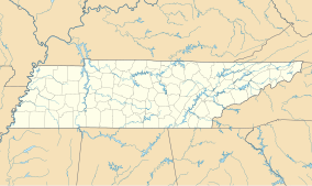
Location in
Tennessee Location in
United States | |
| Location | Monroe County, Tennessee |
| Nearest city | Madisonville, Tennessee |
| Coordinates | 35°18′26″N 84°10′20″W / 35.30722°N 84.17222°W |
| Area | 3,721 ha (14.37 sq mi) |
| Designated | 1984 |
| Operator | United States Forest Service |
Bald River Gorge Wilderness is a 3,721-acre (15 km2) wilderness area of Cherokee National Forest that lies within Monroe County in the U.S. state of Tennessee, designated in 1984. Its elevation is 2,642 feet (805 m) above sea level. [2] [3] It is administered by the United States Forest Service.
References
- ^ Protected Planet Website- Retrieved March 26, 2023
- ^ "Bald River Gorge Wilderness, TN". lat-long.com. Retrieved 2008-12-22.
- ^ "Bald River Gorge Wilderness". wilderness.net. Retrieved 2008-12-22.

