Bến Tre province
Tỉnh Bến Tre | |
|---|---|
 Bến Tre countryside around Cái Mơn | |
 Seal | |
| Nickname: Bamboo Landing | |
 Location of Bến Tre within Vietnam | |
|
| |
| Coordinates: 10°10′N 106°30′E / 10.167°N 106.500°E | |
| Country | |
| Region | Mekong Delta |
| Capital | Bến Tre |
| Government | |
| • People's Council Chair | Nguyễn Hữu Phước |
| • People's Committee Chair | Nguyễn Thị Thanh Hà |
| Area | |
| • Total | 2,394.6 km2 (924.6 sq mi) |
| Population (2021) | |
| • Total | 1,788,463 |
| • Density | 750/km2 (1,900/sq mi) |
| Demographics | |
| • Ethnicities | Vietnamese, Khmer, Hoa, Chăm |
| GDP [1] | |
| • Total |
VND 41.851 trillion US$ 1.818 billion |
| Time zone | UTC+7 ( ICT) |
| Area codes | 75 (until 16 July 2017) 275 (from 17 June 2017) |
| ISO 3166 code | VN-50 |
| Website |
www |
Bến Tre (Vietnamese: [ʔɓen˧˦ ʈɛ˧˧] ⓘ) is a province of Vietnam. It is one of the country's southern provinces, and is situated in the Mekong Delta.
Administrative divisions
Bến Tre is subdivided into 9 district-level subdivisions. The eight districts are Ba Tri, Bình Đại, Châu Thành, Chợ Lách, Giồng Trôm, Mỏ Cày Bắc, Mỏ Cày Nam, and Thạnh Phú. There is also one provincial city of Bến Tre (capital). They are further subdivided into 7 commune-level towns (or townlets), 147 communes, and 10 wards. See also List of communes in Bến Tre province.
Geography

Geographically, Bến Tre is wedged between the two main branches of the Tiền Giang River, which is itself one of the two main branches of the Mekong. The province's northern boundary is formed by the Tiền Giang's main course, while the province's southern boundary is formed by the Tiền Giang's largest branch (which breaks away from the Tiền Giang just upriver from Bến Tre province). Between the Tiền Giang and its main branch are two smaller branches, passing through the middle of Bến Tre.
The entire province is criss-crossed with a network of smaller rivers and canals. The extensive irrigation that this provides makes Bến Tre a major producer of rice, but also means that the area is prone to flooding. The Climate Change Research Institute at Cần Thơ University, in studying the possible consequences of climate change, has predicted that 51% of Bến Tre province can be expected to be flooded if sea levels rise by 1 meter. [2] Bến Tre province is, on average, only 1.25 meters (4 ft 1 in) above sea level.
Transportation
Construction on the Rạch Miễu Bridge, which links Bến Tre to neighboring Tiền Giang province to its north, was started in 2002. The bridge was finished and opened for traffic on 19 January 2009. Before that time, Bến Tre was only accessible to automobiles via ferry.
Start of the Vietnam War
This section may require
cleanup to meet Wikipedia's
quality standards. The specific problem is: Some of the information here is presented in a somewhat incomprehensible manner, and the information needs more citations. Most notably, the article needs to be rewritten to avoid any bias towards the Vietnamese Communists. (January 2021) |
In what has been called "the start of the Vietnam War", in January and February 1960, the Việt Cộng attacked and took temporary control of several districts in Bến Tre, then known as Kiến Hòa. [3] The Việt Cộng set up "people's committees", and confiscated land from landlords and redistributed it to poor farmers. One of the leaders of the uprising was Madame Nguyễn Thị Định, who led the all-female "Long Hair Army".
Although the South Vietnamese army (ARVN) recaptured the villages, uprisings spread to many other areas of South Vietnam. The uprisings were spontaneous rather than planned, as the official policy of the Communist government in Hanoi was that the Việt Cộng's stance should be restrained and defensive, not offensive. [4]
Gallery

-
 Trung học Phổ thông Chuyên Bến Tre
 -
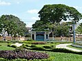 Công viên Trúc Giang
 -
 Kênh Chợ Lách
 -
 Cồn Phụng Hotel
 -
 Tân Thạch Communal House
 -
 Memorial stele
Trương Vĩnh Ký -
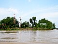 Reserves of Đạo Dừa
at Con Phung -
 Congregation Church
Christ the King -
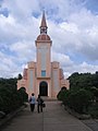 Church of Our Lady
Roman -
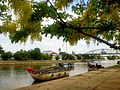
 Tourist boats dock at Con Phung wharf on Tiền River
 -
 The coconut garden is green thanks to alluvium
 -
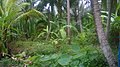
 Coconut is a large-scale and popular crop grown in bến Tre


References
- ^ "Tình hình kinh tế, xã hội Bến Tre năm 2018". Cổng thông tin điện tử tỉnh Bến Tre. Retrieved 10 May 2020.
- ^ "Mekong Delta: more flood and drought" Archived May 5, 2010, at the Wayback Machine. VietnamNet Bridge. 19 March 2009.
- ^ Pringle, James, "Meanwhile: The quiet town where the Vietnam War began", The New York Times, 223 March 2004
- ^ Asselin, Pierre (2013). Hanoi's Road to the Vietnam War, 1954–1965. Berkeley: University of California Press. p. 73.
External links
- Bến Tre website (in English)
- Bến Tre website Archived 2014-11-03 at the Wayback Machine (in Vietnamese)
- Bến Tre province profile
- Website Thành phố Bến Tre - Ben Tre City
Places adjacent to Bến Tre province | |
|---|---|
| International | |
|---|---|
| National | |