| Atsonupuri | |
|---|---|
 | |
| Highest point | |
| Elevation | 1,206 m (3,957 ft) [1] |
| Listing | List of volcanoes in Russia |
| Coordinates | 44°48′29″N 147°07′52″E / 44.808°N 147.131°E [1] |
| Geography | |
| Geology | |
| Mountain type | Stratovolcano |
| Last eruption | 1932 [1] |
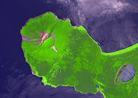
Atsonupuri ( Russian: Атсонупури; Ainu: アトゥサヌプリ, Atusa-nupuri; Japanese: 阿登佐岳, Atosa-dake) is a stratovolcano located in the central part of Iturup Island, Kuril Islands, Russia.

References
- ^ a b c "Atsonupuri". Global Volcanism Program. Smithsonian Institution. Retrieved 2018-01-13.
